
| Distance / Altitude | Location | Report Date / Time | Live Weather | Wind | Gusts | Temp. | Visibility | Cloud |
|---|---|---|---|---|---|---|---|---|
| 57 km SSE / 216 m | Argentia Airport (Newfoundland) | 2026-05-17 01:30 local (2026/05/17 04:00 GMT) | - | light winds from the WSW (17 km/h at 240) | 5°C | 0.0 | ||
| 61 km S / 27 m | MarticotIsland-Nfld (Canada) | 2026-05-17 02:30 local (2026/05/17 05:00 GMT) | no report | light winds from the SW (11 km/h at 220) | 9°C | - | - no observation - | |
| 70 km ESE / 32 m | Bay Roberts (Newfoundland) | 2026-05-17 03:01 local (2026/05/17 05:31 GMT) | dry | calm (5 km/h at 233) | 9°C | - | - - 0 | |
| 77 km ESE / 52 m | The Battery wx (Canada) | 2026-05-17 02:52 local (2026/05/17 05:22 GMT) | dry | light winds from the WSW (13 km/h at 252) | 10°C | - | - - 0 | |
| 87 km N / 216 m | Terra Nova Airport (Newfoundland) | 2026-05-17 01:30 local (2026/05/17 04:00 GMT) | - | light winds from the WNW (17 km/h at 300) | 7°C | 0.0 | ||
| 99 km ESE / 116 m | St. Phillips (Canada) | 2026-05-17 02:52 local (2026/05/17 05:22 GMT) | dry | calm (5 km/h at 316) | 6°C | - | - - 0 | |
| 101 km E / 130 m | Portugal Cove (Canada) | 2026-05-17 02:31 local (2026/05/17 05:01 GMT) | dry | - (- km/h at ) | — | - | - - 0 | |
| 108 km ESE / 115 m | STJohnsWest Climate- Nfld (Canada) | 2026-05-17 02:30 local (2026/05/17 05:00 GMT) | - | calm (4 km/h at 240) | — | - | - no observation - | |
| 110 km E / 216 m | Saint John's Airport (Newfoundland) | 2026-05-17 01:30 local (2026/05/17 04:00 GMT) | Dry and partly cloudy | strong winds from the WNW (39 km/h at 290) | 7°C | 24 | few broken | |
| 110 km ESE / 192 m | Goulds (Canada) | 2026-05-17 02:46 local (2026/05/17 05:16 GMT) | dry | wind obs. (11 kph from 195 degs) was rejected (- km/h at -) | 8°C | - | - - 0 |
| Contours: | Roads & Rivers: | Select a
tide station / surf break / city |
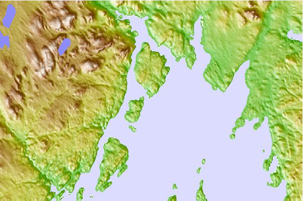
Use this relief map to navigate to tide stations, surf breaks and cities that are in the area of Woody Island, Newfoundland.
Other Nearby Locations' tide tables and tide charts to Woody Island, Newfoundland:
click location name for more details
 Surf breaks close to Woody Island, Newfoundland:
|
||
|---|---|---|
| Closest surf break | Ingonish Beach | 303 mi |
| Second closest surf break | Kennington Cove | 308 mi |
| Third closest surf break | Michaud Point | 345 mi |
| Fourth closest surf break | Martinique | 480 mi |
| Fifth closest surf break | Lawrencetown Left Point | 489 mi |


 Nearest