
| Distance / Altitude | Location | Report Date / Time | Live Weather | Wind | Gusts | Temp. | Visibility | Cloud |
|---|---|---|---|---|---|---|---|---|
| 6 km NE / 12 m | Mount Eden wx (United States) | 2026-03-09 18:02 local (2026/03/10 01:02 GMT) | dry | wind obs. (6 kph from 126 degs) was rejected (- km/h at -) | 26°C | - | - - 0 | |
| 8 km NNE / 218 m | Hayward Airport (California) | 2026-03-09 16:54 local (2026/03/09 23:54 GMT) | Clear | moderate winds from the W (24 km/h at 280) | 18°C | 16 | ||
| 11 km S / 3 m | BUOY-RTYC1 (Marine) | 2026-03-09 17:48 local (2026/03/10 00:48 GMT) | light winds from the WNW (18 km/h at 300) | 20°C | - | |||
| 13 km E / 16 m | Fremont (California) | 2026-03-09 17:30 local (2026/03/10 00:30 GMT) | dry | wind obs. (6 kph from 279 degs) was rejected (- km/h at -) | 19°C | - | - - 0 | |
| 13 km SSW / 393 m | San Carlos Airport (California) | 2026-03-09 17:50 local (2026/03/10 00:50 GMT) | Haze - | light winds from the WNW (19 km/h at 290) | — | 13 | ||
| 13 km NW / 218 m | Oakland Airport (California) | 2026-03-09 16:53 local (2026/03/09 23:53 GMT) | Dry and partly cloudy | moderate winds from the WSW (28 km/h at 250) | 18°C | 16 | broken | |
| 14 km S / 8 m | Atherton (California) | 2026-03-09 17:38 local (2026/03/10 00:38 GMT) | dry | calm (0 km/h at 141) | 22°C | - | - - 0 | |
| 14 km S / 418 m | Palo Alto Airport (California) | 2026-03-09 16:47 local (2026/03/09 23:47 GMT) | - | light winds from the NNW (19 km/h at 330) | — | 16 | ||
| 15 km SSW / 19 m | San Carlos (California) | 2026-03-09 18:13 local (2026/03/10 01:13 GMT) | dry | calm (0 km/h at 0) | 21°C | - | - - 0 | |
| 15 km S / 12 m | Lindenwood wx (United States) | 2026-03-09 18:07 local (2026/03/10 01:07 GMT) | dry | calm (2 km/h at 343) | 22°C | - | - - 0 |
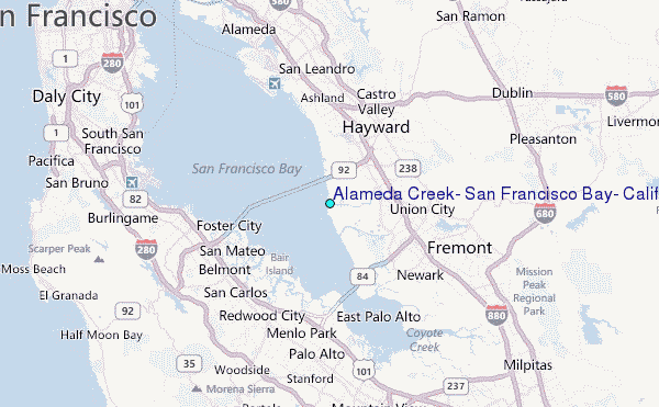
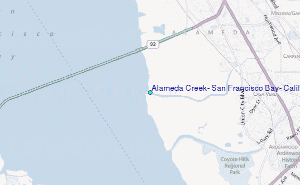
Choose Alameda Creek, San Francisco Bay, California Location Map Zoom:
| Contours: | Roads & Rivers: | Select a
tide station / surf break / city |
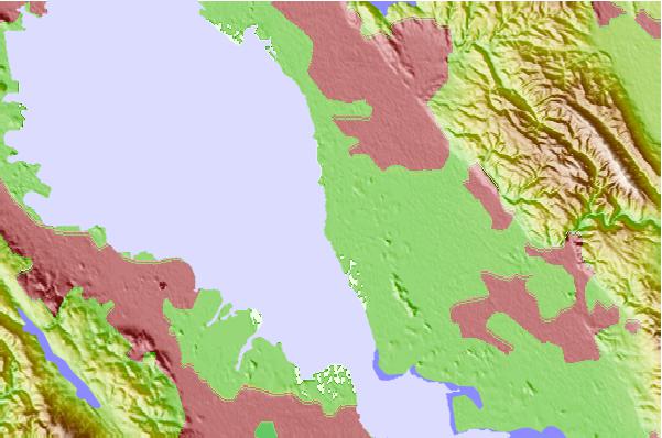
Use this relief map to navigate to tide stations, surf breaks and cities that are in the area of Alameda Creek, San Francisco Bay, California.
Other Nearby Locations' tide tables and tide charts to Alameda Creek, San Francisco Bay, California:
click location name for more details
 Surf breaks close to Alameda Creek, San Francisco Bay, California:
|
||
|---|---|---|
| Closest surf break | Francis Beach | 19 mi |
| Second closest surf break | Princeton Breakwater | 19 mi |
| Third closest surf break | Rockaway | 19 mi |
| Fourth closest surf break | Sharp Park | 19 mi |
| Fifth closest surf break | Linda Mar | 20 mi |


 Nearest
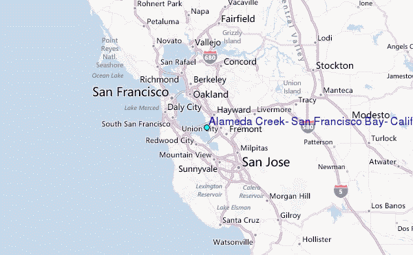