
| Distance / Altitude | Location | Report Date / Time | Live Weather | Wind | Gusts | Temp. | Visibility | Cloud |
|---|---|---|---|---|---|---|---|---|
| 46 km N / 22 m | Mawlamyine (Myanmar) | 2025-12-25 07:30 local (2025/12/25 01:00 GMT) | - | calm (4 km/h at 220) | — | 6 | - mostly cloudy - | |
| 89 km N / 10 m | Hpaan (Myanmar) | 2025-12-25 07:30 local (2025/12/25 01:00 GMT) | - | calm (4 km/h at 230) | — | 7 | - | |
| 98 km SSE / 7 m | YE (Myanmar) | 2025-12-25 07:30 local (2025/12/25 01:00 GMT) | - | wind obs. (7 kph from 220 degs) was rejected (- km/h at -) | — | 5 | - scattered - | |
| 122 km ENE / 9 m | Mae Sot-(แม่สอด) (Thailand) | 2025-12-25 06:30 local (2025/12/25 00:00 GMT) | Mist - | calm (2 km/h at 1) | 18°C | 5.0 | few - - | |
| 125 km ENE / 197 m | Mae Sot (Thailand) | 2025-12-25 07:30 local (2025/12/25 01:00 GMT) | no report | calm (0 km/h at 320) | 21°C | - | - no observation - | |
| 139 km E / 457 m | Umphang (Thailand) | 2025-12-25 07:30 local (2025/12/25 01:00 GMT) | - | wind obs. (11 kph from 240 degs) was rejected (- km/h at -) | — | - | - | |
| 164 km ENE / 868 m | Musoe Agromet (Thailand) | 2025-12-25 07:30 local (2025/12/25 01:00 GMT) | rain | calm (0 km/h at 70) | 16°C | 4000 | - no observation - | |
| 173 km W / 29 m | Mingaladon (Myanmar) | 2025-12-25 07:30 local (2025/12/25 01:00 GMT) | light to moderate thunderstorm | calm (4 km/h at 180) | 26°C | 5 | - | |
| 174 km W / 20 m | Yangon (Myanmar) | 2025-12-25 07:30 local (2025/12/25 01:00 GMT) | light to moderate thunderstorm | calm (2 km/h at 220) | 27°C | 6 | - | |
| 178 km W / 345 m | Yangon International Airport- Myanmar (Viet Nam) | 2025-12-25 07:00 local (2025/12/25 00:30 GMT) | - | wind obs. (6 kph from 70 degs) was rejected (- km/h at -) | 20°C | 6.0 | few |
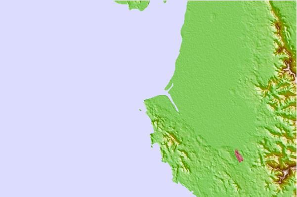
| Contours: | Roads & Rivers: | Select a
tide station / surf break / city |
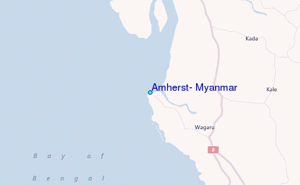
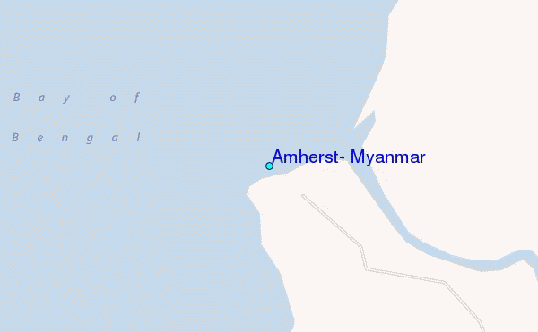
Use this relief map to navigate to tide stations, surf breaks and cities that are in the area of Amherst, Myanmar.
Other Nearby Locations' tide tables and tide charts to Amherst, Myanmar:
click location name for more details
 Surf breaks close to Amherst, Myanmar:
|
||
|---|---|---|
| Closest surf break | Prachuap Khiri Khan | 331 mi |
| Second closest surf break | Rayong Mae Ramphung Beach | 353 mi |
| Third closest surf break | Ko Samet - Sai Kaew | 357 mi |
| Fourth closest surf break | Hinsuay Namsay | 359 mi |
| Fifth closest surf break | Mae Phim Beach (Rayong) | 360 mi |


 Nearest
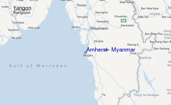