
| Distance / Altitude | Location | Report Date / Time | Live Weather | Wind | Gusts | Temp. | Visibility | Cloud |
|---|---|---|---|---|---|---|---|---|
| 2 km SE / 40 m | Aptos (California) | 2026-06-03 09:09 local (2026/06/03 16:09 GMT) | dry | wind obs. (11 kph from 307 degs) was rejected (- km/h at -) | 18°C | - | - - 0 | |
| 2 km SE / 71 m | Rio del Mar (California) | 2026-06-03 09:00 local (2026/06/03 16:00 GMT) | dry | calm (3 km/h at 211) | 13°C | - | - - 0 | |
| 4 km SE / 30 m | La Selva Beach wx (United States) | 2026-06-03 09:35 local (2026/06/03 16:35 GMT) | dry | calm (3 km/h at 168) | 12°C | - | - - 0 | |
| 4 km WNW / 61 m | Cliftwood Mobile Home Park wx (United States) | 2026-06-03 09:40 local (2026/06/03 16:40 GMT) | dry | calm (2 km/h at 97) | 15°C | - | - - 0 | |
| 5 km WSW / 25 m | Capitola (California) | 2026-06-03 09:38 local (2026/06/03 16:38 GMT) | dry | - (- km/h at ) | — | - | - - 0 | |
| 6 km WSW / 20 m | Santa Cruz (California) | 2026-06-03 09:39 local (2026/06/03 16:39 GMT) | dry | calm (2 km/h at 117) | 13°C | - | - - 0 | |
| 7 km SW / 10 m | Santa Cruz (California) | 2026-06-03 09:45 local (2026/06/03 16:45 GMT) | dry | calm (3 km/h at 206) | 13°C | - | - - 0 | |
| 7 km W / 108 m | Santa Cruz (California) | 2026-06-03 09:12 local (2026/06/03 16:12 GMT) | dry | calm (2 km/h at 145) | 12°C | - | - - 0 | |
| 10 km NW / 143 m | Soquel (California) | 2026-06-03 09:06 local (2026/06/03 16:06 GMT) | dry | calm (0 km/h at 114) | 16°C | - | - - 0 | |
| 10 km WSW / 16 m | Santa Cruz wx (United States) | 2026-06-03 09:19 local (2026/06/03 16:19 GMT) | dry | calm (0 km/h at 1) | 16°C | - | - - 0 |
| Contours: | Roads & Rivers: | Select a
tide station / surf break / city |
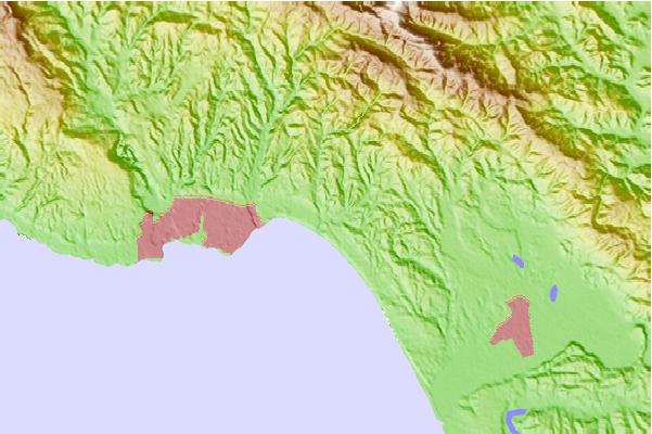
Use this relief map to navigate to tide stations, surf breaks and cities that are in the area of Aptos.
Other Nearby Locations' tide tables and tide charts to Aptos:
click location name for more details
 Surf breaks close to Aptos:
|
||
|---|---|---|
| Closest surf break | Capitola Rivermouth | 2 mi |
| Second closest surf break | Beer Can Beach | 3 mi |
| Third closest surf break | Capitola Jetty | 3 mi |
| Fourth closest surf break | Manresa State Beach | 3 mi |
| Fifth closest surf break | Pleasure Point-First Peak | 4 mi |


 Nearest