
| Distance / Altitude | Location | Report Date / Time | Live Weather | Wind | Gusts | Temp. | Visibility | Cloud |
|---|---|---|---|---|---|---|---|---|
| 36 km S / 368 m | Faleolo International/Apia Airport (Samoa/polynesia) | 2025-12-24 19:00 local (2025/12/25 06:00 GMT) | Dry and partly cloudy | light winds from the S (9 km/h at 190) | 28°C | 10.0 | few broken | |
| 77 km ESE / 5 m | FaleoloAirport (Samoa) | 2025-12-24 19:00 local (2025/12/25 06:00 GMT) | no report | wind obs. (7 kph from 100 degs) was rejected (- km/h at -) | 25°C | 20 | - mostly cloudy - | |
| 209 km ESE / 3 m | BUOY-51214 (Marine) | 2025-12-24 20:00 local (2025/12/25 07:00 GMT) | - (- km/h at -) | 28°C | - | |||
| 227 km ESE / 3 m | BUOY-NSTP6 (Marine) | 2025-12-24 20:00 local (2025/12/25 07:00 GMT) | - (- km/h at -) | — | - | |||
| 227 km ESE / 213 m | Pago Pago Airport (Samoa/polynesia) | 2025-12-24 18:52 local (2025/12/25 05:52 GMT) | Dry and partly cloudy | moderate winds from the S (26 km/h at 190) | 28°C | 19 | scattered broken broken | |
| 227 km ESE / 5 m | PagoPagoInt.airp.American Samoa (United States) | 2025-12-24 19:00 local (2025/12/25 06:00 GMT) | - | moderate winds from the S (26 km/h at 190) | 28°C | 39 km | mostly cloudy | |
| 246 km ESE / 3 m | Aunuu- American Samoa (Marine) | 2025-12-24 19:56 local (2025/12/25 06:56 GMT) | - (- km/h at -) | — | - | |||
| 484 km N / 3 m | NukunonuAws (Tokelau) | 2025-12-24 20:00 local (2025/12/25 07:00 GMT) | - | light winds from the SSW (6 km/h at 210) | 28°C | - | no observation | |
| 599 km WSW / 36 m | Maopoopo (Ile Futuna) (France) | 2025-12-24 19:00 local (2025/12/25 06:00 GMT) | no report | calm (4 km/h at 20) | 26°C | - | - | |
| 681 km SSE / 189 m | Alofi Airport (Samoa/polynesia) | 2025-12-24 19:30 local (2025/12/25 06:30 GMT) | - | light winds from the ESE (17 km/h at 110) | 25°C | 10.0 |
Choose Asau Harbor, Savaii Island, Samoa Islands Location Map Zoom:
| Contours: | Roads & Rivers: | Select a
tide station / surf break / city |
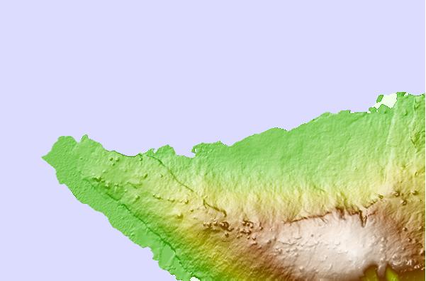
Use this relief map to navigate to tide stations, surf breaks and cities that are in the area of Asau Harbor, Savaii Island, Samoa Islands.
Other Nearby Locations' tide tables and tide charts to Asau Harbor, Savaii Island, Samoa Islands:
click location name for more details
 Surf breaks close to Asau Harbor, Savaii Island, Samoa Islands:
|
||
|---|---|---|
| Closest surf break | The Leap | 10 mi |
| Second closest surf break | Salailua | 16 mi |
| Third closest surf break | Malama Lefts | 24 mi |
| Fourth closest surf break | Aganoa Beach | 29 mi |
| Fifth closest surf break | The Wharf | 32 mi |


 Nearest