
| Distance / Altitude | Location | Report Date / Time | Live Weather | Wind | Gusts | Temp. | Visibility | Cloud |
|---|---|---|---|---|---|---|---|---|
| 2 km W / 3 m | BUOY-BDRN4 (Marine) | 2025-12-24 06:36 local (2025/12/24 11:36 GMT) | light winds from the NW (17 km/h at 320) | 7°C | - | |||
| 11 km NE / 3 m | BUOY-NBLP1 (Marine) | 2025-12-24 07:00 local (2025/12/24 12:00 GMT) | moderate winds from the NNW (22 km/h at 340) | 7°C | - | |||
| 14 km WSW / 217 m | Philadelphia/ne Airport (Pennsylvania) | 2025-12-24 05:54 local (2025/12/24 10:54 GMT) | Clear | moderate winds from the WNW (20 km/h at 300) | 6°C | 16 | ||
| 14 km WNW / 58 m | Siles wx (United States) | 2025-12-24 07:45 local (2025/12/24 12:45 GMT) | - | light winds from the WNW (16 km/h at 295) | — | - | - - 0 | |
| 15 km SW / 19 m | Philadelphia (Pennsylvania) | 2025-12-24 07:29 local (2025/12/24 12:29 GMT) | dry | light winds from the NW (19 km/h at 325) | 6°C | - | - - 0 | |
| 16 km SW / 27 m | Parry wx (United States) | 2025-12-24 07:15 local (2025/12/24 12:15 GMT) | dry | light winds from the NW (10 km/h at 325) | 6°C | - | - - 0 | |
| 16 km S / 218 m | Mount Holly Airport (New Jersey) | 2025-12-24 05:54 local (2025/12/24 10:54 GMT) | Clear | light winds from the W (13 km/h at 260) | 3°C | 16 | ||
| 16 km SSW / 20 m | Cinnaminson (New Jersey) | 2025-12-24 07:45 local (2025/12/24 12:45 GMT) | dry | calm (3 km/h at 307) | 6°C | - | - - 0 | |
| 19 km WNW / 205 m | Holland (Pennsylvania) | 2025-12-24 06:48 local (2025/12/24 11:48 GMT) | dry | light winds from the NW (8 km/h at 309) | 6°C | - | - - 0 | |
| 20 km SSW / 16 m | Kingston Estates wx (United States) | 2025-12-24 06:22 local (2025/12/24 11:22 GMT) | dry | light winds from the NW (10 km/h at 318) | 6°C | - | - - 0 |
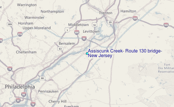
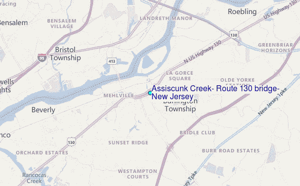
Choose Assiscunk Creek, Route 130 bridge, New Jersey Location Map Zoom:
| Contours: | Roads & Rivers: | Select a
tide station / surf break / city |
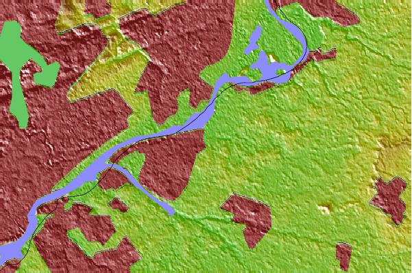
Use this relief map to navigate to tide stations, surf breaks and cities that are in the area of Assiscunk Creek, Route 130 bridge, New Jersey.
Other Nearby Locations' tide tables and tide charts to Assiscunk Creek, Route 130 bridge, New Jersey:
click location name for more details
 Surf breaks close to Assiscunk Creek, Route 130 bridge, New Jersey:
|
||
|---|---|---|
| Closest surf break | Bay Head | 42 mi |
| Second closest surf break | Brick Beach | 42 mi |
| Third closest surf break | Lavallette | 42 mi |
| Fourth closest surf break | Meters | 42 mi |
| Fifth closest surf break | Normandy Beach - 7th Street | 42 mi |


 Nearest
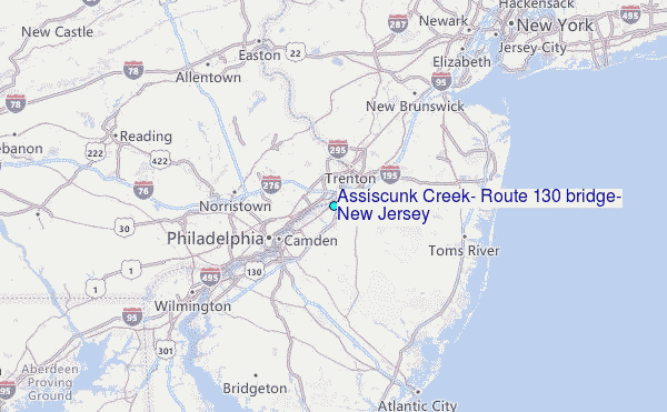