
| Distance / Altitude | Location | Report Date / Time | Live Weather | Wind | Gusts | Temp. | Visibility | Cloud |
|---|---|---|---|---|---|---|---|---|
| 24 km NW / 129 m | Sitiawan Airport (Malaysia) | 2026-07-10 09:00 local (2026/07/10 01:00 GMT) | distant precipitation but not falling at station | wind obs. (7 kph from 290 degs) was rejected (- km/h at -) | 31°C | 12 | - | |
| 25 km NW / 217 m | Sitiawan (Malaysia) | 2026-07-10 08:00 local (2026/07/10 00:00 GMT) | - | calm (2 km/h at 1) | 26°C | 10.0 | few | |
| 73 km NNE / 216 m | Ipoh Airport (Malaysia) | 2026-07-10 08:00 local (2026/07/10 00:00 GMT) | - | calm (0 km/h at 0) | 25°C | 10.0 | few | |
| 111 km SW / 15 m | SHIP6011 (Marine) | 2026-07-10 08:00 local (2026/07/10 00:00 GMT) | - (- km/h at -) | — | - km | |||
| 131 km SE / 218 m | Kuala Lumpur/sub Airport (Malaysia) | 2026-07-10 08:30 local (2026/07/10 00:30 GMT) | - | wind obs. (6 kph from 1 degs) was rejected (- km/h at -) | 28°C | 10.0 | few | |
| 111 km SW / 15 m | SHIP3197 (Marine) | 2026-07-10 08:00 local (2026/07/10 00:00 GMT) | - (- km/h at -) | — | - km | |||
| 131 km SE / 218 m | Kuala Lumpur/sub Airport (Malaysia) | 2026-07-10 08:30 local (2026/07/10 00:30 GMT) | - | wind obs. (6 kph from 1 degs) was rejected (- km/h at -) | 28°C | 10.0 | few | |
| 131 km SE / 217 m | Kuala Lumpur Sultan Abdul Aziz Shah Airport (Malaysia) | 2026-07-10 08:00 local (2026/07/10 00:00 GMT) | - | calm (4 km/h at 1) | 28°C | 10.0 | few | |
| 132 km SE / 22 m | Sultan Abdul Aziz Shah Airport (Malaysia) | 2026-07-10 09:00 local (2026/07/10 01:00 GMT) | - | wind obs. (13 kph from 260 degs) was rejected (- km/h at -) | — | 12 | - - - | |
| 152 km NW / 218 m | Penang International Airport/Bayan Lepas (Malaysia) | 2026-07-10 08:30 local (2026/07/10 00:30 GMT) | Thunderstorm - | calm (4 km/h at 1) | 27°C | 6.0 | few few scattered |
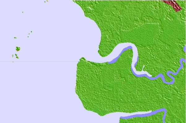
| Contours: | Roads & Rivers: | Select a
tide station / surf break / city |
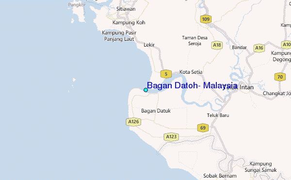
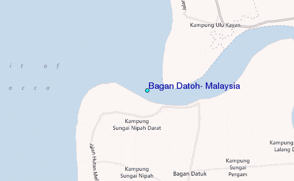
Use this relief map to navigate to tide stations, surf breaks and cities that are in the area of Bagan Datoh, Malaysia.
Other Nearby Locations' tide tables and tide charts to Bagan Datoh, Malaysia:
click location name for more details
 Surf breaks close to Bagan Datoh, Malaysia:
|
||
|---|---|---|
| Closest surf break | Tengah Beach (Bank Negara) | 172 mi |
| Second closest surf break | Cenang Beach (The Cliff) | 173 mi |
| Third closest surf break | Cherating | 183 mi |
| Fourth closest surf break | Kelulut (Marang) | 189 mi |
| Fifth closest surf break | Kijal | 189 mi |


 Nearest
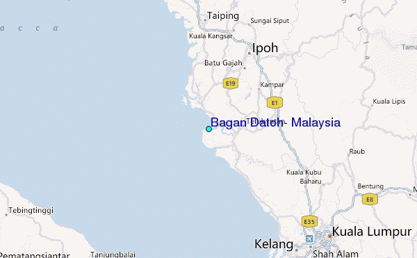