
| Distance / Altitude | Location | Report Date / Time | Live Weather | Wind | Gusts | Temp. | Visibility | Cloud |
|---|---|---|---|---|---|---|---|---|
| 18 km W / 2 m | Basrah International Airport l (Iraq) | 2026-06-25 16:00 local (2026/06/25 13:00 GMT) | - | fresh winds from the W (35 km/h at 280) | — | 0.0 | ||
| 42 km ESE / 200 m | Abadan International Airport (Iran, Islamic Rep) | 2026-06-25 15:00 local (2026/06/25 12:00 GMT) | - | moderate winds from the W (22 km/h at 280) | — | 0.0 | ||
| 118 km NE / 216 m | Ahwaz Airport (Iran, Islamic Rep) | 2026-06-25 15:30 local (2026/06/25 12:30 GMT) | - | light winds from the WNW (19 km/h at 300) | — | 0.0 | ||
| 130 km E / 213 m | Bandar Mahshahr Airport (Iran, Islamic Rep) | 2026-06-25 15:00 local (2026/06/25 12:00 GMT) | - | moderate winds from the WNW (28 km/h at 300) | — | 0.0 | ||
| 133 km S / 144 m | Ali Alabama Salem Airport (Kuwait) | 2026-06-25 15:11 local (2026/06/25 12:11 GMT) | Clear | fresh winds from the W (33 km/h at 280) | 44°C | 10.0 | ||
| 176 km E / 160 m | Agha Jari Airport (Iran, Islamic Rep) | 2026-06-25 15:00 local (2026/06/25 12:00 GMT) | - | moderate winds from the WNW (26 km/h at 290) | — | 0.0 | ||
| 210 km NE / 351 m | Masjed-Soleyman Airport (Iran, Islamic Rep) | 2026-06-25 15:00 local (2026/06/25 12:00 GMT) | - | light winds from the S (11 km/h at 190) | — | 0.0 | ||
| 286 km E / 601 m | Gach Saran Airport (Iran, Islamic Rep) | 2026-06-25 15:00 local (2026/06/25 12:00 GMT) | - | light winds from the W (11 km/h at 270) | — | 0.0 | ||
| 296 km SSW / 687 m | Hafr Al-batin AR Airport (Saudi Arabia) | 2026-06-25 15:00 local (2026/06/25 12:00 GMT) | - | light winds from the NW (15 km/h at 320) | — | 0.0 | ||
| 326 km N / 1175 m | Khoram Abad Airport (Iran, Islamic Rep) | 2026-06-25 15:00 local (2026/06/25 12:00 GMT) | - | moderate winds from the WNW (22 km/h at 290) | — | 0.0 |
| Contours: | Roads & Rivers: | Select a
tide station / surf break / city |
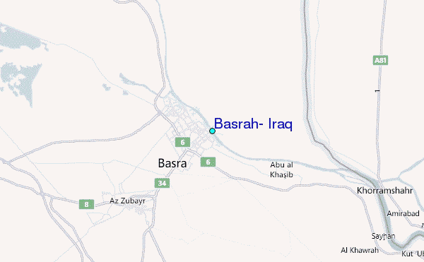
Use this relief map to navigate to tide stations, surf breaks and cities that are in the area of Basrah, Iraq.
Other Nearby Locations' tide tables and tide charts to Basrah, Iraq:
click location name for more details
 Surf breaks close to Basrah, Iraq:
|
||
|---|---|---|
| Closest surf break | Mangaf | 99 mi |
| Second closest surf break | Jebal Ali Lefts | 580 mi |
| Third closest surf break | Jumeirah Beach | 582 mi |
| Fourth closest surf break | Al Hamra - Ras Al Khema | 587 mi |
| Fifth closest surf break | Tim's Reef | 625 mi |


 Nearest
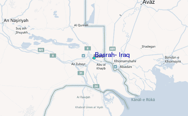