
| Distance / Altitude | Location | Report Date / Time | Live Weather | Wind | Gusts | Temp. | Visibility | Cloud |
|---|---|---|---|---|---|---|---|---|
| 22 km S / 212 m | Maasin (Philippines) | 2026-03-17 08:00 local (2026/03/17 00:00 GMT) | distant precipitation but not falling at station | - (- km/h at -) | 29°C | 22 | - | |
| 97 km SE / 219 m | Surigao (Philippines) | 2026-03-17 08:00 local (2026/03/17 00:00 GMT) | haze | calm (4 km/h at 270) | 29°C | 25 | - | |
| 129 km NE / 214 m | Guiuan (Samar Island) (Philippines) | 2026-03-17 08:00 local (2026/03/17 00:00 GMT) | distant precipitation but not falling at station | - (- km/h at -) | 28°C | 18 | - | |
| 156 km SE / 36 m | Del Pilar wx (Philippines) | 2026-03-17 08:03 local (2026/03/17 00:03 GMT) | dry | calm (0 km/h at 93) | 27°C | - | - - 0 | |
| 161 km N / 96 m | Catbalogan-Samar (Philippines) | 2026-03-17 08:00 local (2026/03/17 00:00 GMT) | state of sky unchanged | calm (4 km/h at 140) | 29°C | 22 | - | |
| 162 km NNE / 95 m | Borongan (Philippines) | 2026-03-17 08:00 local (2026/03/17 00:00 GMT) | haze | calm (4 km/h at 40) | 29°C | 18 | - | |
| 162 km ESE / 20 m | BRAVO SIARGAO (Philippines) | 2026-03-17 08:00 local (2026/03/17 00:00 GMT) | - | light winds from the N (13 km/h at 357) | 28°C | - | - - 0 | |
| 171 km SSE / 46 m | Butuan (Philippines) | 2026-03-17 08:00 local (2026/03/17 00:00 GMT) | light to moderate thunderstorm | calm (4 km/h at 180) | 28°C | 8 | - | |
| 197 km SSW / 8 m | Dumaguete (Philippines) | 2026-03-17 08:00 local (2026/03/17 00:00 GMT) | distant precipitation but not falling at station | wind obs. (11 kph from 110 degs) was rejected (- km/h at -) | 28°C | 10 | few - - | |
| 197 km SSW / 8 m | Dumaguete–Sibulan Airport (Philippines) | 2026-03-17 08:00 local (2026/03/17 00:00 GMT) | - | wind obs. (11 kph from 360 degs) was rejected (- km/h at -) | 26°C | 10.0 | few |
| Contours: | Roads & Rivers: | Select a
tide station / surf break / city |
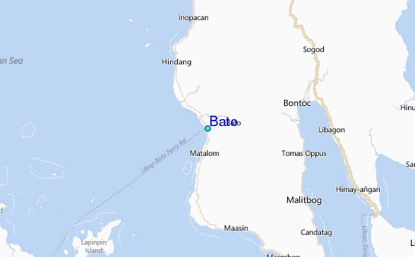
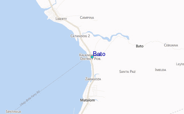
Use this relief map to navigate to tide stations, surf breaks and cities that are in the area of Bato.
Other Nearby Locations' tide tables and tide charts to Bato:
click location name for more details
 Surf breaks close to Bato:
|
||
|---|---|---|
| Closest surf break | Calicoan Island ABCD Beach | 83 mi |
| Second closest surf break | Sulingan Beach | 83 mi |
| Third closest surf break | Burgos | 90 mi |
| Fourth closest surf break | Llorente | 91 mi |
| Fifth closest surf break | Pacifico | 93 mi |


 Nearest
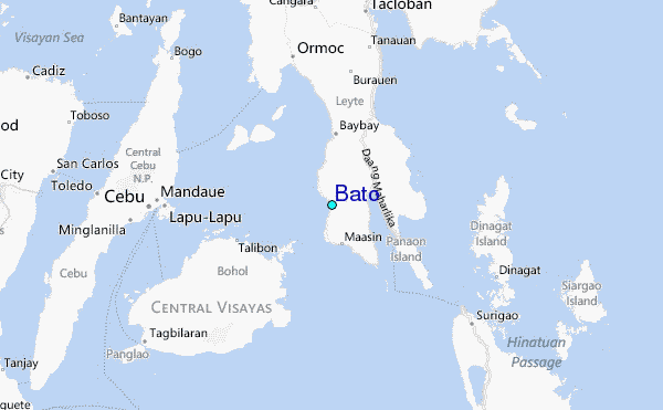