
| Distance / Altitude | Location | Report Date / Time | Live Weather | Wind | Gusts | Temp. | Visibility | Cloud |
|---|---|---|---|---|---|---|---|---|
| 3 km N / 3 m | BUOY-WYCM6 (Marine) | 2026-07-12 19:00 local (2026/07/13 00:00 GMT) | calm (4 km/h at 270) | 26°C | - | |||
| 13 km W / 391 m | Bay St Louis Airport (Mississippi) | 2026-07-12 17:50 local (2026/07/12 22:50 GMT) | Dry and partly cloudy | calm (0 km/h at 0) | 26°C | 16 | scattered broken | |
| 15 km ENE / 7 m | Long Beach (Mississippi) | 2026-07-12 19:02 local (2026/07/13 00:02 GMT) | dry | calm (0 km/h at 0) | 24°C | - | - - 0 | |
| 27 km ENE / 209 m | Gulfport Airport (Mississippi) | 2026-07-12 17:53 local (2026/07/12 22:53 GMT) | Light rain | calm (0 km/h at 0) | 25°C | 8 | broken overcast | |
| 32 km NE / 23 m | Gulfport (Mississippi) | 2026-07-12 19:22 local (2026/07/13 00:22 GMT) | - | calm (0 km/h at 169) | 24°C | - | - - 0 | |
| 41 km ENE / 218 m | Biloxi/Keesler Airport (Mississippi) | 2026-07-12 18:11 local (2026/07/12 23:11 GMT) | Dry and partly cloudy | calm (0 km/h at 0) | 25°C | 16 | broken broken broken | |
| 41 km NW / 58 m | Caesar wx (United States) | 2026-07-12 19:33 local (2026/07/13 00:33 GMT) | dry | calm (0 km/h at 282) | 24°C | - | - - 0 | |
| 42 km WSW / 5 m | Pine Shadows wx (United States) | 2026-07-12 19:17 local (2026/07/13 00:17 GMT) | dry | calm (0 km/h at 328) | 25°C | - | - - 0 | |
| 43 km WSW / 219 m | Slidell Airport (Louisiana) | 2026-07-12 17:53 local (2026/07/12 22:53 GMT) | Light rain | calm (0 km/h at 0) | 25°C | 14 | broken | |
| 52 km NNE / 79 m | Perry wx (United States) | 2026-07-12 19:01 local (2026/07/13 00:01 GMT) | dry | calm (0 km/h at 277) | 23°C | - | - - 0 |
| Contours: | Roads & Rivers: | Select a
tide station / surf break / city |
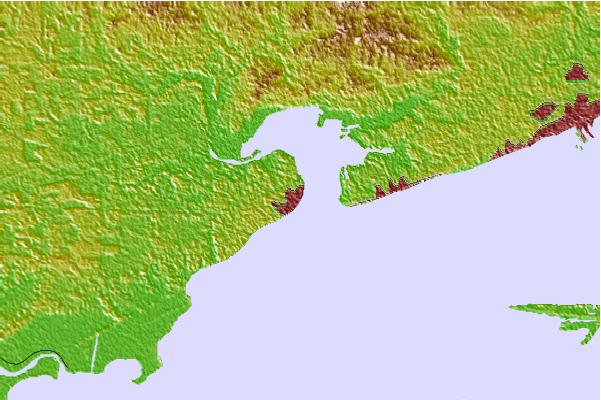
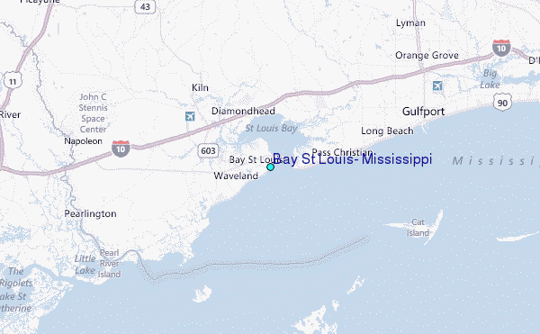
Use this relief map to navigate to tide stations, surf breaks and cities that are in the area of Bay St Louis, Mississippi.
Other Nearby Locations' tide tables and tide charts to Bay St Louis, Mississippi:
click location name for more details
 Surf breaks close to Bay St Louis, Mississippi:
|
||
|---|---|---|
| Closest surf break | Chandeleur Islands | 44 mi |
| Second closest surf break | Dauphin Island Pier | 75 mi |
| Third closest surf break | West Pass | 95 mi |
| Fourth closest surf break | Terry s Cove | 104 mi |
| Fifth closest surf break | Alabama Point | 106 mi |


 Nearest
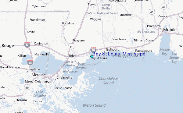