
| Distance / Altitude | Location | Report Date / Time | Live Weather | Wind | Gusts | Temp. | Visibility | Cloud |
|---|---|---|---|---|---|---|---|---|
| 17 km WSW / 3 m | BUOY-JCRN4 (Marine) | 2025-12-26 05:30 local (2025/12/26 10:30 GMT) | calm (4 km/h at 290) | -4°C | - | |||
| 25 km SSW / 3 m | BUOY-ACYN4 (Marine) | 2025-12-26 06:00 local (2025/12/26 11:00 GMT) | - (- km/h at -) | -3°C | - | |||
| 29 km SW / 217 m | Atlantic City Airport (New Jersey) | 2025-12-26 05:54 local (2025/12/26 10:54 GMT) | - | light winds from the N (17 km/h at 10) | -4°C | 16 | ||
| 42 km NNE / 4 m | Seaside Park- NJ (United States) | 2025-12-26 06:00 local (2025/12/26 11:00 GMT) | - | strong winds from the NNW (48 km/h at 341) | -3°C | - | - - 0 | |
| 43 km N / 25 m | Toms River (New jersey) | 2025-12-26 04:56 local (2025/12/26 09:56 GMT) | Clear | light winds from the N (6 km/h at 350) | -5°C | 16 | ||
| 48 km ENE / 3 m | Barnegat- NJ (Marine) | 2025-12-26 06:00 local (2025/12/26 11:00 GMT) | - (- km/h at -) | — | - | |||
| 59 km NW / 218 m | Wrightst/Mcguire Airport (New Jersey) | 2025-12-26 04:55 local (2025/12/26 09:55 GMT) | Clear | light winds from the NNW (13 km/h at 340) | -6°C | 16 | ||
| 65 km WNW / 218 m | Mount Holly Airport (New Jersey) | 2025-12-26 04:54 local (2025/12/26 09:54 GMT) | Clear | light winds from the NNW (9 km/h at 340) | -3°C | 16 | ||
| 70 km W / 47.5 m | Washington Township (New Jersey) | 2025-12-26 06:05 local (2025/12/26 11:05 GMT) | - | calm (3 km/h at 70) | 1°C | - | - - 0 | |
| 70 km N / 219 m | Belmar/Farmdale Airport (New Jersey) | 2025-12-26 05:18 local (2025/12/26 10:18 GMT) | Clear | light winds from the NNW (13 km/h at 330) | -5°C | 16 |
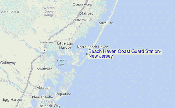
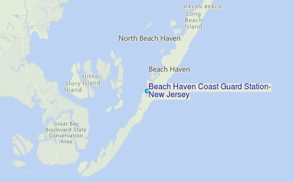
Choose Beach Haven Coast Guard Station, New Jersey Location Map Zoom:
| Contours: | Roads & Rivers: | Select a
tide station / surf break / city |
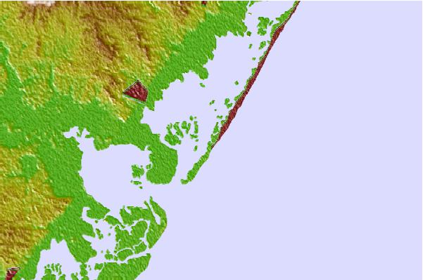

Use this relief map to navigate to tide stations, surf breaks and cities that are in the area of Beach Haven Coast Guard Station, New Jersey.
Other Nearby Locations' tide tables and tide charts to Beach Haven Coast Guard Station, New Jersey:
click location name for more details
 Surf breaks close to Beach Haven Coast Guard Station, New Jersey:
|
||
|---|---|---|
| Closest surf break | Hollyoake | 1 mi |
| Second closest surf break | Lbi 5th Street Beach Haven | 2 mi |
| Third closest surf break | Wooden Jetties | 3 mi |
| Fourth closest surf break | Lbi 82st | 5 mi |
| Fifth closest surf break | 30th Street/Ship Bottom | 7 mi |


 Nearest
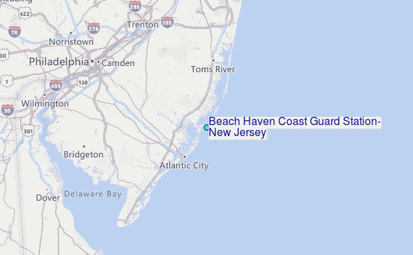