
| Distance / Altitude | Location | Report Date / Time | Live Weather | Wind | Gusts | Temp. | Visibility | Cloud |
|---|---|---|---|---|---|---|---|---|
| 27 km S / 219 m | Bristol/Lulsgate Airport (United Kingdom) | 2026-05-24 16:20 local (2026/05/24 15:20 GMT) | Dry and partly cloudy | light winds from the SSW.(Wind varies from 140 to 270 degs) (6 km/h at 210) | 26°C | 10.0 | no cloud | |
| 37 km WNW / 550 m | Blorenge (United Kingdom) | 2026-05-24 17:00 local (2026/05/24 16:00 GMT) | - | moderate winds from the SSE (28 km/h at 156) | 25°C | - | - - 0 | |
| 38 km SSW / 3 m | Weston Bay Waverider (Marine) | 2026-05-24 16:22 local (2026/05/24 15:22 GMT) | - (- km/h at -) | — | - | |||
| 45 km NE / 368 m | Gloucestershire Airport/Staverton Airport (United Kingdom) | 2026-05-24 16:20 local (2026/05/24 15:20 GMT) | - | calm (4 km/h at 1) | — | 0.0 | ||
| 46 km ESE / 145 m | Lyneham (United Kingdom) | 2026-05-24 17:00 local (2026/05/24 16:00 GMT) | no report | - (- km/h at -) | 19°C | - | - | |
| 52 km SE / 210 m | Edington Airstrip (United Kingdom) | 2026-05-24 17:00 local (2026/05/24 16:00 GMT) | - | light winds from the SSW (11 km/h at 199) | 35°C | - | - - 0 | |
| 54 km SW / 80 m | Llantrithyd Park (United Kingdom) | 2026-05-24 17:00 local (2026/05/24 16:00 GMT) | - | calm (2 km/h at 79) | 26°C | - | - - 0 | |
| 55 km SW / 209 m | Cardiff-Wales Airport (United Kingdom) | 2026-05-24 16:20 local (2026/05/24 15:20 GMT) | Dry and partly cloudy | light winds from the ESE (11 km/h at 120) | 25°C | 10.0 | no cloud | |
| 57 km SSW / 3 m | Hinkley Point 2 Waverider (Marine) | 2026-05-24 17:00 local (2026/05/24 16:00 GMT) | - (- km/h at -) | — | - | |||
| 60 km SW / 49 m | St Athan (United Kingdom) | 2026-05-24 17:00 local (2026/05/24 16:00 GMT) | no report | wind obs. (9 kph from 160 degs) was rejected (- km/h at -) | 19°C | 35 | - |
Choose Beachley (Aust), Severn River, England Location Map Zoom:
| Contours: | Roads & Rivers: | Select a
tide station / surf break / city |
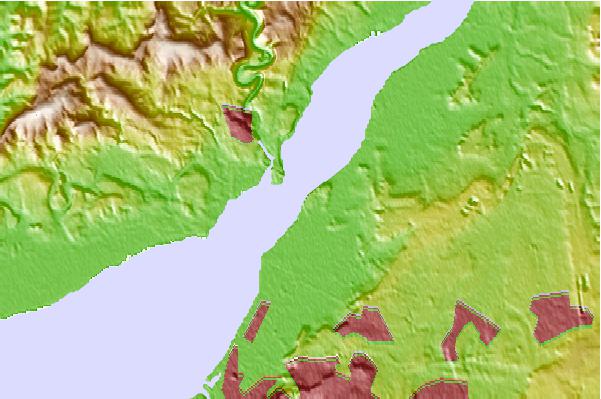
Use this relief map to navigate to tide stations, surf breaks and cities that are in the area of Beachley (Aust), Severn River, England.
Other Nearby Locations' tide tables and tide charts to Beachley (Aust), Severn River, England:
click location name for more details
 Surf breaks close to Beachley (Aust), Severn River, England:
|
||
|---|---|---|
| Closest surf break | The Knap | 32 mi |
| Second closest surf break | Gileston | 37 mi |
| Third closest surf break | Llantwit Major | 40 mi |
| Fourth closest surf break | Southerndown | 44 mi |
| Fifth closest surf break | Ogmore-by-Sea | 44 mi |


 Nearest