
| Distance / Altitude | Location | Report Date / Time | Live Weather | Wind | Gusts | Temp. | Visibility | Cloud |
|---|---|---|---|---|---|---|---|---|
| 103 km WSW / 209 m | MiddlePercyIsland (Australia) | 2025-12-25 21:00 local (2025/12/25 11:00 GMT) | Rain | wind obs. (13 kph from 360 degs) was rejected (- km/h at -) | 26°C | - | - no observation - | |
| 119 km S / 240 m | Samuel Hill Aerodrome (Australia) | 2025-12-25 21:00 local (2025/12/25 11:00 GMT) | Continuous light rain | light winds from the S (9 km/h at 170) | 25°C | - | - overcast - | |
| 127 km E / 8 m | GannetCay (Australia) | 2025-12-25 21:00 local (2025/12/25 11:00 GMT) | No report | moderate winds from the N (24 km/h at 10) | 26°C | - | no observation | |
| 132 km SW / 28 m | Williamson (Australia) | 2025-12-25 21:00 local (2025/12/25 11:00 GMT) | Moderate to heavy rain and snow showers | wind obs. (20 kph from 230 degs) was rejected (- km/h at -) | 24°C | - | no observation | |
| 139 km SE / 0 m | lightning 154km NE of Yeppoon (Australia) | 2025-12-25 20:05 local (2025/12/25 10:05 GMT) | Thunderstorm | (- km/h at -) | — | |||
| 155 km S / 6 m | Yeppoon (Australia) | 2025-12-25 21:00 local (2025/12/25 11:00 GMT) | Patches of fog | light winds from the SW (9 km/h at 220) | 24°C | - | no observation | |
| 155 km S / 6 m | Yeppoon Automatic Weather Station (Australia) | 2025-12-25 21:00 local (2025/12/25 11:00 GMT) | Patches of fog | light winds from the SW (9 km/h at 220) | 24°C | - | - no observation - | |
| 163 km SE / 0 m | lightning 169km NNE of Gladstone (Australia) | 2025-12-25 21:18 local (2025/12/25 11:18 GMT) | Thunderstorm | (- km/h at -) | — | |||
| 169 km NW / 6 m | Creal Reef (Australia) | 2025-12-25 21:00 local (2025/12/25 11:00 GMT) | No report | light winds from the NNE (19 km/h at 20) | 28°C | - | - no observation - | |
| 188 km SW / 10 m | St. Lawrence (Australia) | 2025-12-25 21:00 local (2025/12/25 11:00 GMT) | Moderate to heavy hail showers | moderate winds from the SSE (22 km/h at 160) | 22°C | - | - no observation - |
| Contours: | Roads & Rivers: | Select a
tide station / surf break / city |


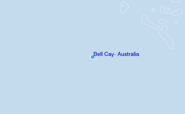
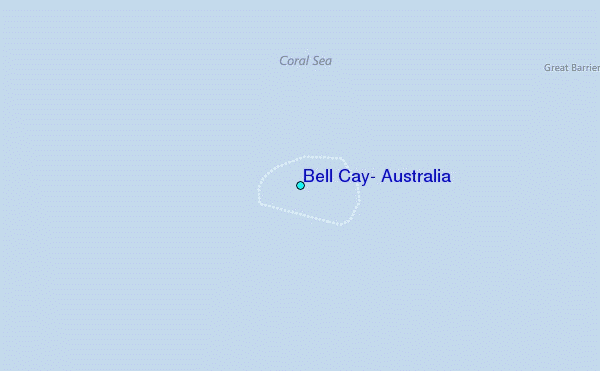
Use this relief map to navigate to tide stations, surf breaks and cities that are in the area of Bell Cay, Australia.
Other Nearby Locations' tide tables and tide charts to Bell Cay, Australia:
click location name for more details
 Surf breaks close to Bell Cay, Australia:
|
||
|---|---|---|
| Closest surf break | North Wall Mackay Harbour Beach | 139 mi |
| Second closest surf break | South Wall Mackay Harbour | 139 mi |
| Third closest surf break | Lamberts Beach | 140 mi |
| Fourth closest surf break | Dolphin Heads | 144 mi |
| Fifth closest surf break | Eimeo Point | 144 mi |


 Nearest
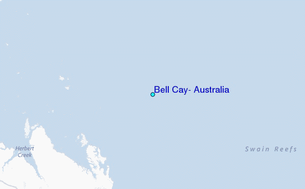