
| Distance / Altitude | Location | Report Date / Time | Live Weather | Wind | Gusts | Temp. | Visibility | Cloud |
|---|---|---|---|---|---|---|---|---|
| 20 km NE / 59 m | Calp wx (Spain) | 2026-06-01 09:20 local (2026/06/01 07:20 GMT) | - | - (- km/h at ) | 28°C | - | - - 0 | |
| 26 km SW / 287 m | Urbanización El Carril wx (Spain) | 2026-06-01 10:20 local (2026/06/01 08:20 GMT) | dry | calm (2 km/h at 181) | 28°C | - | - - 0 | |
| 26 km SW / 31 m | El Campello wx (Spain) | 2026-06-01 10:03 local (2026/06/01 08:03 GMT) | dry | calm (2 km/h at 90) | 26°C | - | - - 0 | |
| 30 km NE / 157 m | Teulada (Spain) | 2026-06-01 09:41 local (2026/06/01 07:41 GMT) | dry | calm (5 km/h at 331) | 23°C | - | - - 0 | |
| 32 km NNE / 86 m | Pedreguer wx (Spain) | 2026-06-01 10:01 local (2026/06/01 08:01 GMT) | dry | calm (2 km/h at 295) | 26°C | - | - - 0 | |
| 35 km NE / 3 m | SHIP3178 (Marine) | 2026-06-01 08:00 local (2026/06/01 06:00 GMT) | - (- km/h at -) | 23°C | - | |||
| 35 km NE / 15 m | SHIP8219 (Marine) | 2026-06-01 08:00 local (2026/06/01 06:00 GMT) | - (- km/h at -) | — | - km | |||
| 35 km NE / 3 m | SHIP7347 (Marine) | 2026-06-01 08:00 local (2026/06/01 06:00 GMT) | - (- km/h at -) | 23°C | - | |||
| 35 km NE / 15 m | SHIP2731 (Marine) | 2026-06-01 08:00 local (2026/06/01 06:00 GMT) | - (- km/h at -) | — | - km | |||
| 35 km NE / 15 m | SHIP7519 (Marine) | 2026-06-01 08:00 local (2026/06/01 06:00 GMT) | - (- km/h at -) | — | - km |
| Contours: | Roads & Rivers: | Select a
tide station / surf break / city |
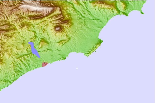
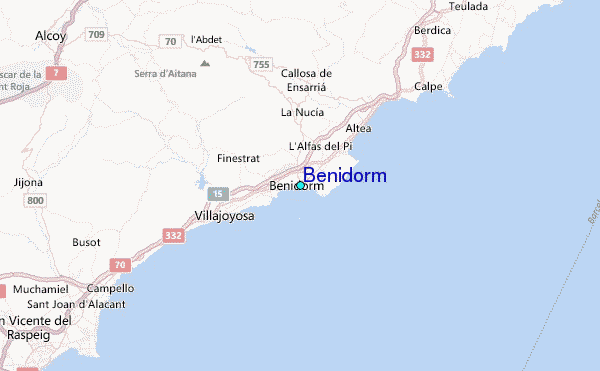
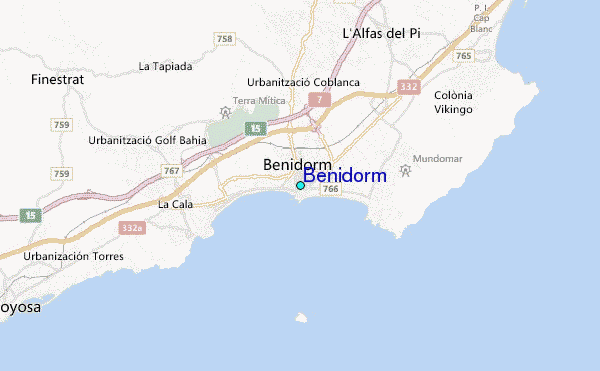
Use this relief map to navigate to tide stations, surf breaks and cities that are in the area of Benidorm.
Other Nearby Locations' tide tables and tide charts to Benidorm:
click location name for more details
 Surf breaks close to Benidorm:
|
||
|---|---|---|
| Closest surf break | Puerto Benidorm | 0 mi |
| Second closest surf break | Playa Poniente | 1 mi |
| Third closest surf break | Derecha de la Cala | 2 mi |
| Fourth closest surf break | Playa del Torres | 4 mi |
| Fifth closest surf break | Playa Finestrat | 5 mi |


 Nearest
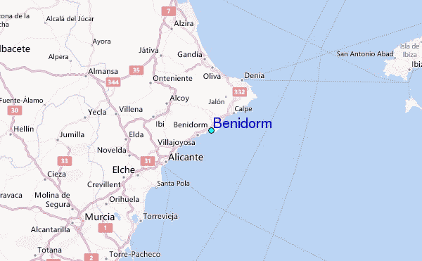