
| Distance / Altitude | Location | Report Date / Time | Live Weather | Wind | Gusts | Temp. | Visibility | Cloud |
|---|---|---|---|---|---|---|---|---|
| 21 km N / 3 m | InvercargillAeroAws (New Zealand) | 2026-02-28 14:00 local (2026/02/28 01:00 GMT) | Clear skies | fresh winds from the W (31 km/h at 270) | 16°C | 10 km | no observation | |
| 100 km SSW / 240 m | South West Cape Automatic Weather Station (New Zealand) | 2026-02-28 14:00 local (2026/02/28 01:00 GMT) | - | strong winds from the NW (46 km/h at 310) | 13°C | - | no observation | |
| 113 km E / 131 m | Nugget Point Automatic Weather Station (New Zealand) | 2026-02-28 14:00 local (2026/02/28 01:00 GMT) | - | moderate winds from the WSW (22 km/h at 240) | 15°C | - | no observation | |
| 142 km W / 44 m | PuysegurPointAws (New Zealand) | 2026-02-28 14:00 local (2026/02/28 01:00 GMT) | - | light winds from the WNW (9 km/h at 290) | 15°C | - | no observation | |
| 160 km ENE / 2 m | Dunedin Airport (New zealand) | 2026-02-28 13:30 local (2026/02/28 00:30 GMT) | Dry and partly cloudy | light winds from the SSW.(Wind varies from 170 to 230 degs) (11 km/h at 200) | 18°C | 10.0 | no cloud | |
| 161 km ENE / 2 m | DunedinAeroAws (New Zealand) | 2026-02-28 14:00 local (2026/02/28 01:00 GMT) | Clear skies | light winds from the S (6 km/h at 180) | 18°C | 20 km | no observation | |
| 178 km N / 357 m | QueenstownAeroAws (New Zealand) | 2026-02-28 14:00 local (2026/02/28 01:00 GMT) | Clear skies | light winds from the W (15 km/h at 260) | 16°C | 20 km | no observation | |
| 191 km WNW / 19 m | SecretaryIslandAws (New Zealand) | 2026-02-28 14:00 local (2026/02/28 01:00 GMT) | - | moderate winds from the WSW (28 km/h at 250) | 18°C | - | no observation | |
| 202 km NNE / 372 m | Lauder (New Zealand) | 2026-02-28 13:00 local (2026/02/28 00:00 GMT) | - | wind obs. (7 kph from 60 degs) was rejected (- km/h at -) | — | - | - - - | |
| 217 km WSW / 15 m | ASCATC166E46S (Marine) | 2026-02-28 11:34 local (2026/02/27 22:34 GMT) | moderate winds from the W (27 km/h at 262) | — | - km |
| Contours: | Roads & Rivers: | Select a
tide station / surf break / city |
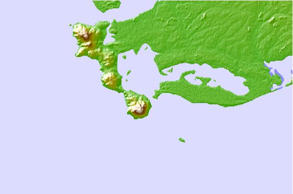
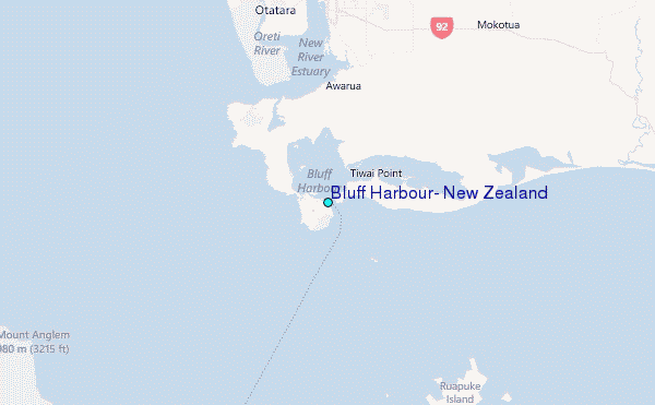
Use this relief map to navigate to tide stations, surf breaks and cities that are in the area of Bluff Harbour, New Zealand.
Other Nearby Locations' tide tables and tide charts to Bluff Harbour, New Zealand:
click location name for more details
 Surf breaks close to Bluff Harbour, New Zealand:
|
||
|---|---|---|
| Closest surf break | Oreti Beach | 12 mi |
| Second closest surf break | Mitchell's Bay | 21 mi |
| Third closest surf break | Nicks Point | 27 mi |
| Fourth closest surf break | Colac Bay | 27 mi |
| Fifth closest surf break | Dinner Plates | 32 mi |


 Nearest
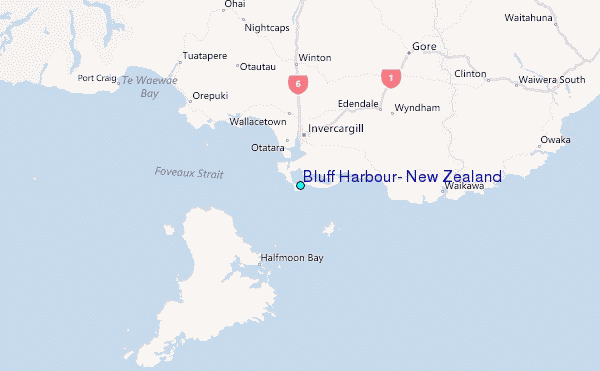