
| Distance / Altitude | Location | Report Date / Time | Live Weather | Wind | Gusts | Temp. | Visibility | Cloud |
|---|---|---|---|---|---|---|---|---|
| 32 km W / 12 m | Linea de Base wx (Panama) | 2026-03-23 19:23 local (2026/03/24 00:23 GMT) | dry | calm (2 km/h at 343) | 22°C | - | - - 0 | |
| 65 km S / 2132 m | Cerro Punta wx (Panama) | 2026-03-23 19:23 local (2026/03/24 00:23 GMT) | dry | calm (5 km/h at 5) | 9°C | - | - - 0 | |
| 66 km S / 1156 m | Los Pinos wx (Panama) | 2026-03-23 19:24 local (2026/03/24 00:24 GMT) | dry | light winds from the NNE (8 km/h at 26) | 16°C | - | - - 0 | |
| 77 km S / 1363 m | Barriada Volcán wx (Panama) | 2026-03-23 19:23 local (2026/03/24 00:23 GMT) | dry | calm (5 km/h at 25) | 13°C | - | - - 0 | |
| 80 km W / 1 m | Cahuita wx (Costa Rica) | 2026-03-23 20:14 local (2026/03/24 01:14 GMT) | dry | calm (0 km/h at 108) | 26°C | - | - - 0 | |
| 107 km S / 26 m | David (Panama) | 2026-03-23 19:00 local (2026/03/24 00:00 GMT) | - | calm (0 km/h at 0) | 28°C | 40 km | scattered | |
| 107 km S / 323 m | David/Enrique Malek International Airport (Panama) | 2026-03-23 19:00 local (2026/03/24 00:00 GMT) | - | light winds from the SW (11 km/h at 220) | 28°C | 10.0 | few | |
| 108 km S / 26 m | Enrique Malek wx (Panama) | 2026-03-23 19:23 local (2026/03/24 00:23 GMT) | dry | wind obs. (18 kph from 230 degs) was rejected (- km/h at -) | 25°C | - | - - 0 | |
| 108 km WNW / 3 m | PuertoLimon (Costa Rica) | 2026-03-23 19:00 local (2026/03/24 00:00 GMT) | - | light winds from the WNW (6 km/h at 300) | 26°C | 35 km | mostly cloudy | |
| 110 km WNW / 358 m | Limon International Airport (Costa Rica) | 2026-03-23 19:00 local (2026/03/24 00:00 GMT) | Dry and partly cloudy | light winds from the WNW (6 km/h at 300) | 26°C | 10.0 | few broken |
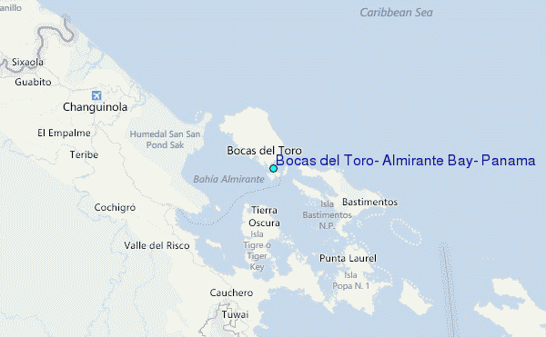
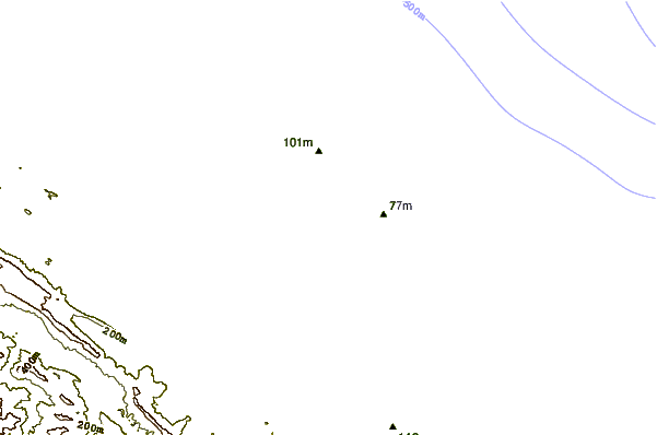
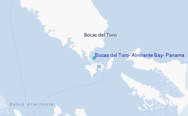
Choose Bocas del Toro, Almirante Bay, Panama Location Map Zoom:
| Contours: | Roads & Rivers: | Select a
tide station / surf break / city |
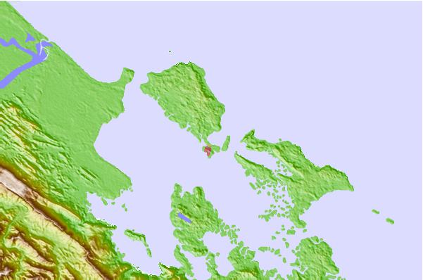
Use this relief map to navigate to tide stations, surf breaks and cities that are in the area of Bocas del Toro, Almirante Bay, Panama.
Other Nearby Locations' tide tables and tide charts to Bocas del Toro, Almirante Bay, Panama:
click location name for more details
 Surf breaks close to Bocas del Toro, Almirante Bay, Panama:
|
||
|---|---|---|
| Closest surf break | Careneros Point Break | 1 mi |
| Second closest surf break | Paunch Reef | 2 mi |
| Third closest surf break | Dumpers | 2 mi |
| Fourth closest surf break | Silverbacks | 4 mi |
| Fifth closest surf break | Bluff | 4 mi |


 Nearest
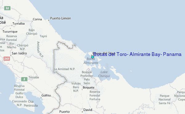