
| Distance / Altitude | Location | Report Date / Time | Live Weather | Wind | Gusts | Temp. | Visibility | Cloud |
|---|---|---|---|---|---|---|---|---|
| 60 km SE / 219 m | Dagupan (Philippines) | 2026-05-09 08:00 local (2026/05/09 00:00 GMT) | haze | light winds from the SSE (7 km/h at 160) | 33°C | 12 | - | |
| 75 km E / 1501 m | Baguio (Philippines) | 2026-05-09 08:00 local (2026/05/09 00:00 GMT) | Fog at a distance | wind obs. (7 kph from 160 degs) was rejected (- km/h at -) | 22°C | 13 | - | |
| 119 km S / 5 m | Iba (Philippines) | 2026-05-09 08:00 local (2026/05/09 00:00 GMT) | thunderstorm but no precipitation falling at station | wind obs. (18 kph from 220 degs) was rejected (- km/h at -) | 32°C | 20 | - | |
| 138 km SE / 19 m | Santa Lucia wx (Philippines) | 2026-05-09 08:13 local (2026/05/09 00:13 GMT) | dry | light winds from the S (8 km/h at 173) | 31°C | - | - - 0 | |
| 141 km NNE / 5 m | Rugsuanan wx (Philippines) | 2026-05-09 08:15 local (2026/05/09 00:15 GMT) | - | - (- km/h at ) | 33°C | - | - - 0 | |
| 152 km SSE / 155 m | Clark AB (Philippines) | 2026-05-09 08:00 local (2026/05/09 00:00 GMT) | haze | wind obs. (18 kph from 180 degs) was rejected (- km/h at -) | 33°C | 15 | - | |
| 155 km SSE / 584 m | Angeles/Pampanga Airport (Philippines) | 2026-05-09 07:00 local (2026/05/08 23:00 GMT) | - | wind obs. (7 kph from 310 degs) was rejected (- km/h at -) | 28°C | 10.0 | few | |
| 175 km NNE / 49 m | Sinait Synoptic Station (Philippines) | 2026-05-09 08:00 local (2026/05/09 00:00 GMT) | thunderstorm but no precipitation falling at station | - (- km/h at -) | 31°C | 15 | - | |
| 181 km SSE / 0 m | Olongapo/Subic Bay Airport (Philippines) | 2026-05-09 08:00 local (2026/05/09 00:00 GMT) | haze | calm (4 km/h at 1) | 29°C | 10.0 | few - - | |
| 199 km ESE / 145 m | Baler Radar Station (Philippines) | 2026-05-09 08:00 local (2026/05/09 00:00 GMT) | no report | calm (4 km/h at 160) | 29°C | 30 | - |
| Contours: | Roads & Rivers: | Select a
tide station / surf break / city |
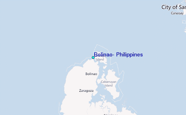
Use this relief map to navigate to tide stations, surf breaks and cities that are in the area of Bolinao, Philippines.
Other Nearby Locations' tide tables and tide charts to Bolinao, Philippines:
click location name for more details
 Surf breaks close to Bolinao, Philippines:
|
||
|---|---|---|
| Closest surf break | Bauang | 29 mi |
| Second closest surf break | Poro Point | 29 mi |
| Third closest surf break | Car-rille | 30 mi |
| Fourth closest surf break | Mona Liza Point | 33 mi |
| Fifth closest surf break | San Juan | 33 mi |


 Nearest
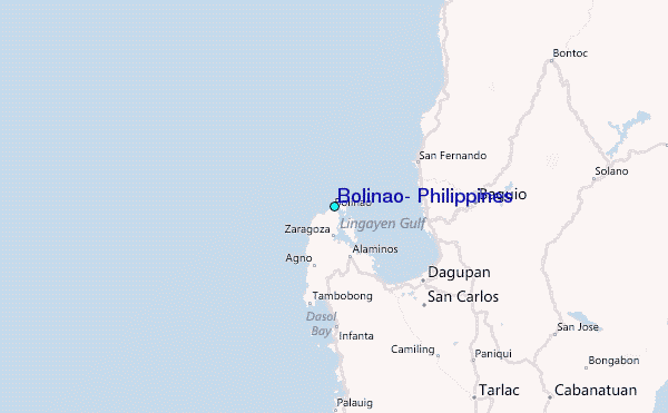