
| Distance / Altitude | Location | Report Date / Time | Live Weather | Wind | Gusts | Temp. | Visibility | Cloud |
|---|---|---|---|---|---|---|---|---|
| 168 km S / 3 m | BalikpapanSepinggan (Indonesia) | 2026-06-13 07:30 local (2026/06/12 23:30 GMT) | Dry and partly cloudy | wind obs. (11 kph from 230 degs) was rejected (- km/h at -) | 27°C | 10.0 | scattered broken broken | |
| 354 km N / 50 m | Juwata Airport (Indonesia) | 2026-06-13 07:30 local (2026/06/12 23:30 GMT) | - | light winds from the SW (11 km/h at 230) | 27°C | 10.0 | few | |
| 458 km N / 130 m | Tawau (Malaysia) | 2026-06-13 08:00 local (2026/06/13 00:00 GMT) | Haze | calm (4 km/h at 310) | 28°C | 34 km | mostly cloudy | |
| 459 km N / 215 m | Tawau/Kalimantan Airport (Malaysia) | 2026-06-13 07:00 local (2026/06/12 23:00 GMT) | - | calm (0 km/h at 0) | 25°C | 10.0 | few | |
| 476 km ESE / 133 m | lightning 77km E of Poso (Indonesia) | 2026-06-13 07:18 local (2026/06/12 23:18 GMT) | Thunderstorm | (- km/h at -) | — | |||
| 499 km SSW / 20 m | Syamsudin Noor International Airport (Indonesia) | 2026-06-13 07:30 local (2026/06/12 23:30 GMT) | - | wind obs. (7 kph from 110 degs) was rejected (- km/h at -) | 25°C | 9.0 | few | |
| 594 km S / 0 m | lightning 165km SE of Martapura (Indonesia) | 2026-06-13 05:34 local (2026/06/12 21:34 GMT) | Thunderstorm | (- km/h at -) | — | |||
| 602 km NW / 215 m | Brunei International Airport (Malaysia) | 2026-06-13 07:30 local (2026/06/12 23:30 GMT) | Dry and partly cloudy | light winds from the SE (6 km/h at 140) | 26°C | 10.0 | few broken | |
| 602 km WNW / 130 m | Bintulu Airport (Malaysia) | 2026-06-13 08:00 local (2026/06/13 00:00 GMT) | Clouds dissolving | light winds from the SE (6 km/h at 130) | 25°C | 50 km | mostly cloudy | |
| 603 km WNW / 215 m | Bintulu Airport (Malaysia) | 2026-06-13 07:00 local (2026/06/12 23:00 GMT) | - | calm (2 km/h at 1) | 24°C | 10.0 | few |
| Contours: | Roads & Rivers: | Select a
tide station / surf break / city |
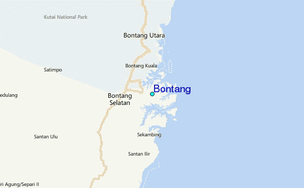
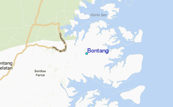
Use this relief map to navigate to tide stations, surf breaks and cities that are in the area of Bontang.
Other Nearby Locations' tide tables and tide charts to Bontang:
click location name for more details
 Surf breaks close to Bontang:
|
||
|---|---|---|
| Closest surf break | Tanjung Batu | 379 mi |
| Second closest surf break | Berakas Beach | 380 mi |
| Third closest surf break | Tungku Beach or KM26 | 380 mi |
| Fourth closest surf break | Tanjung Aru Beach | 413 mi |
| Fifth closest surf break | Pulau Manukan | 417 mi |


 Nearest
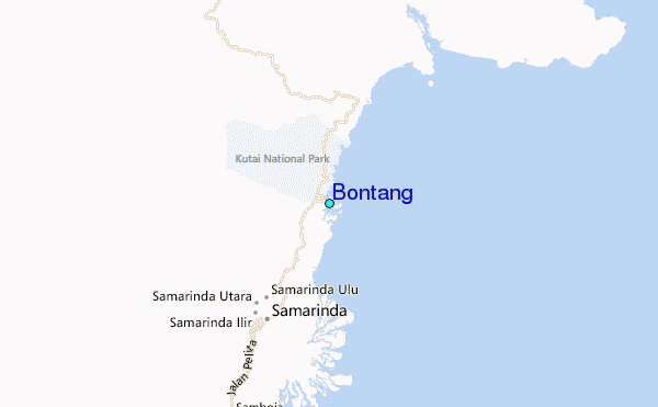