
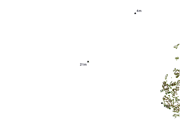
| Distance / Altitude | Location | Report Date / Time | Live Weather | Wind | Gusts | Temp. | Visibility | Cloud |
|---|---|---|---|---|---|---|---|---|
| 27 km W / 15 m | ASCATC142E11S (Marine) | 2025-12-23 22:26 local (2025/12/23 12:26 GMT) | light winds from the SSE (10 km/h at 157) | — | - km | |||
| 41 km E / 5 m | Horn Island Automatic Weather Station (Australia) | 2025-12-23 23:00 local (2025/12/23 13:00 GMT) | no report | wind obs. (6 kph from 140 degs) was rejected (- km/h at -) | 27°C | - | - no observation - | |
| 42 km E / 13 m | Horn Island Airport (Australia) | 2025-12-23 22:30 local (2025/12/23 12:30 GMT) | Dry and partly cloudy | calm (2 km/h at 140) | 27°C | 10.0 | no cloud | |
| 78 km WSW / 15 m | ASCATC141E11S (Marine) | 2025-12-23 22:26 local (2025/12/23 12:26 GMT) | light winds from the ESE (11 km/h at 116) | — | - km | |||
| 93 km NE / 15 m | SHIP4373 (Marine) | 2025-12-23 21:00 local (2025/12/23 11:00 GMT) | light winds from the SW (7.2 km/h at 230) | 30°C | - km | |||
| 93 km NE / 15 m | SHIP7818 (Marine) | 2025-12-23 21:00 local (2025/12/23 11:00 GMT) | light winds from the SW (7.2 km/h at 230) | 30°C | - km | |||
| 93 km NE / 15 m | SHIP2701 (Marine) | 2025-12-23 21:00 local (2025/12/23 11:00 GMT) | light winds from the SW (7.2 km/h at 230) | 30°C | - km | |||
| 93 km NE / 15 m | SHIP3804 (Marine) | 2025-12-23 21:00 local (2025/12/23 11:00 GMT) | light winds from the SW (7.2 km/h at 230) | 30°C | - km | |||
| 93 km NE / 15 m | SHIP6598 (Marine) | 2025-12-23 21:00 local (2025/12/23 11:00 GMT) | light winds from the SW (7.2 km/h at 230) | 30°C | - km | |||
| 105 km N / 15 m | ASCATC142E10S (Marine) | 2025-12-23 22:26 local (2025/12/23 12:26 GMT) | light winds from the SE (9 km/h at 142) | — | - km |
| Contours: | Roads & Rivers: | Select a
tide station / surf break / city |

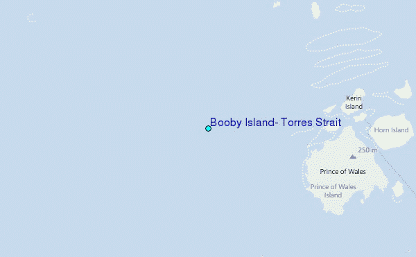
Use this relief map to navigate to tide stations, surf breaks and cities that are in the area of Booby Island, Torres Strait.
Other Nearby Locations' tide tables and tide charts to Booby Island, Torres Strait:
click location name for more details
 Surf breaks close to Booby Island, Torres Strait:
|
||
|---|---|---|
| Closest surf break | Tupira Right | 489 mi |
| Second closest surf break | Forok Point | 499 mi |
| Third closest surf break | The Wharf (Mission Point) | 500 mi |
| Fourth closest surf break | Wewak Point | 502 mi |
| Fifth closest surf break | Moem Point | 502 mi |


 Nearest
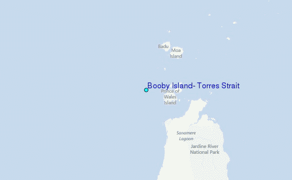