
| Distance / Altitude | Location | Report Date / Time | Live Weather | Wind | Gusts | Temp. | Visibility | Cloud |
|---|---|---|---|---|---|---|---|---|
| 36 km NE / 410 m | Scotts Peak Dam (Australia) | 2026-04-30 06:00 local (2026/04/29 20:00 GMT) | No report | light winds from the SE (7 km/h at 130) | 8°C | - | - no observation - | |
| 44 km SSE / 148 m | Maatsuyker Island Lighthouse (Australia) | 2026-04-30 04:00 local (2026/04/29 18:00 GMT) | no report | light winds from the NNE (9 km/h at 30) | 9°C | - | - | |
| 55 km WNW / 34 m | Low Rocky Point Automatic Weather Station (Australia) | 2026-04-30 06:00 local (2026/04/29 20:00 GMT) | no report | light winds from the N (17 km/h at 10) | 8°C | - | - no observation - | |
| 55 km WNW / 34 m | Low Rocky Point (Australia) | 2026-04-30 06:00 local (2026/04/29 20:00 GMT) | no report | wind obs. (15 kph from 110 degs) was rejected (- km/h at -) | 8°C | - | - | |
| 64 km ENE / 831 m | HartzMountains(Keoghs Pimple) (Australia) | 2026-04-30 06:00 local (2026/04/29 20:00 GMT) | no report | light winds from the S (13 km/h at 170) | 2°C | - | - no observation - | |
| 64 km ENE / 495 m | Warra (Australia) | 2026-04-30 04:00 local (2026/04/29 18:00 GMT) | no report | light winds from the SSW (7 km/h at 200) | 4°C | - | - | |
| 95 km ESE / 60 m | Cape Bruny (Australia) | 2026-04-30 06:00 local (2026/04/29 20:00 GMT) | No report | light winds from the N (19 km/h at 10) | 11°C | - | no observation | |
| 95 km ESE / 60 m | Cape Bruny (Australia) | 2026-04-30 06:00 local (2026/04/29 20:00 GMT) | no report | wind obs. (15 kph from 170 degs) was rejected (- km/h at -) | 10°C | - | - no observation - | |
| 95 km ENE / 65 m | Grove (Research Station) (Australia) | 2026-04-30 06:00 local (2026/04/29 20:00 GMT) | no report | light winds from the ESE (6 km/h at 110) | 7°C | - | - no observation - | |
| 100 km NE / 27 m | BushyPark(Bushy Park Estates) (Australia) | 2026-04-30 06:00 local (2026/04/29 20:00 GMT) | no report | wind obs. (13 kph from 230 degs) was rejected (- km/h at -) | 7°C | - | - no observation - |
| Contours: | Roads & Rivers: | Select a
tide station / surf break / city |
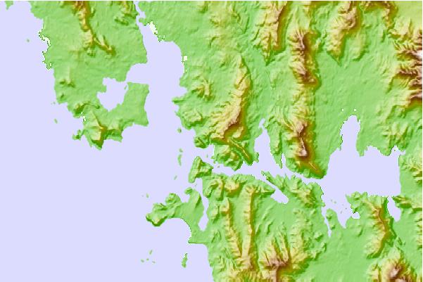
Use this relief map to navigate to tide stations, surf breaks and cities that are in the area of Bramble Cove, Tasmania.
Other Nearby Locations' tide tables and tide charts to Bramble Cove, Tasmania:
click location name for more details
 Surf breaks close to Bramble Cove, Tasmania:
|
||
|---|---|---|
| Closest surf break | Bruny Island - Lighthouse Bay | 58 mi |
| Second closest surf break | Bruny Island - Mabel Bay | 59 mi |
| Third closest surf break | Bruny Island - Jawbones | 61 mi |
| Fourth closest surf break | Bruny Island - Lagoons | 61 mi |
| Fifth closest surf break | Bruny Island - Cloudy Bay | 62 mi |


 Nearest