
| Distance / Altitude | Location | Report Date / Time | Live Weather | Wind | Gusts | Temp. | Visibility | Cloud |
|---|---|---|---|---|---|---|---|---|
| 1 km SW / 3 m | BUOY-BMTW1 (Marine) | 2026-03-03 16:00 local (2026/03/04 00:00 GMT) | light winds from the ENE (11 km/h at 60) | 11°C | - | |||
| 12 km SSW / 537 m | Bremerton National Airport (Washington) | 2026-03-03 15:43 local (2026/03/03 23:43 GMT) | - | light winds from the SW.(Wind varies from 004 to 008 degs) (19 km/h at 220) | 1°C | 0.0 | ||
| 18 km NE / 3 m | BUOY-WPOW1 (Marine) | 2026-03-03 16:00 local (2026/03/04 00:00 GMT) | fresh winds from the SW (32 km/h at 220) | 11°C | - | |||
| 18 km E / 100 m | Seattle (Washington) | 2026-03-03 15:15 local (2026/03/03 23:15 GMT) | - | wind obs. (6 kph from 130 degs) was rejected (- km/h at -) | 20°C | - | - - 0 | |
| 23 km NE / 15 m | SHIP4507 (Marine) | 2026-03-03 15:00 local (2026/03/03 23:00 GMT) | light winds from the SSE (12.96 km/h at 160) | — | - km | |||
| 23 km NE / 15 m | SHIP4212 (Marine) | 2026-03-03 14:00 local (2026/03/03 22:00 GMT) | light winds from the SSE (14.76 km/h at 160) | — | - km | |||
| 23 km NE / - m | SHIP702 (ocean) | 2026-03-03 16:00 local (2026/03/04 00:00 GMT) | - | light winds from the S (9 km/h at 190) | 12°C | - | no observation | |
| 23 km NE / 15 m | SHIP8088 (Marine) | 2026-03-03 16:00 local (2026/03/04 00:00 GMT) | light winds from the S (9.360000000000001 km/h at 190) | — | - km | |||
| 23 km NE / 15 m | SHIP4015 (Marine) | 2026-03-03 16:00 local (2026/03/04 00:00 GMT) | calm (5.4 km/h at 170) | — | - km | |||
| 23 km NE / 15 m | SHIP7505 (Marine) | 2026-03-03 14:00 local (2026/03/03 22:00 GMT) | light winds from the SSE (14.76 km/h at 160) | — | - km |
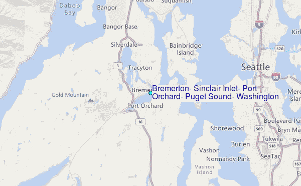
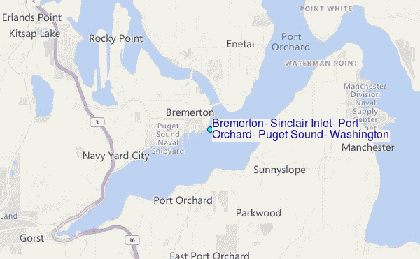
Choose Bremerton, Sinclair Inlet, Port Orchard, Puget Sound, Washington Location Map Zoom:
| Contours: | Roads & Rivers: | Select a
tide station / surf break / city |
Use this relief map to navigate to tide stations, surf breaks and cities that are in the area of Bremerton, Sinclair Inlet, Port Orchard, Puget Sound, Washington.
Other Nearby Locations' tide tables and tide charts to Bremerton, Sinclair Inlet, Port Orchard, Puget Sound, Washington:
click location name for more details
 Surf breaks close to Bremerton, Sinclair Inlet, Port Orchard, Puget Sound, Washington:
|
||
|---|---|---|
| Closest surf break | Fort. Ebey | 47 mi |
| Second closest surf break | Super green | 49 mi |
| Third closest surf break | Elwha | 60 mi |
| Fourth closest surf break | Crescent | 65 mi |
| Fifth closest surf break | Whiskey Creek | 68 mi |


 Nearest
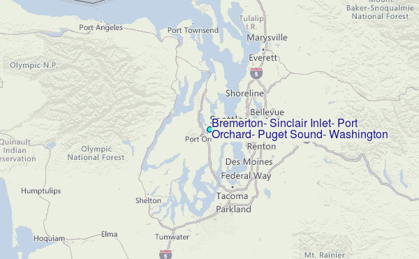