
| Distance / Altitude | Location | Report Date / Time | Live Weather | Wind | Gusts | Temp. | Visibility | Cloud |
|---|---|---|---|---|---|---|---|---|
| 7 km E / 3 m | Calais/Dunkerque Airport (France) | 2026-04-09 02:30 local (2026/04/09 00:30 GMT) | - | calm (4 km/h at 260) | — | 0.0 | ||
| 15 km NW / 3 m | Sandettie Buoy (Marine) | 2026-04-09 01:00 local (2026/04/08 23:00 GMT) | light winds from the S (15 km/h at 170) | 13°C | 3.7 | |||
| 32 km SSW / 74 m | Boulogne (France) | 2026-04-09 03:00 local (2026/04/09 01:00 GMT) | no report | wind obs. (11 kph from 40 degs) was rejected (- km/h at -) | 16°C | - | - | |
| 32 km NNE / 3 m | F3 Light Vessel (Marine) | 2026-04-09 01:00 local (2026/04/08 23:00 GMT) | moderate winds from the SE (21 km/h at 130) | 13°C | 3.7 | |||
| 35 km ENE / 23 m | Dunkerque (France) | 2026-04-09 03:00 local (2026/04/09 01:00 GMT) | no report | wind obs. (22 kph from 30 degs) was rejected (- km/h at -) | 17°C | - | - | |
| 39 km W / 117 m | Langdon Bay (United Kingdom) | 2026-04-09 03:00 local (2026/04/09 01:00 GMT) | no report | wind obs. (26 kph from 20 degs) was rejected (- km/h at -) | 16°C | - | - - - | |
| 41 km WNW / 3 m | Goodwin Sands Waverider (Marine) | 2026-04-09 02:01 local (2026/04/09 00:01 GMT) | - (- km/h at -) | — | - | |||
| 52 km W / 3 m | Folkestone Waverider (Marine) | 2026-04-09 01:50 local (2026/04/08 23:50 GMT) | - (- km/h at -) | — | - | |||
| 53 km S / 14 m | Le Touquet Airport (France) | 2026-04-09 03:00 local (2026/04/09 01:00 GMT) | no report | wind obs. (14 kph from 40 degs) was rejected (- km/h at -) | 18°C | 40 | - - - | |
| 54 km NW / 1 m | Kingsgate wx (United Kingdom) | 2026-04-09 02:45 local (2026/04/09 00:45 GMT) | dry | calm (0 km/h at 0) | 9°C | - | - - 0 |
| Contours: | Roads & Rivers: | Select a
tide station / surf break / city |
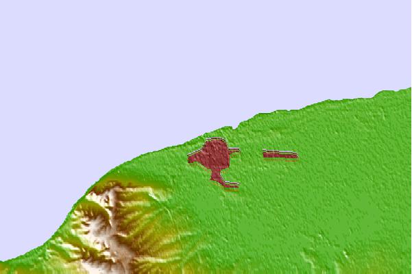
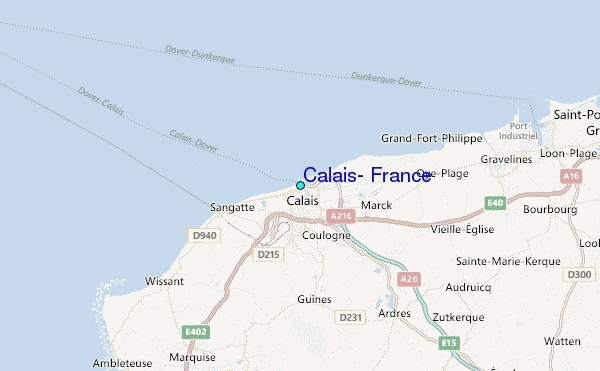
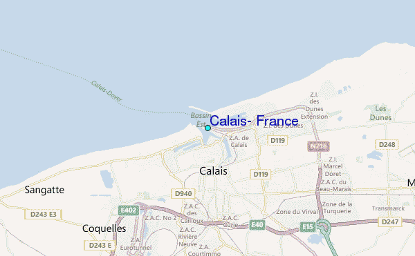
Use this relief map to navigate to tide stations, surf breaks and cities that are in the area of Calais, France.
Other Nearby Locations' tide tables and tide charts to Calais, France:
click location name for more details
 Surf breaks close to Calais, France:
|
||
|---|---|---|
| Closest surf break | Sangatte | 5 mi |
| Second closest surf break | Cap Blanc Nez | 6 mi |
| Third closest surf break | Oye Plage Escardines | 9 mi |
| Fourth closest surf break | Wissant | 9 mi |
| Fifth closest surf break | Tardinghen | 11 mi |


 Nearest
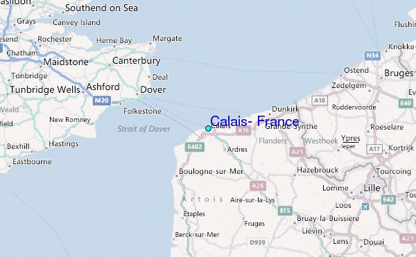