
| Distance / Altitude | Location | Report Date / Time | Live Weather | Wind | Gusts | Temp. | Visibility | Cloud |
|---|---|---|---|---|---|---|---|---|
| 2 km SE / 12 m | Roosevelt Roads Naval Station Airport (Puerto rico) | 2025-12-18 21:53 local (2025/12/19 01:53 GMT) | Clear | light winds from the E (7 km/h at 80) | 26°C | 16 | ||
| 7 km N / 18 m | Boulevarda Montanez wx (Puerto Rico) | 2025-12-18 23:02 local (2025/12/19 03:02 GMT) | dry | calm (0 km/h at 279) | — | - | - - 0 | |
| 7 km N / 20 m | Vega Baja wx (Puerto Rico) | 2025-12-18 23:34 local (2025/12/19 03:34 GMT) | dry | calm (2 km/h at 138) | 24°C | - | - - 0 | |
| 19 km SW / 424 m | Naguabo (Puerto Rico) | 2025-12-18 23:43 local (2025/12/19 03:43 GMT) | dry | calm (0 km/h at 275) | 22°C | - | - - 0 | |
| 20 km E / 3 m | Vieques Island- PR (Marine) | 2025-12-18 23:00 local (2025/12/19 03:00 GMT) | - (- km/h at -) | — | - | |||
| 23 km SSW / 13 m | Humacao (Puerto Rico) | 2025-12-18 23:21 local (2025/12/19 03:21 GMT) | dry | calm (2 km/h at 264) | 24°C | - | - - 0 | |
| 27 km SW / 117 m | Parkhurst wx (Puerto Rico) | 2025-12-18 23:30 local (2025/12/19 03:30 GMT) | dry | calm (0 km/h at 298) | 22°C | - | - - 0 | |
| 37 km ENE / 22 m | Villa Muneco wx (Puerto Rico) | 2025-12-18 23:23 local (2025/12/19 03:23 GMT) | dry | light winds from the E (10 km/h at 101) | 26°C | - | - - 0 | |
| 39 km WSW / 196 m | Caguas (Puerto Rico) | 2025-12-18 23:00 local (2025/12/19 03:00 GMT) | dry | calm (0 km/h at 255) | 22°C | - | - - 0 | |
| 42 km WSW / 83 m | Caguas (Puerto Rico) | 2025-12-18 23:05 local (2025/12/19 03:05 GMT) | dry | calm (0 km/h at 198) | 23°C | - | - - 0 |
| Contours: | Roads & Rivers: | Select a
tide station / surf break / city |
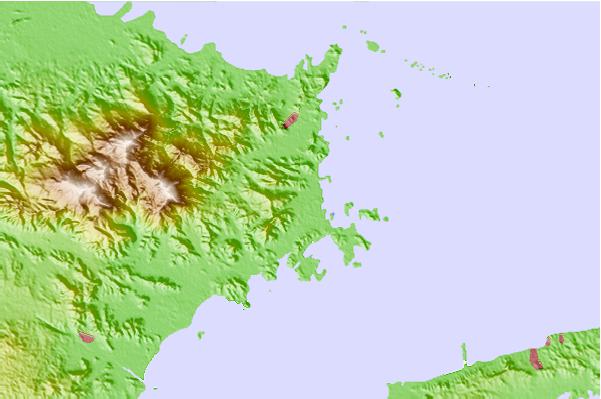
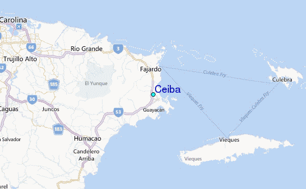
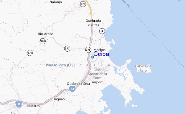
Use this relief map to navigate to tide stations, surf breaks and cities that are in the area of Ceiba.
Other Nearby Locations' tide tables and tide charts to Ceiba:
click location name for more details
 Surf breaks close to Ceiba:
|
||
|---|---|---|
| Closest surf break | Luquillo - La Selva | 7 mi |
| Second closest surf break | Luquillo - La Pared | 9 mi |
| Third closest surf break | Palmas Del Mar (Bohio) | 16 mi |
| Fourth closest surf break | The Search | 17 mi |
| Fifth closest surf break | Playa El Cocal | 22 mi |


 Nearest