
| Distance / Altitude | Location | Report Date / Time | Live Weather | Wind | Gusts | Temp. | Visibility | Cloud |
|---|---|---|---|---|---|---|---|---|
| 25 km WNW / 212 m | Chignik Bay Airport (Alaska) | 2025-12-24 22:56 local (2025/12/25 07:56 GMT) | Clear | calm (0 km/h at 0) | 2°C | 16 | ||
| 129 km W / 3 m | BUOY-CPSA2 (Marine) | 2025-12-24 23:02 local (2025/12/25 08:02 GMT) | light winds from the ENE (15 km/h at 60) | — | - | |||
| 163 km NNE / 18 m | Pilot Point (Alaska) | 2025-12-24 22:41 local (2025/12/25 07:41 GMT) | - | light winds from the NNE (11 km/h at 20) | -4°C | 0.0 | broken | |
| 191 km WSW / 4 m | Nelson Lagoon Airport (Alaska) | 2025-12-24 21:56 local (2025/12/25 06:56 GMT) | - | light winds from the NE (13 km/h at 50) | -1°C | 0.1 | ||
| 192 km WSW / 3 m | BUOY-NLXA2 (Marine) | 2025-12-24 23:02 local (2025/12/25 08:02 GMT) | light winds from the E (18 km/h at 80) | 1°C | - | |||
| 257 km ENE / 14 m | Akhiok (Alaska) | 2025-12-24 21:56 local (2025/12/25 06:56 GMT) | - | light winds from the WNW (9 km/h at 300) | 1°C | 0.0 | ||
| 286 km SW / 47 m | King Cove Airport (Alabama) (Alaska) | 2025-12-24 21:56 local (2025/12/25 06:56 GMT) | - | light winds from the E (9 km/h at 100) | 1°C | 0.0 | ||
| 292 km SW / 3 m | BUOY-KGCA2 (Marine) | 2025-12-24 22:30 local (2025/12/25 07:30 GMT) | calm (4 km/h at 220) | 2°C | - | |||
| 296 km NNE / 211 m | King Salmon Airport (Alaska) | 2025-12-24 21:54 local (2025/12/25 06:54 GMT) | Dry and cloudy | light winds from the N (17 km/h at 360) | -9°C | 16 | overcast | |
| 305 km NE / 3 m | Shelikof Strait- AK (Marine) | 2025-12-24 22:50 local (2025/12/25 07:50 GMT) | moderate winds from the WNW (22 km/h at 290) | 4°C | - |
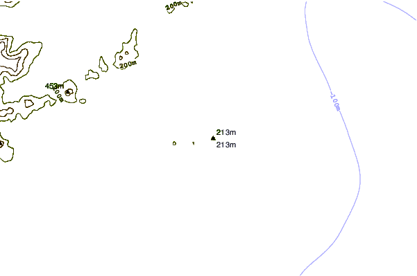
| Contours: | Roads & Rivers: | Select a
tide station / surf break / city |
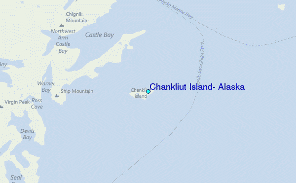
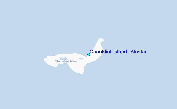
Use this relief map to navigate to tide stations, surf breaks and cities that are in the area of Chankliut Island, Alaska.
Other Nearby Locations' tide tables and tide charts to Chankliut Island, Alaska:
click location name for more details
 Surf breaks close to Chankliut Island, Alaska:
|
||
|---|---|---|
| Closest surf break | Fossil Beach Kodiak | 235 mi |
| Second closest surf break | Monashka Bay | 243 mi |
| Third closest surf break | Termination Point | 245 mi |
| Fourth closest surf break | Mill Bay | 245 mi |
| Fifth closest surf break | Bird Point (Tidal Bore) | 398 mi |


 Nearest
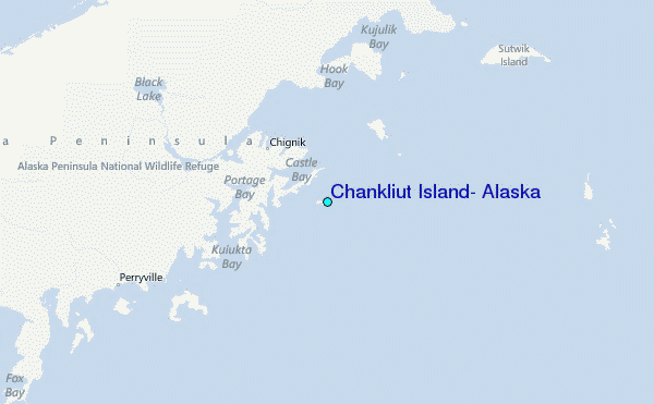