
| Distance / Altitude | Location | Report Date / Time | Live Weather | Wind | Gusts | Temp. | Visibility | Cloud |
|---|---|---|---|---|---|---|---|---|
| 4 km WNW / 210 m | Beaufort Airport (North Carolina) | 2026-06-04 10:58 local (2026/06/04 14:58 GMT) | Clear | moderate winds from the N (22 km/h at 360) | 25°C | 16 | ||
| 5 km W / 3 m | BUOY-BFTN7 (Marine) | 2026-06-04 11:48 local (2026/06/04 15:48 GMT) | moderate winds from the NNE (21 km/h at 20) | — | - | |||
| 13 km SE / 3 m | BUOY-CLKN7 (Marine) | 2026-06-04 11:50 local (2026/06/04 15:50 GMT) | moderate winds from the NE (22 km/h at 50) | 24°C | - | |||
| 30 km WNW / 213 m | Cherry Point Airport (North Carolina) | 2026-06-04 10:55 local (2026/06/04 14:55 GMT) | Clear | light winds from the N (19 km/h at 10) | 25°C | 16 | ||
| 37 km WSW / 204 m | Bogue/Swansboro Airport (North Carolina) | 2026-06-04 10:51 local (2026/06/04 14:51 GMT) | Clear | light winds from the NE (17 km/h at 40) | 26°C | 14 | ||
| 38 km NNE / 210 m | Piney Island Bt-11 Bombing Range (NC) Airport (United States) | 2026-06-04 11:51 local (2026/06/04 15:51 GMT) | Clear | light winds from the NNE (19 km/h at 20) | 24°C | 16 | ||
| 56 km WNW / 218 m | New Bern Airport (North Carolina) | 2026-06-04 10:54 local (2026/06/04 14:54 GMT) | Clear | light winds from the N (9 km/h at 350) | 25°C | 16 | ||
| 62 km S / 3 m | Onslow Bay Outer- NC (Marine) | 2026-06-04 11:56 local (2026/06/04 15:56 GMT) | - (- km/h at -) | — | - | |||
| 63 km S / 3 m | BUOY-41064 (Marine) | 2026-06-04 11:08 local (2026/06/04 15:08 GMT) | moderate winds from the NE (25 km/h at 40) | 23°C | - | |||
| 76 km WSW / 219 m | New River Marine Corps Air Station Airport (North Carolina) | 2026-06-04 10:56 local (2026/06/04 14:56 GMT) | Clear | light winds from the N (15 km/h at 360) | 26°C | 16 |
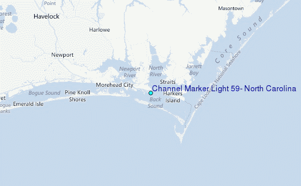
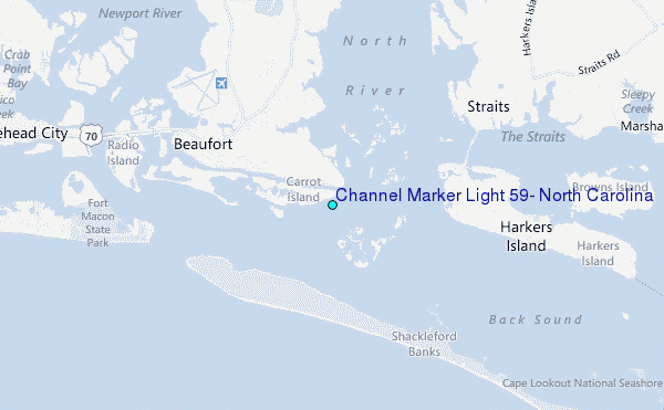
Choose Channel Marker Light #59, North Carolina Location Map Zoom:
| Contours: | Roads & Rivers: | Select a
tide station / surf break / city |
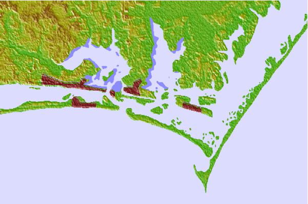

Use this relief map to navigate to tide stations, surf breaks and cities that are in the area of Channel Marker Light #59, North Carolina.
Other Nearby Locations' tide tables and tide charts to Channel Marker Light #59, North Carolina:
click location name for more details
 Surf breaks close to Channel Marker Light #59, North Carolina:
|
||
|---|---|---|
| Closest surf break | Shackleford Banks | 3 mi |
| Second closest surf break | Triple S Pier | 4 mi |
| Third closest surf break | Atlantic Beach | 7 mi |
| Fourth closest surf break | Bogue Pier | 21 mi |
| Fifth closest surf break | The Point | 27 mi |


 Nearest
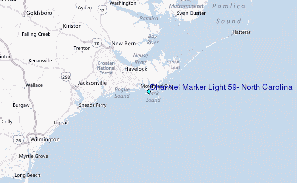