
| Distance / Altitude | Location | Report Date / Time | Live Weather | Wind | Gusts | Temp. | Visibility | Cloud |
|---|---|---|---|---|---|---|---|---|
| 8 km WSW / 217 m | Wallops Island Airport (Virginia) | 2026-07-09 21:44 local (2026/07/10 01:44 GMT) | Thunderstorm light rain thunderstorm | light winds from the W (7 km/h at 280) | 23°C | 8 | scattered scattered | |
| 23 km WNW / 4 m | thunderstorm affecting Pocomoke City (United States) | 2026-07-09 21:36 local (2026/07/10 01:36 GMT) | Thunderstorm | (- km/h at -) | — | |||
| 24 km NW / 7 m | lightning 7km WSW of Snow Hill (United States) | 2026-07-09 21:05 local (2026/07/10 01:05 GMT) | Thunderstorm | (- km/h at -) | — | |||
| 27 km SW / 2 m | lightning 18km N of Onancock (United States) | 2026-07-09 20:51 local (2026/07/10 00:51 GMT) | Thunderstorm | (- km/h at -) | — | |||
| 31 km W / 2 m | lightning 13km NE of Crisfield (United States) | 2026-07-09 20:50 local (2026/07/10 00:50 GMT) | Thunderstorm | (- km/h at -) | — | |||
| 33 km WNW / 6 m | lightning 8km SE of Princess Anne (United States) | 2026-07-09 20:50 local (2026/07/10 00:50 GMT) | Thunderstorm | (- km/h at -) | — | |||
| 45 km NW / 218 m | Salisbury Airport (Maryland) | 2026-07-09 21:38 local (2026/07/10 01:38 GMT) | Light rain | light winds from the WNW (6 km/h at 300) | 23°C | 16 | few scattered | |
| 46 km SSW / 3 m | BUOY-WAHV2 (Marine) | 2026-07-09 22:00 local (2026/07/10 02:00 GMT) | calm (5 km/h at 310) | 23°C | - | |||
| 48 km SSW / 217 m | Melfa/Accomack County Airport (Virginia) | 2026-07-09 21:15 local (2026/07/10 01:15 GMT) | Heavy rain | fresh winds from the WNW (30 km/h at 300) | 23°C | 6 | scattered scattered broken | |
| 48 km NNE / 217 m | Ocean City Airport (Maryland) | 2026-07-09 21:25 local (2026/07/10 01:25 GMT) | Dry and cloudy | light winds from the SSW (6 km/h at 200) | 26°C | 14 | overcast |
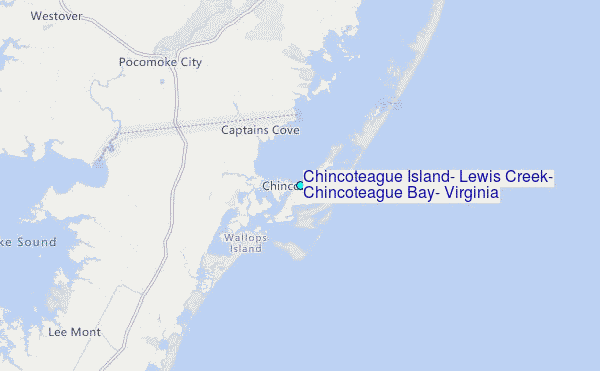
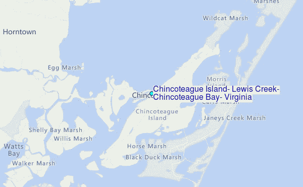
Choose Chincoteague Island, Lewis Creek, Chincoteague Bay, Virginia Location Map Zoom:
| Contours: | Roads & Rivers: | Select a
tide station / surf break / city |
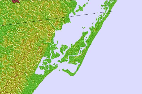
Use this relief map to navigate to tide stations, surf breaks and cities that are in the area of Chincoteague Island, Lewis Creek, Chincoteague Bay, Virginia.
Other Nearby Locations' tide tables and tide charts to Chincoteague Island, Lewis Creek, Chincoteague Bay, Virginia:
click location name for more details
 Surf breaks close to Chincoteague Island, Lewis Creek, Chincoteague Bay, Virginia:
|
||
|---|---|---|
| Closest surf break | Chincoteague | 3 mi |
| Second closest surf break | Out Front | 4 mi |
| Third closest surf break | Assateague | 23 mi |
| Fourth closest surf break | Outside Shoals | 29 mi |
| Fifth closest surf break | North Assateague (The Wedge) | 30 mi |


 Nearest
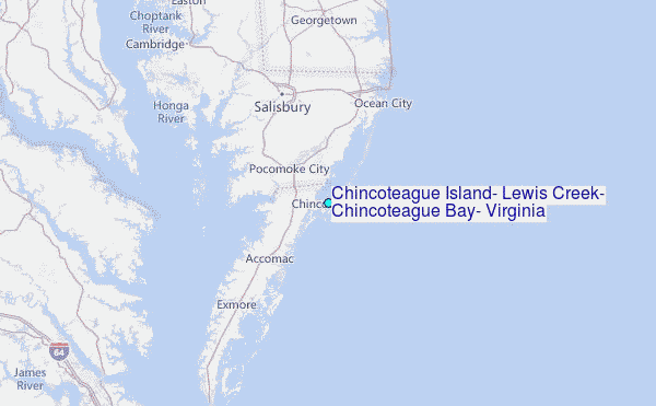