
| Distance / Altitude | Location | Report Date / Time | Live Weather | Wind | Gusts | Temp. | Visibility | Cloud |
|---|---|---|---|---|---|---|---|---|
| 14 km WSW / 1 m | lightning 11km SE of Leisure City (United States) | 2026-07-27 19:17 local (2026/07/27 23:17 GMT) | Thunderstorm | (- km/h at -) | — | |||
| 16 km W / 216 m | Homestead Air Force Base Airport (Florida) | 2026-07-27 20:17 local (2026/07/28 00:17 GMT) | Dry and partly cloudy | light winds from the SSW (7 km/h at 210) | 25°C | 16 | scattered | |
| 26 km NW / 2 m | Palmetto Bay (Florida) | 2026-07-27 21:46 local (2026/07/28 01:46 GMT) | dry | calm (0 km/h at 143) | 24°C | - | - - 0 | |
| 27 km WNW / 5 m | thunderstorm affecting South Miami Heights (United States) | 2026-07-27 19:17 local (2026/07/27 23:17 GMT) | Thunderstorm | (- km/h at -) | — | |||
| 27 km N / 2 m | lightning 4km NE of Cutler (United States) | 2026-07-27 19:02 local (2026/07/27 23:02 GMT) | Thunderstorm | (- km/h at -) | — | |||
| 28 km W / 3 m | thunderstorm affecting Florida City (United States) | 2026-07-27 19:15 local (2026/07/27 23:15 GMT) | Thunderstorm | (- km/h at -) | — | |||
| 30 km NW / 6.1 m | Pinecrest (Florida) | 2026-07-27 21:11 local (2026/07/28 01:11 GMT) | dry | calm (0 km/h at 213) | 24°C | - | - - 0 | |
| 31 km W / 3 m | lightning 7km WNW of Naranja (United States) | 2026-07-27 19:15 local (2026/07/27 23:15 GMT) | Thunderstorm | (- km/h at -) | — | |||
| 32 km WNW / 4 m | Richmond West wx (United States) | 2026-07-27 21:02 local (2026/07/28 01:02 GMT) | dry | calm (0 km/h at ) | 24°C | - | - - 0 | |
| 33 km NW / 4 m | thunderstorm affecting Three Lakes (United States) | 2026-07-27 19:02 local (2026/07/27 23:02 GMT) | Thunderstorm | (- km/h at -) | — |
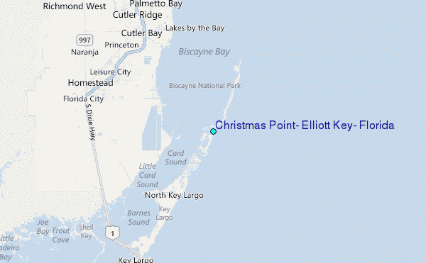
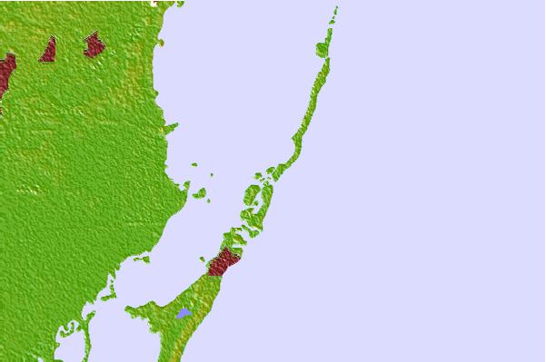
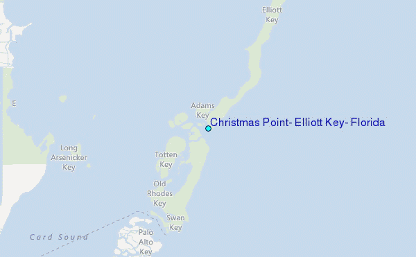
Choose Christmas Point, Elliott Key, Florida Location Map Zoom:
| Contours: | Roads & Rivers: | Select a
tide station / surf break / city |


Use this relief map to navigate to tide stations, surf breaks and cities that are in the area of Christmas Point, Elliott Key, Florida.
Other Nearby Locations' tide tables and tide charts to Christmas Point, Elliott Key, Florida:
click location name for more details
 Surf breaks close to Christmas Point, Elliott Key, Florida:
|
||
|---|---|---|
| Closest surf break | South Beach (Miami) | 27 mi |
| Second closest surf break | Fifth Street (Miami) | 27 mi |
| Third closest surf break | 21st Street (Miami) | 29 mi |
| Fourth closest surf break | Dunes Hotel (Miami) | 30 mi |
| Fifth closest surf break | Harbor House | 35 mi |


 Nearest
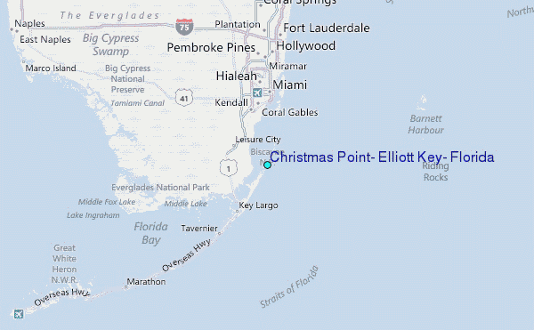