
| Distance / Altitude | Location | Report Date / Time | Live Weather | Wind | Gusts | Temp. | Visibility | Cloud |
|---|---|---|---|---|---|---|---|---|
| 7 km NNE / 2 m | Merritt Island (Florida) | 2026-04-09 06:11 local (2026/04/09 10:11 GMT) | dry | calm (0 km/h at 37) | 15°C | - | - - 0 | |
| 14 km E / 3 m | SHIP7676 (Marine) | 2026-04-09 07:00 local (2026/04/09 11:00 GMT) | - (- km/h at -) | 20°C | - | |||
| 15 km ENE / 3 m | BUOY-TRDF1 (Marine) | 2026-04-09 07:18 local (2026/04/09 11:18 GMT) | moderate winds from the ENE (22 km/h at 60) | — | - | |||
| 15 km NW / 326 m | Titusville Airport (Florida) | 2026-04-09 06:47 local (2026/04/09 10:47 GMT) | Dry and cloudy | moderate winds from the ENE (24 km/h at 70) | 22°C | 11 | scattered overcast | |
| 20 km NW / 11 m | South Titusville wx (United States) | 2026-04-09 07:48 local (2026/04/09 11:48 GMT) | dry | wind obs. (10 kph from 294 degs) was rejected (- km/h at -) | 21°C | - | - - 0 | |
| 21 km E / 3 m | Cape Canaveral Nearshore- FL (Marine) | 2026-04-09 07:26 local (2026/04/09 11:26 GMT) | - (- km/h at -) | — | - | |||
| 22 km ENE / 217 m | Cape Canaveral Airport (Florida) | 2026-04-09 05:55 local (2026/04/09 09:55 GMT) | Light rain | moderate winds from the ENE (28 km/h at 70) | 20°C | 16 | few |
| Contours: | Roads & Rivers: | Select a
tide station / surf break / city |
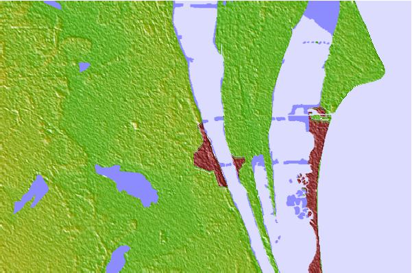
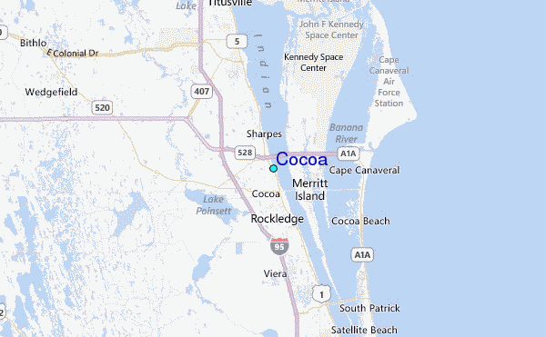
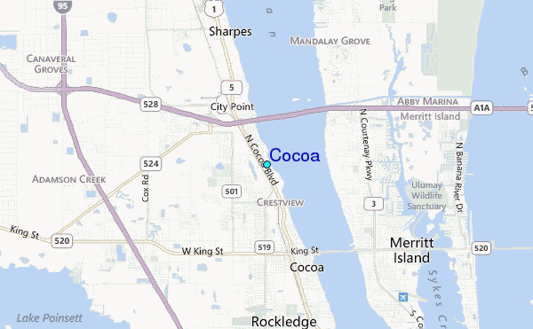
Use this relief map to navigate to tide stations, surf breaks and cities that are in the area of Cocoa.
Other Nearby Locations' tide tables and tide charts to Cocoa:
click location name for more details
 Surf breaks close to Cocoa:
|
||
|---|---|---|
| Closest surf break | Lori Wilson Park | 9 mi |
| Second closest surf break | Cocoa Beach Pier | 9 mi |
| Third closest surf break | Jetty Park | 9 mi |
| Fourth closest surf break | 13th Street | 10 mi |
| Fifth closest surf break | Patrick Air Force Base | 14 mi |


 Nearest
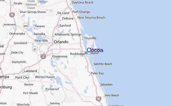