
| Distance / Altitude | Location | Report Date / Time | Live Weather | Wind | Gusts | Temp. | Visibility | Cloud |
|---|---|---|---|---|---|---|---|---|
| 71 km SE / 216 m | Gustavus Airport (Alaska) | 2026-03-22 15:56 local (2026/03/22 23:56 GMT) | Clear | wind obs. (7 kph from 90 degs) was rejected (- km/h at -) | 2°C | 16 | ||
| 72 km SE / 3 m | BUOY-GUXA2 (Marine) | 2026-03-22 17:02 local (2026/03/23 01:02 GMT) | light winds from the N (8 km/h at 350) | 2°C | - | |||
| 75 km ENE / 3 m | BUOY-HAXA2 (Marine) | 2026-03-22 17:02 local (2026/03/23 01:02 GMT) | calm (2 km/h at 120) | 3°C | - | |||
| 76 km S / 3 m | BUOY-GEXA2 (Marine) | 2026-03-22 17:02 local (2026/03/23 01:02 GMT) | moderate winds from the NNE (22 km/h at 20) | 1°C | - | |||
| 76 km ENE / 212 m | Haines Airport (Alaska) | 2026-03-22 15:54 local (2026/03/22 23:54 GMT) | Dry and partly cloudy | wind obs. (7 kph from 150 degs) was rejected (- km/h at -) | 1°C | 16 | few scattered broken | |
| 76 km S / 3 m | BUOY-CSXA2 (Marine) | 2026-03-22 17:02 local (2026/03/23 01:02 GMT) | moderate winds from the ENE (21 km/h at 70) | — | - | |||
| 76 km S / 3 m | BUOY-CSPA2 (Marine) | 2026-03-22 16:10 local (2026/03/23 00:10 GMT) | - (0 km/h at -) | 1°C | - | |||
| 78 km S / 3 m | BUOY-ELFA2 (Marine) | 2026-03-22 16:48 local (2026/03/23 00:48 GMT) | - (- km/h at -) | — | - | |||
| 78 km E / 3 m | BUOY-ERXA2 (Marine) | 2026-03-22 17:02 local (2026/03/23 01:02 GMT) | light winds from the NNE (8 km/h at 20) | 1°C | - | |||
| 95 km NE / 3 m | BUOY-SKXA2 (Marine) | 2026-03-22 17:02 local (2026/03/23 01:02 GMT) | light winds from the N (15 km/h at 350) | 2°C | - |
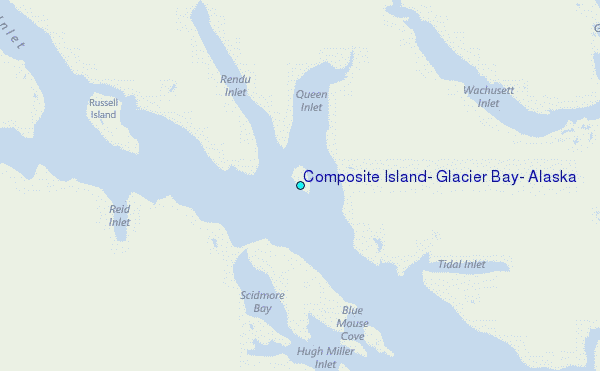
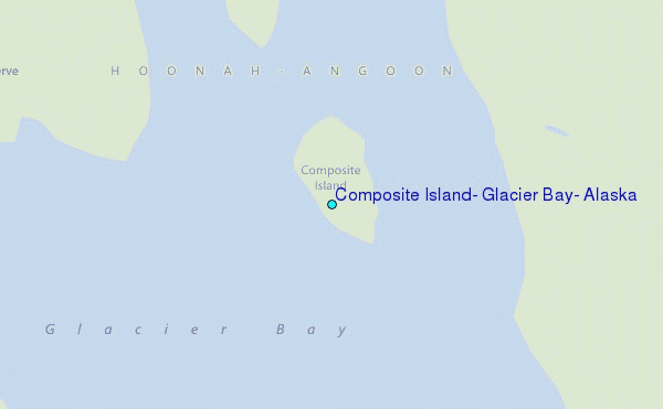
Choose Composite Island, Glacier Bay, Alaska Location Map Zoom:
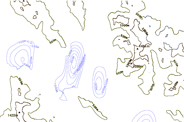
| Contours: | Roads & Rivers: | Select a
tide station / surf break / city |

Use this relief map to navigate to tide stations, surf breaks and cities that are in the area of Composite Island, Glacier Bay, Alaska.
Other Nearby Locations' tide tables and tide charts to Composite Island, Glacier Bay, Alaska:
click location name for more details
 Surf breaks close to Composite Island, Glacier Bay, Alaska:
|
||
|---|---|---|
| Closest surf break | Cannon Beach | 121 mi |
| Second closest surf break | Graveyards | 124 mi |
| Third closest surf break | Ocean Cape | 126 mi |
| Fourth closest surf break | Lepus Beach (Haida-Gwaii) | 352 mi |
| Fifth closest surf break | Tow Hill Beach | 378 mi |


 Nearest
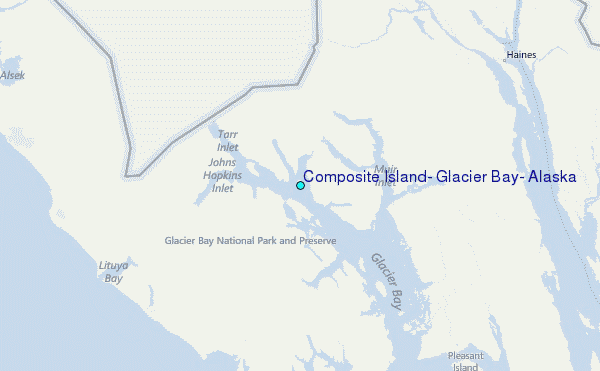