
| Distance / Altitude | Location | Report Date / Time | Live Weather | Wind | Gusts | Temp. | Visibility | Cloud |
|---|---|---|---|---|---|---|---|---|
| 60 km S / 89 m | Montería/Los Garzones Airport (Columbia) | 2026-06-08 18:00 local (2026/06/08 23:00 GMT) | Dry and partly cloudy | wind obs. (6 kph from 300 degs) was rejected (- km/h at -) | 27°C | 10.0 | scattered | |
| 61 km S / 26 m | MonteriaLosGarzones (Colombia) | 2026-06-08 18:00 local (2026/06/08 23:00 GMT) | Haze | wind obs. (7 kph from 290 degs) was rejected (- km/h at -) | 28°C | 30 km | - overcast - | |
| 123 km N / 201 m | Cartagena/Rafael Airport (Columbia) | 2026-06-08 18:00 local (2026/06/08 23:00 GMT) | Dry and partly cloudy | light winds from the SSW.(Wind varies from 160 to 260 degs) (6 km/h at 210) | 28°C | 10.0 | scattered | |
| 125 km N / 12 m | CartagenaRafaelNunez (Colombia) | 2026-06-08 18:00 local (2026/06/08 23:00 GMT) | Haze | light winds from the S (7 km/h at 190) | 28°C | 35 km | - overcast - | |
| 197 km NNE / 30 m | BarranquillaErnestoCortissoz (Colombia) | 2026-06-08 18:00 local (2026/06/08 23:00 GMT) | Haze | light winds from the W (7 km/h at 280) | 29°C | 30 km | mostly cloudy | |
| 199 km NNE / 206 m | Barranquilla/Ernesto Cortissoz International Airport (Columbia) | 2026-06-08 18:00 local (2026/06/08 23:00 GMT) | - | wind obs. (6 kph from 1 degs) was rejected (- km/h at -) | 29°C | 10.0 | few | |
| 203 km SSW / 20 m | ApartadoLosCedros (Colombia) | 2026-06-08 18:00 local (2026/06/08 23:00 GMT) | - | calm (4 km/h at 990) | 29°C | 35 km | - mostly cloudy - | |
| 206 km S / 78 m | Apartadó-Antonio Roldán Betancourt Airport (Columbia) | 2026-06-08 18:00 local (2026/06/08 23:00 GMT) | - | calm (2 km/h at 1) | — | 0.0 | ||
| 206 km SW / 48 m | Puerto Obaldía wx (Panama) | 2026-06-08 18:49 local (2026/06/08 23:49 GMT) | dry | light winds from the SW (8 km/h at 228) | 24°C | - | - - 0 | |
| 253 km NE / 96 m | Santa Marta/Simón Bolívar International Airport (Columbia) | 2026-06-08 18:00 local (2026/06/08 23:00 GMT) | Thunderstorm - in the vicinity | light winds from the N.(Wind varies from 280 to 080 degs) (6 km/h at 10) | 29°C | 10.0 | broken |
| Contours: | Roads & Rivers: | Select a
tide station / surf break / city |
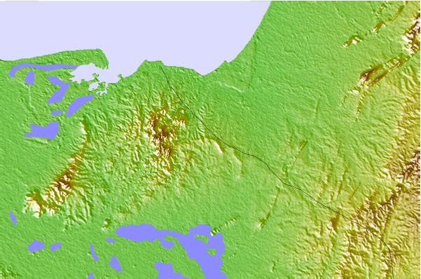
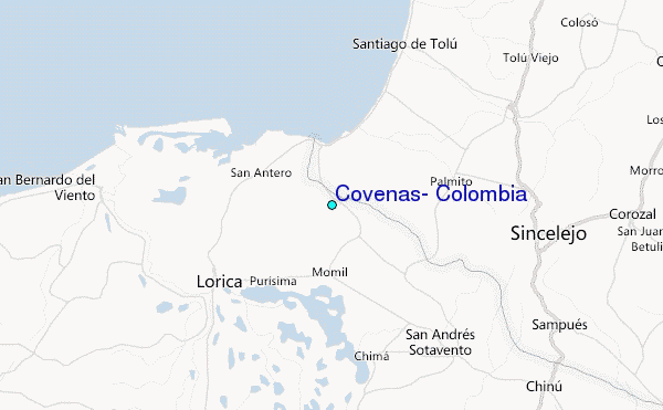
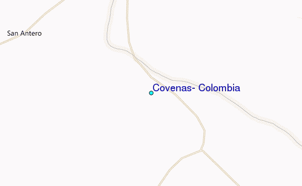
Use this relief map to navigate to tide stations, surf breaks and cities that are in the area of Covenas, Colombia.
Other Nearby Locations' tide tables and tide charts to Covenas, Colombia:
click location name for more details
 Surf breaks close to Covenas, Colombia:
|
||
|---|---|---|
| Closest surf break | Miramar | 29 mi |
| Second closest surf break | Colpipe | 35 mi |
| Third closest surf break | Cartagena - Jetty | 74 mi |
| Fourth closest surf break | Cartagena - Castillo Grande | 74 mi |
| Fifth closest surf break | Cartagena - Hilton | 74 mi |


 Nearest
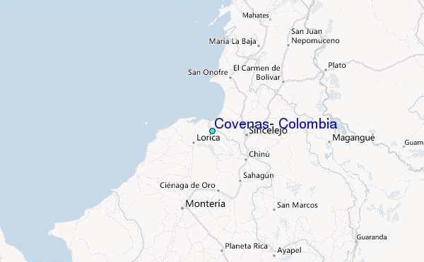