
| Distance / Altitude | Location | Report Date / Time | Live Weather | Wind | Gusts | Temp. | Visibility | Cloud |
|---|---|---|---|---|---|---|---|---|
| 0 km WSW / 3 m | BUOY-DPHA1 (Marine) | 2026-06-02 19:00 local (2026/06/03 00:00 GMT) | - (8 km/h at -) | 28°C | - | |||
| 0 km WSW / 3 m | BUOY-DILA1 (Marine) | 2026-06-02 19:48 local (2026/06/03 00:48 GMT) | fresh winds from the NNE (33 km/h at 30) | — | - | |||
| 8 km ESE / 3 m | BUOY-FRMA1 (Marine) | 2026-06-02 19:48 local (2026/06/03 00:48 GMT) | fresh winds from the NNW (30 km/h at 330) | — | 10.9 | |||
| 13 km WSW / 3 m | BUOY-KATA1 (Marine) | 2026-06-02 19:30 local (2026/06/03 00:30 GMT) | - (0 km/h at -) | 28°C | - | |||
| 13 km WNW / 1 m | lightning 10km NW of Dauphin Island (United States) | 2026-06-02 19:50 local (2026/06/03 00:50 GMT) | Thunderstorm | (- km/h at -) | — | |||
| 19 km N / 0 m | lightning 13km WSW of Point Clear (United States) | 2026-06-02 20:19 local (2026/06/03 01:19 GMT) | Thunderstorm | (- km/h at -) | — | |||
| 21 km NNE / 3 m | BUOY-EFLA1 (Marine) | 2026-06-02 19:00 local (2026/06/03 00:00 GMT) | - (- km/h at -) | 28°C | 10.9 | |||
| 22 km SSW / 3 m | BUOY-42357 (Marine) | 2026-06-02 19:05 local (2026/06/03 00:05 GMT) | - (- km/h at -) | — | - | |||
| 24 km WNW / 0 m | lightning 5km SW of Bayou La Batre (United States) | 2026-06-02 20:18 local (2026/06/03 01:18 GMT) | Thunderstorm | (- km/h at -) | — | |||
| 26 km N / 0 m | lightning 11km ESE of Theodore (United States) | 2026-06-02 19:50 local (2026/06/03 00:50 GMT) | Thunderstorm | (- km/h at -) | — |
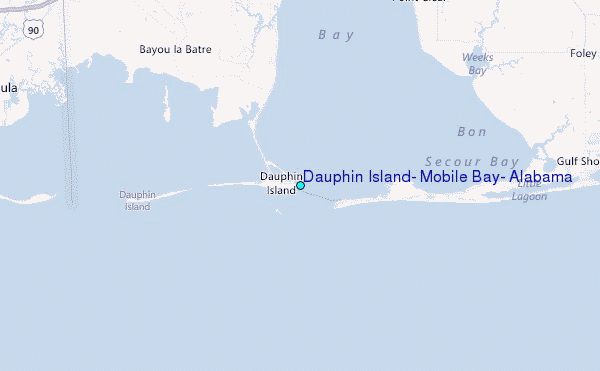
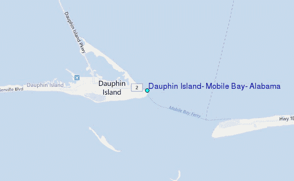
Choose Dauphin Island, Mobile Bay, Alabama Location Map Zoom:
| Contours: | Roads & Rivers: | Select a
tide station / surf break / city |


Use this relief map to navigate to tide stations, surf breaks and cities that are in the area of Dauphin Island, Mobile Bay, Alabama.
Other Nearby Locations' tide tables and tide charts to Dauphin Island, Mobile Bay, Alabama:
click location name for more details
 Surf breaks close to Dauphin Island, Mobile Bay, Alabama:
|
||
|---|---|---|
| Closest surf break | Dauphin Island Pier | 0 mi |
| Second closest surf break | West Pass | 20 mi |
| Third closest surf break | Terry s Cove | 30 mi |
| Fourth closest surf break | Alabama Point | 31 mi |
| Fifth closest surf break | Spuds | 32 mi |


 Nearest
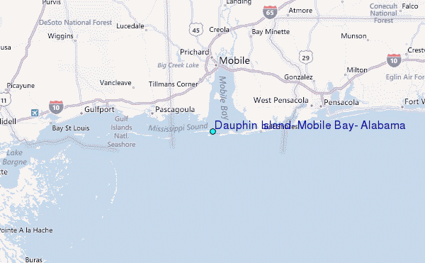