
| Distance / Altitude | Location | Report Date / Time | Live Weather | Wind | Gusts | Temp. | Visibility | Cloud |
|---|---|---|---|---|---|---|---|---|
| 247 km W / 23 m | Gurney (Papua New Guinea) | 2026-04-08 22:00 local (2026/04/08 12:00 GMT) | distant precipitation but not falling at station | - (- km/h at -) | 26°C | 30 | - - - | |
| 602 km W / 48 m | Port Moresby (Papua New Guinea) | 2026-04-08 22:00 local (2026/04/08 12:00 GMT) | haze | wind obs. (30 kph from 160 degs) was rejected (- km/h at -) | 26°C | 20 | - | |
| 612 km S / 472 m | Willis Island (Australia) | 2026-04-09 00:00 local (2026/04/08 14:00 GMT) | no report | fresh winds from the ESE (31 km/h at 110) | 25°C | - | - no observation - | |
| 629 km ENE / 6 m | Munda-New Georgia (Solomon Islands) | 2026-04-08 22:00 local (2026/04/08 12:00 GMT) | distant precipitation but not falling at station | - (- km/h at -) | 25°C | 4000 | - - - | |
| 648 km S / 0 m | Lihou Reef Lighthouse (Australia) | 2026-04-08 23:00 local (2026/04/08 13:00 GMT) | no report | fresh winds from the ESE (30 km/h at 110) | 24°C | - | - | |
| 672 km NE / 3 m | Taro Island (Solomon Islands) | 2026-04-08 22:00 local (2026/04/08 12:00 GMT) | distant precipitation but not falling at station | wind obs. (11 kph from 140 degs) was rejected (- km/h at -) | 26°C | 20 | - | |
| 673 km ENE / 2 m | Penrhyn Island (Samoa) | 2026-04-08 23:00 local (2026/04/08 13:00 GMT) | - | light winds from the ENE (13 km/h at 70) | 29°C | 10.0 | few | |
| 734 km SSW / 13 m | Bougainville Reef (Australia) | 2026-04-09 00:00 local (2026/04/08 14:00 GMT) | no report | fresh winds from the ESE (31 km/h at 120) | 25°C | - | - | |
| 752 km SSW / 6 m | Holmes Reef (Australia) | 2026-04-09 00:00 local (2026/04/08 14:00 GMT) | no report | moderate winds from the ESE (28 km/h at 120) | 25°C | - | - | |
| 811 km WNW / 70 m | Nadzab (Papua New Guinea) | 2026-04-08 22:00 local (2026/04/08 12:00 GMT) | rain | - (- km/h at -) | 25°C | 30 | - |
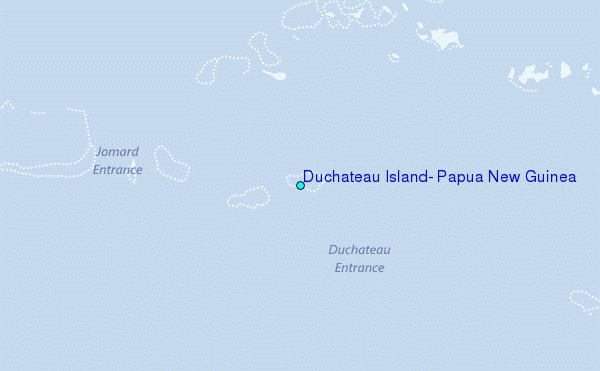
Choose Duchateau Island, Papua New Guinea Location Map Zoom:
| Contours: | Roads & Rivers: | Select a
tide station / surf break / city |
Use this relief map to navigate to tide stations, surf breaks and cities that are in the area of Duchateau Island, Papua New Guinea.
Other Nearby Locations' tide tables and tide charts to Duchateau Island, Papua New Guinea:
click location name for more details
 Surf breaks close to Duchateau Island, Papua New Guinea:
|
||
|---|---|---|
| Closest surf break | Pailongge | 374 mi |
| Second closest surf break | Titiana | 374 mi |
| Third closest surf break | Coves | 380 mi |
| Fourth closest surf break | Makuti | 380 mi |
| Fifth closest surf break | Despretes | 382 mi |


 Nearest
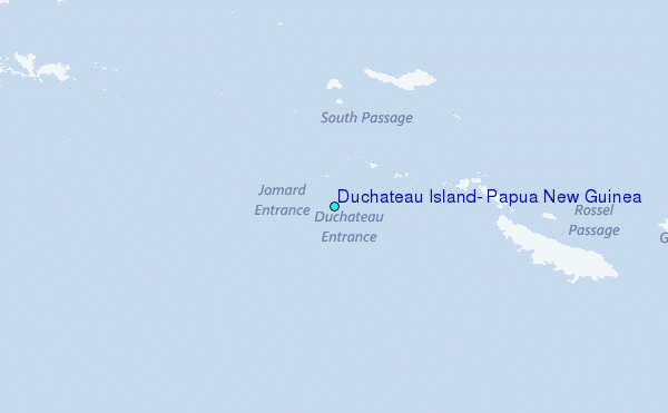