
| Distance / Altitude | Location | Report Date / Time | Live Weather | Wind | Gusts | Temp. | Visibility | Cloud |
|---|---|---|---|---|---|---|---|---|
| 40 km NW / 19 m | South Johnstone Station (Australia) | 2026-05-06 00:00 local (2026/05/05 14:00 GMT) | No report | calm (0 km/h at 0) | 19°C | - | no observation | |
| 44 km NW / 15 m | InnisfailAerodrome (Australia) | 2026-05-06 00:00 local (2026/05/05 14:00 GMT) | Clear skies | light winds from the WSW (6 km/h at 240) | 19°C | - | - no observation - | |
| 70 km SSE / 10 m | LucindaPoint (Australia) | 2026-05-06 00:00 local (2026/05/05 14:00 GMT) | No report | wind obs. (17 kph from 240 degs) was rejected (- km/h at -) | 22°C | - | no observation | |
| 79 km NW / 140 m | Bellenden Ker wx (Australia) | 2026-05-05 23:40 local (2026/05/05 13:40 GMT) | dry | calm (2 km/h at 11) | 18°C | - | - - 0 | |
| 103 km ENE / 15 m | ASCATC147E18S (Marine) | 2026-05-05 21:31 local (2026/05/05 11:31 GMT) | moderate winds from the SE (24 km/h at 128) | — | - km | |||
| 117 km NW / 4 m | CairnsRacecourse (Australia) | 2026-05-06 00:00 local (2026/05/05 14:00 GMT) | no report | light winds from the S (6 km/h at 170) | 20°C | - | - no observation - | |
| 120 km ESE / 15 m | ASCATC147E19S (Marine) | 2026-05-05 21:31 local (2026/05/05 11:31 GMT) | moderate winds from the ESE (20 km/h at 106) | — | - km | |||
| 123 km WNW / 473 m | MareebaAirport (Australia) | 2026-05-06 00:00 local (2026/05/05 14:00 GMT) | Clear skies | light winds from the SSE (15 km/h at 160) | 18°C | - | - no observation - | |
| 125 km NW / 8 m | Cairns Airport (Australia) | 2026-05-06 00:00 local (2026/05/05 14:00 GMT) | no report | light winds from the S (15 km/h at 170) | 22°C | - | - no observation - | |
| 133 km WNW / 400 m | Mareeba (Australia) | 2026-05-05 23:36 local (2026/05/05 13:36 GMT) | dry | calm (5 km/h at 148) | 18°C | - | - - 0 |
| Contours: | Roads & Rivers: | Select a
tide station / surf break / city |

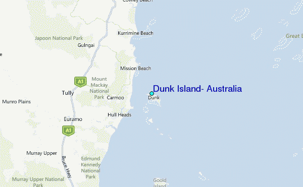
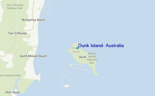
Use this relief map to navigate to tide stations, surf breaks and cities that are in the area of Dunk Island, Australia.
Other Nearby Locations' tide tables and tide charts to Dunk Island, Australia:
click location name for more details
 Surf breaks close to Dunk Island, Australia:
|
||
|---|---|---|
| Closest surf break | Eimeo Point | 291 mi |
| Second closest surf break | Dolphin Heads | 291 mi |
| Third closest surf break | Lamberts Beach | 296 mi |
| Fourth closest surf break | North Wall Mackay Harbour Beach | 296 mi |
| Fifth closest surf break | South Wall Mackay Harbour | 298 mi |


 Nearest
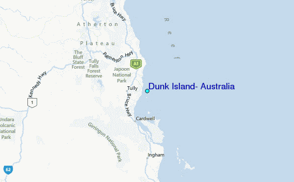