
| Distance / Altitude | Location | Report Date / Time | Live Weather | Wind | Gusts | Temp. | Visibility | Cloud |
|---|---|---|---|---|---|---|---|---|
| 19 km SW / 13 m | Horn Island Airport (Australia) | 2025-12-25 17:30 local (2025/12/25 07:30 GMT) | - | wind obs. (7 kph from 290 degs) was rejected (- km/h at -) | 29°C | 10.0 | few | |
| 20 km SW / 5 m | Horn Island Automatic Weather Station (Australia) | 2025-12-25 17:00 local (2025/12/25 07:00 GMT) | no report | wind obs. (7 kph from 280 degs) was rejected (- km/h at -) | 29°C | - | - no observation - | |
| 84 km NE / 4 m | Coconut Island (Australia) | 2025-12-25 17:00 local (2025/12/25 07:00 GMT) | no report | - (- km/h at -) | 26°C | - | - | |
| 150 km S / 15 m | SHIP4497 (Marine) | 2025-12-25 16:00 local (2025/12/25 06:00 GMT) | - (- km/h at -) | — | - km | |||
| 239 km S / 40 m | Scherger Raaf (Australia) | 2025-12-25 18:00 local (2025/12/25 08:00 GMT) | No report | wind obs. (6 kph from 10 degs) was rejected (- km/h at -) | 28°C | - | - overcast - | |
| 149 km S / 15 m | SHIP5819 (Marine) | 2025-12-25 16:00 local (2025/12/25 06:00 GMT) | - (- km/h at -) | — | - km | |||
| 149 km S / 15 m | SHIP9089 (Marine) | 2025-12-25 16:00 local (2025/12/25 06:00 GMT) | - (- km/h at -) | — | - km | |||
| 149 km S / 15 m | SHIP8640 (Marine) | 2025-12-25 17:00 local (2025/12/25 07:00 GMT) | - (- km/h at -) | 31°C | - km | |||
| 237 km S / 40 m | Scherger Raaf (Australia) | 2025-12-25 18:00 local (2025/12/25 08:00 GMT) | No report | wind obs. (6 kph from 10 degs) was rejected (- km/h at -) | 28°C | - | - overcast - | |
| 248 km S / 471 m | Weipa Aerodrome (Australia) | 2025-12-25 18:00 local (2025/12/25 08:00 GMT) | no report | wind obs. (15 kph from 100 degs) was rejected (- km/h at -) | 24°C | - | - overcast - |
| Contours: | Roads & Rivers: | Select a
tide station / surf break / city |
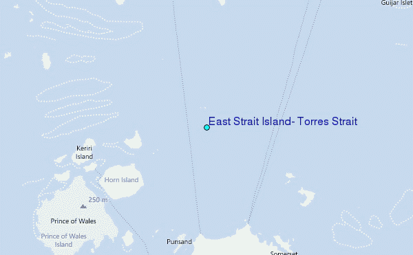
Use this relief map to navigate to tide stations, surf breaks and cities that are in the area of East Strait Island, Torres Strait.
Other Nearby Locations' tide tables and tide charts to East Strait Island, Torres Strait:
click location name for more details
 Surf breaks close to East Strait Island, Torres Strait:
|
||
|---|---|---|
| Closest surf break | Tupira Right | 466 mi |
| Second closest surf break | Forok Point | 484 mi |
| Third closest surf break | The Wharf (Mission Point) | 486 mi |
| Fourth closest surf break | Wewak Point | 487 mi |
| Fifth closest surf break | Moem Point | 488 mi |


 Nearest
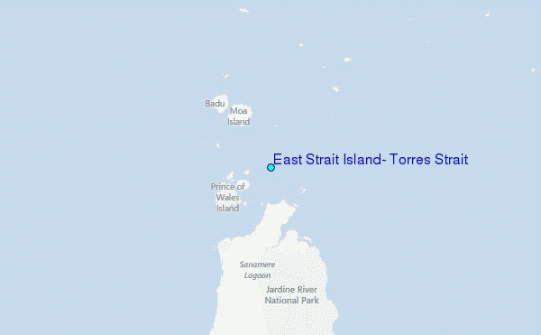