
| Distance / Altitude | Location | Report Date / Time | Live Weather | Wind | Gusts | Temp. | Visibility | Cloud |
|---|---|---|---|---|---|---|---|---|
| 3 km SW / 10 m | Dunn Creek wx (United States) | 2026-03-19 19:37 local (2026/03/19 23:37 GMT) | dry | calm (2 km/h at 57) | 13°C | - | - - 0 | |
| 12 km N / 9 m | Fernandina Beach (Florida) | 2026-03-19 19:19 local (2026/03/19 23:19 GMT) | dry | calm (2 km/h at 49) | 12°C | - | - - 0 | |
| 13 km S / 3 m | BUOY-BLIF1 (Marine) | 2026-03-19 19:00 local (2026/03/19 23:00 GMT) | moderate winds from the NE (21 km/h at 40) | 14°C | 10.9 | |||
| 13 km S / 3 m | BUOY-DMSF1 (Marine) | 2026-03-19 19:00 local (2026/03/19 23:00 GMT) | - (- km/h at -) | — | - | |||
| 13 km S / 28 m | Jacksonville (Florida) | 2026-03-19 19:06 local (2026/03/19 23:06 GMT) | dry | light winds from the NE (8 km/h at 45) | 13°C | - | - - 0 | |
| 14 km WSW / 218 m | Jacksonville Airport (Florida) | 2026-03-19 17:56 local (2026/03/19 21:56 GMT) | - | moderate winds from the ENE (22 km/h at 60) | 16°C | 16 | few | |
| 14 km SSW / 3 m | BUOY-NFDF1 (Marine) | 2026-03-19 19:00 local (2026/03/19 23:00 GMT) | light winds from the NE (18 km/h at 40) | 14°C | 10.9 | |||
| 15 km NNE / 5 m | Fernandina Beach Airport (Florida) (Florida) | 2026-03-19 18:35 local (2026/03/19 22:35 GMT) | Clear | moderate winds from the NE (22 km/h at 50) | 14°C | 16 | ||
| 15 km S / 10 m | Jacksonville (Florida) | 2026-03-19 19:23 local (2026/03/19 23:23 GMT) | dry | calm (3 km/h at 106) | 13°C | - | - - 0 | |
| 16 km SSE / 3 m | BUOY-LTJF1 (Marine) | 2026-03-19 19:00 local (2026/03/19 23:00 GMT) | - (- km/h at -) | 14°C | 10.9 |
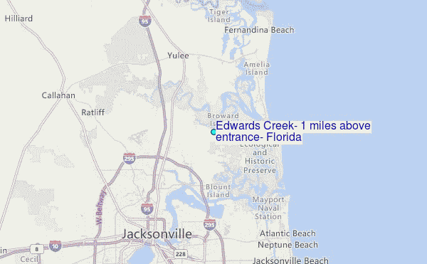
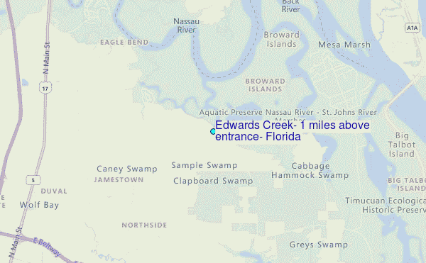
Choose Edwards Creek, 1 miles above entrance, Florida Location Map Zoom:
| Contours: | Roads & Rivers: | Select a
tide station / surf break / city |
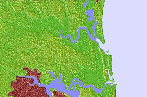
Use this relief map to navigate to tide stations, surf breaks and cities that are in the area of Edwards Creek, 1 miles above entrance, Florida.
Other Nearby Locations' tide tables and tide charts to Edwards Creek, 1 miles above entrance, Florida:
click location name for more details
 Surf breaks close to Edwards Creek, 1 miles above entrance, Florida:
|
||
|---|---|---|
| Closest surf break | Little Talbot Island | 8 mi |
| Second closest surf break | The Shoals | 10 mi |
| Third closest surf break | North Jetty | 11 mi |
| Fourth closest surf break | Fernandina Beach Pier | 12 mi |
| Fifth closest surf break | Hanna Park/Mayport Poles | 12 mi |


 Nearest
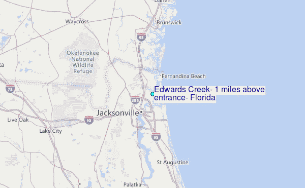