
| Distance / Altitude | Location | Report Date / Time | Live Weather | Wind | Gusts | Temp. | Visibility | Cloud |
|---|---|---|---|---|---|---|---|---|
| 101 km SSW / 6 m | Tumaco/la Florid (Colombia) | 2025-12-25 02:00 local (2025/12/25 07:00 GMT) | - | light winds from the SW.(Wind varies from 180 to 270 degs) (6 km/h at 230) | 24°C | |||
| 151 km SE / 1709 m | Pasto-Antonio Nariño Airport (Columbia) | 2025-12-25 02:00 local (2025/12/25 07:00 GMT) | Shower light rain shower | wind obs. (7 kph from 40 degs) was rejected (- km/h at -) | 16°C | 0.6 | broken overcast | |
| 169 km SE / 2627 m | Acuapasto wx (Colombia) | 2025-12-25 03:33 local (2025/12/25 08:33 GMT) | - | calm (2 km/h at 303) | 14°C | - | - - 0 | |
| 171 km E / 1730 m | Popayan/guillerm (Colombia) | 2025-12-25 02:00 local (2025/12/25 07:00 GMT) | - | calm (2 km/h at 1) | 16°C | |||
| 192 km SSE / 2905 m | Ipiales/San Luis Airport (Columbia) | 2025-12-25 02:00 local (2025/12/25 07:00 GMT) | Light rain | calm (4 km/h at 110) | — | 0.3 | broken broken | |
| 225 km ENE / 715 m | Buyal wx (Colombia) | 2025-12-25 03:02 local (2025/12/25 08:02 GMT) | - | calm (3 km/h at 130) | 19°C | - | - - 0 | |
| 227 km ENE / 650 m | Cali/Alfonso Bonilla Aragón International Airport (Columbia) | 2025-12-25 02:00 local (2025/12/25 07:00 GMT) | Dry and partly cloudy | calm (4 km/h at 1) | 19°C | 10.0 | few scattered | |
| 237 km S / 2952 m | AEP Yuracrucito (Ecuador) | 2025-12-25 03:00 local (2025/12/25 08:00 GMT) | - | light winds from the SW (11 km/h at 225) | 11°C | - | - - 0 | |
| 253 km SE / 511 m | Puerto Guzmán wx (Colombia) | 2025-12-25 03:14 local (2025/12/25 08:14 GMT) | dry | calm (2 km/h at 44) | 24°C | - | - - 0 | |
| 283 km SE / 254 m | Puerto Asis (Colombia) | 2025-12-25 02:00 local (2025/12/25 07:00 GMT) | - | calm (2 km/h at 1) | 24°C |
| Contours: | Roads & Rivers: | Select a
tide station / surf break / city |
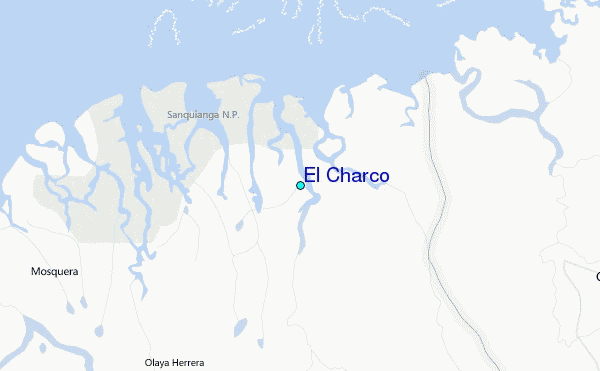
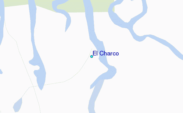
Use this relief map to navigate to tide stations, surf breaks and cities that are in the area of El Charco.
Other Nearby Locations' tide tables and tide charts to El Charco:
click location name for more details
 Surf breaks close to El Charco:
|
||
|---|---|---|
| Closest surf break | Tumaco | 70 mi |
| Second closest surf break | Playa Ladrilleros | 121 mi |
| Third closest surf break | Atacames | 163 mi |
| Fourth closest surf break | Casablanca | 168 mi |
| Fifth closest surf break | Tonchigue | 170 mi |


 Nearest
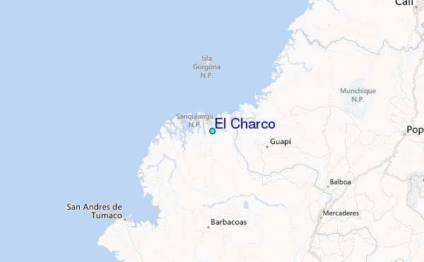