
| Distance / Altitude | Location | Report Date / Time | Live Weather | Wind | Gusts | Temp. | Visibility | Cloud |
|---|---|---|---|---|---|---|---|---|
| 7 km SSW / 3 m | BUOY-CHAO3 (Marine) | 2026-04-29 05:36 local (2026/04/29 12:36 GMT) | calm (5 km/h at 110) | — | - | |||
| 14 km S / 3 m | BUOY-SNTO3 (Marine) | 2026-04-29 05:30 local (2026/04/29 12:30 GMT) | - (0 km/h at -) | 4°C | - | |||
| 46 km NW / 3 m | Umpqua Offshore- OR (Marine) | 2026-04-29 06:30 local (2026/04/29 13:30 GMT) | - (- km/h at -) | 11°C | - | |||
| 66 km NNE / 16 m | Florence Municipal Airport (Oregon) | 2026-04-29 05:35 local (2026/04/29 12:35 GMT) | Dry and partly cloudy | calm (0 km/h at 0) | 5°C | 16 | broken | |
| 75 km S / 3 m | BUOY-PORO3 (Marine) | 2026-04-29 06:00 local (2026/04/29 13:00 GMT) | light winds from the N (15 km/h at 350) | 8°C | - | |||
| 78 km ESE / 218 m | Roseburg Airport (Oregon) | 2026-04-29 04:53 local (2026/04/29 11:53 GMT) | Clear | calm (0 km/h at 0) | 6°C | 16 | ||
| 79 km S / - m | SHIP240 (ocean) | 2026-04-29 06:00 local (2026/04/29 13:00 GMT) | - | fresh winds from the NNE (36 km/h at 20) | 11°C | - | no observation | |
| 79 km S / - m | SHIP160 (ocean) | 2026-04-29 06:00 local (2026/04/29 13:00 GMT) | - | fresh winds from the NNE (36 km/h at 20) | 11°C | - | no observation | |
| 79 km S / - m | SHIP985 (ocean) | 2026-04-29 04:00 local (2026/04/29 11:00 GMT) | - | fresh winds from the N (32 km/h at 10) | 11°C | - | no observation | |
| 79 km S / - m | SHIP528 (ocean) | 2026-04-29 04:00 local (2026/04/29 11:00 GMT) | - | fresh winds from the N (36 km/h at 10) | 11°C | - | no observation |
| Contours: | Roads & Rivers: | Select a
tide station / surf break / city |
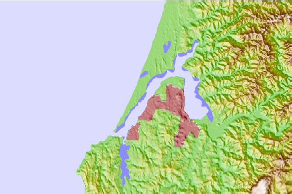
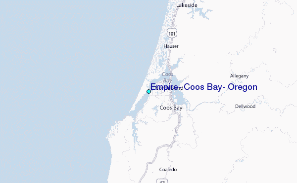
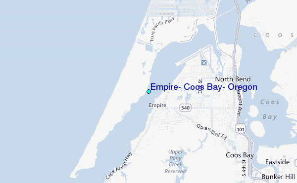
Use this relief map to navigate to tide stations, surf breaks and cities that are in the area of Empire, Coos Bay, Oregon.
Other Nearby Locations' tide tables and tide charts to Empire, Coos Bay, Oregon:
click location name for more details
 Surf breaks close to Empire, Coos Bay, Oregon:
|
||
|---|---|---|
| Closest surf break | Coos Bay North | 3 mi |
| Second closest surf break | Coos Bay-South Jetty | 4 mi |
| Third closest surf break | Bastendorff Beach | 5 mi |
| Fourth closest surf break | Coos Bay Bastendorf Beach | 5 mi |
| Fifth closest surf break | Simpsons Reef | 9 mi |


 Nearest
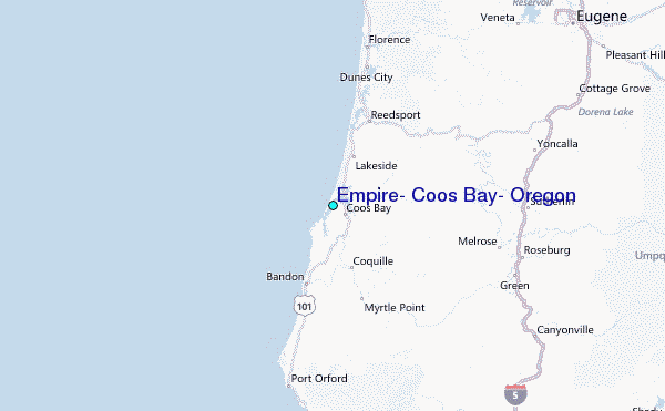