
| Distance / Altitude | Location | Report Date / Time | Live Weather | Wind | Gusts | Temp. | Visibility | Cloud |
|---|---|---|---|---|---|---|---|---|
| 47 km W / 182 m | Platinum (AK) Airport (United States) | 2025-12-25 10:56 local (2025/12/25 19:56 GMT) | Dry and cloudy | fresh winds from the ENE (30 km/h at 60) | -8°C | 14 | overcast | |
| 49 km ENE / 194 m | Togiak Airport (Alaska) | 2025-12-25 10:56 local (2025/12/25 19:56 GMT) | Dry and cloudy | light winds from the N (11 km/h at 360) | -10°C | 16 | overcast | |
| 52 km ENE / 3 m | BUOY-TGXA2 (Marine) | 2025-12-25 12:32 local (2025/12/25 21:32 GMT) | light winds from the N (13 km/h at 10) | -8°C | - | |||
| 59 km SW / 646 m | Cape Newenham Airport (Alaska) | 2025-12-25 10:55 local (2025/12/25 19:55 GMT) | Dry and cloudy | wind obs. (54 kph from 30 degs) was rejected (- km/h at -) | -4°C | 16 | overcast | |
| 113 km NW / 13 m | Quinhagak (AK) (Alaska) | 2025-12-25 10:56 local (2025/12/25 19:56 GMT) | Dry and cloudy | light winds from the N (13 km/h at 10) | -12°C | 16 | overcast | |
| 120 km E / 16 m | Manokotak Airport (Alaska) | 2025-12-25 10:56 local (2025/12/25 19:56 GMT) | Dry and partly cloudy | moderate winds from the NE (22 km/h at 50) | -12°C | 16 | broken | |
| 151 km ENE / 213 m | Dillingham Airport (Alaska) | 2025-12-25 10:56 local (2025/12/25 19:56 GMT) | Clear | light winds from the NNE (19 km/h at 20) | -13°C | 16 | ||
| 207 km WNW / 213 m | Kipnuk Airport (AK) (United States) | 2025-12-25 10:56 local (2025/12/25 19:56 GMT) | Dry and cloudy | moderate winds from the ENE (28 km/h at 60) | -14°C | 16 | overcast | |
| 223 km N / 214 m | Bethel Airport (Alaska) | 2025-12-25 10:53 local (2025/12/25 19:53 GMT) | Clear | moderate winds from the NNE (22 km/h at 20) | -18°C | 16 | ||
| 224 km N / 3 m | BUOY-BEXA2 (Marine) | 2025-12-25 12:32 local (2025/12/25 21:32 GMT) | light winds from the NNE (15 km/h at 30) | -15°C | - |
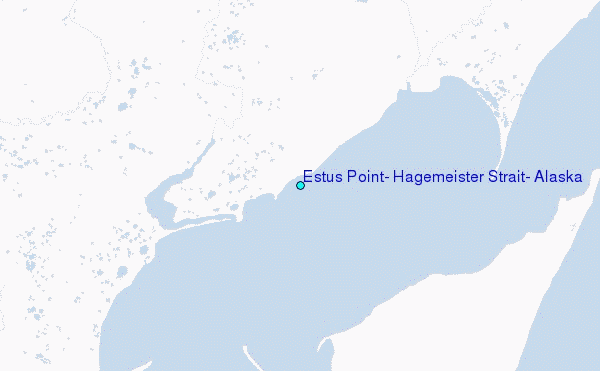
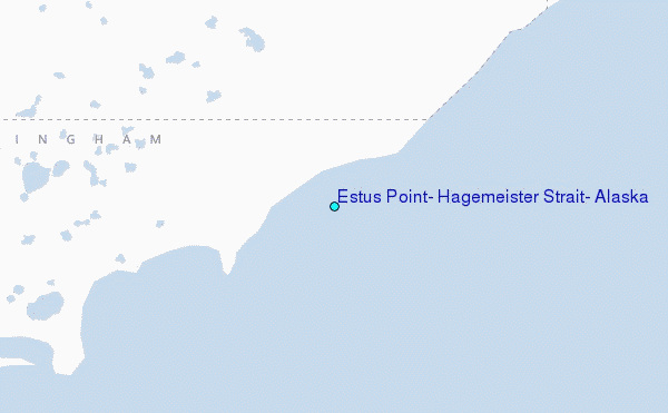
Choose Estus Point, Hagemeister Strait, Alaska Location Map Zoom:
| Contours: | Roads & Rivers: | Select a
tide station / surf break / city |
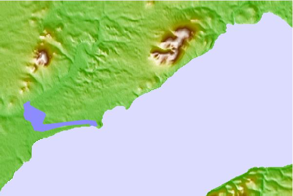
Use this relief map to navigate to tide stations, surf breaks and cities that are in the area of Estus Point, Hagemeister Strait, Alaska.
Other Nearby Locations' tide tables and tide charts to Estus Point, Hagemeister Strait, Alaska:
click location name for more details
 Surf breaks close to Estus Point, Hagemeister Strait, Alaska:
|
||
|---|---|---|
| Closest surf break | Monashka Bay | 322 mi |
| Second closest surf break | Termination Point | 322 mi |
| Third closest surf break | Mill Bay | 324 mi |
| Fourth closest surf break | Fossil Beach Kodiak | 333 mi |
| Fifth closest surf break | Bird Point (Tidal Bore) | 362 mi |


 Nearest
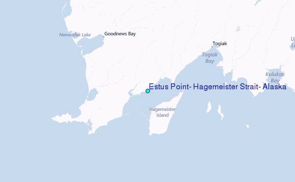