
| Distance / Altitude | Location | Report Date / Time | Live Weather | Wind | Gusts | Temp. | Visibility | Cloud |
|---|---|---|---|---|---|---|---|---|
| 10 km N / 3 m | BUOY-44084 (Marine) | 2026-04-23 09:26 local (2026/04/23 13:26 GMT) | - (- km/h at -) | — | - | |||
| 14 km S / 3 m | BUOY-OCIM2 (Marine) | 2026-04-23 09:00 local (2026/04/23 13:00 GMT) | light winds from the NNE (8 km/h at 20) | 12°C | - | |||
| 16 km S / 217 m | Ocean City Airport (Maryland) | 2026-04-23 07:53 local (2026/04/23 11:53 GMT) | Clear | light winds from the NNE (7 km/h at 20) | 13°C | 16 | ||
| 31 km E / - m | SHIP104 (ocean) | 2026-04-23 09:00 local (2026/04/23 13:00 GMT) | - | light winds from the NE (11 km/h at 50) | 11°C | - | no observation | |
| 31 km E / 3 m | Delaware Bay Buoy (Marine) | 2026-04-23 09:20 local (2026/04/23 13:20 GMT) | light winds from the NE (14 km/h at 40) | 11°C | - | |||
| 31 km E / - m | SHIP540 (ocean) | 2026-04-23 08:00 local (2026/04/23 12:00 GMT) | - | light winds from the NE (11 km/h at 40) | 10°C | - | no observation | |
| 31 km E / - m | SHIP329 (ocean) | 2026-04-23 09:00 local (2026/04/23 13:00 GMT) | - | light winds from the NE (11 km/h at 50) | 11°C | - | no observation | |
| 31 km E / - m | SHIP657 (ocean) | 2026-04-23 09:00 local (2026/04/23 13:00 GMT) | - | light winds from the NE (11 km/h at 50) | 11°C | - | no observation | |
| 31 km E / - m | SHIP1016 (ocean) | 2026-04-23 08:00 local (2026/04/23 12:00 GMT) | - | light winds from the NE (11 km/h at 40) | 10°C | - | no observation | |
| 31 km E / - m | SHIP472 (ocean) | 2026-04-23 09:00 local (2026/04/23 13:00 GMT) | - | light winds from the NE (11 km/h at 50) | 11°C | - | no observation |
| Contours: | Roads & Rivers: | Select a
tide station / surf break / city |
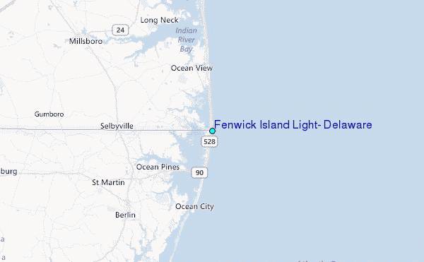
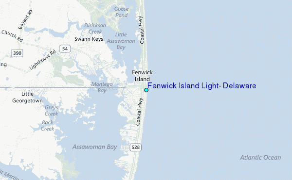
Use this relief map to navigate to tide stations, surf breaks and cities that are in the area of Fenwick Island Light, Delaware.
Other Nearby Locations' tide tables and tide charts to Fenwick Island Light, Delaware:
click location name for more details
 Surf breaks close to Fenwick Island Light, Delaware:
|
||
|---|---|---|
| Closest surf break | 120th Street | 1 mi |
| Second closest surf break | Fenwick | 2 mi |
| Third closest surf break | Ocean City | 3 mi |
| Fourth closest surf break | 48th Street | 4 mi |
| Fifth closest surf break | Bethany | 6 mi |


 Nearest
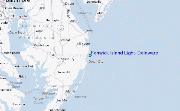