
| Distance / Altitude | Location | Report Date / Time | Live Weather | Wind | Gusts | Temp. | Visibility | Cloud |
|---|---|---|---|---|---|---|---|---|
| 1 km SSW / 7 m | Fort Pierce (Florida) | 2026-06-21 20:06 local (2026/06/22 00:06 GMT) | dry | calm (0 km/h at 65) | 24°C | - | - - 0 | |
| 5 km E / 0 m | lightning 8km NE of Fort Pierce (United States) | 2026-06-21 20:02 local (2026/06/22 00:02 GMT) | Thunderstorm | (- km/h at -) | — | |||
| 9 km WSW / 6 m | thunderstorm affecting Lakewood Park (United States) | 2026-06-21 19:00 local (2026/06/21 23:00 GMT) | Thunderstorm | (- km/h at -) | — | |||
| 9 km W / 218 m | Fort Pierce Airport (Florida) | 2026-06-21 19:43 local (2026/06/21 23:43 GMT) | Thunderstorm - in the vicinity | wind obs. (7 kph from 310 degs) was rejected (- km/h at -) | 24°C | 16 | scattered | |
| 12 km SE / 0 m | lightning 9km NE of Indian River Estates (United States) | 2026-06-21 19:34 local (2026/06/21 23:34 GMT) | Thunderstorm | (- km/h at -) | — | |||
| 12 km S / 6 m | Ankona wx (United States) | 2026-06-21 20:02 local (2026/06/22 00:02 GMT) | dry | calm (5 km/h at 29) | 26°C | - | - - 0 | |
| 15 km WNW / 7 m | thunderstorm affecting Lakewood Park (United States) | 2026-06-21 19:01 local (2026/06/21 23:01 GMT) | Thunderstorm | (- km/h at -) | — | |||
| 17 km SSW / 8 m | lightning 7km WSW of White City (United States) | 2026-06-21 18:35 local (2026/06/21 22:35 GMT) | Thunderstorm | (- km/h at -) | — | |||
| 17 km NE / 3 m | BUOY-41068 (Marine) | 2026-06-21 19:08 local (2026/06/21 23:08 GMT) | moderate winds from the SW (22 km/h at 230) | 28°C | - | |||
| 17 km NW / 5 m | thunderstorm affecting Florida Ridge (United States) | 2026-06-21 19:34 local (2026/06/21 23:34 GMT) | Thunderstorm | (- km/h at -) | — |
| Contours: | Roads & Rivers: | Select a
tide station / surf break / city |

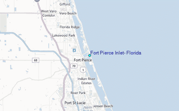
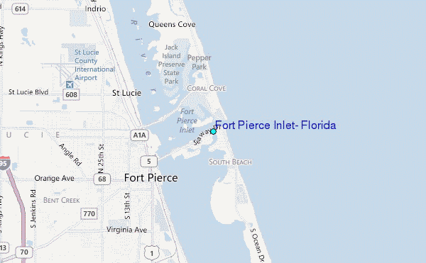
Use this relief map to navigate to tide stations, surf breaks and cities that are in the area of Fort Pierce Inlet, Florida.
Other Nearby Locations' tide tables and tide charts to Fort Pierce Inlet, Florida:
click location name for more details
 Surf breaks close to Fort Pierce Inlet, Florida:
|
||
|---|---|---|
| Closest surf break | Fort Pierce North Jetty | 1 mi |
| Second closest surf break | Walton Rocks (Power Plant) | 9 mi |
| Third closest surf break | Riomar Reef | 11 mi |
| Fourth closest surf break | Jensen Beach | 16 mi |
| Fifth closest surf break | Vero Beach Pier | 17 mi |


 Nearest
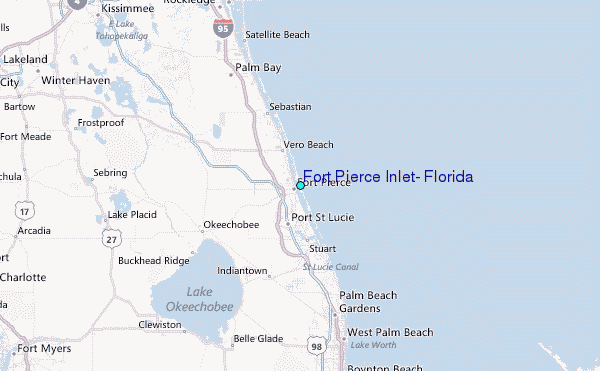