
| Distance / Altitude | Location | Report Date / Time | Live Weather | Wind | Gusts | Temp. | Visibility | Cloud |
|---|---|---|---|---|---|---|---|---|
| 2 km ESE / 3 m | BUOY-FPST2 (Marine) | 2026-06-03 14:00 local (2026/06/03 19:00 GMT) | light winds from the ENE (18 km/h at 60) | 27°C | - | |||
| 17 km NNE / 1 m | lightning 14km NNE of Oyster Creek (United States) | 2026-06-03 13:19 local (2026/06/03 18:19 GMT) | Thunderstorm | (- km/h at -) | — | |||
| 24 km NW / 6 m | lightning 4km SSW of Angleton (United States) | 2026-06-03 12:31 local (2026/06/03 17:31 GMT) | Thunderstorm | (- km/h at -) | — | |||
| 24 km WNW / 217 m | Angleton Airport (Texas) | 2026-06-03 13:11 local (2026/06/03 18:11 GMT) | Thunderstorm - in the vicinity | light winds from the N (6 km/h at 10) | 24°C | 11 | scattered broken overcast | |
| 24 km NE / 3 m | BUOY-LUIT2 (Marine) | 2026-06-03 14:00 local (2026/06/03 19:00 GMT) | light winds from the ENE (18 km/h at 60) | 27°C | - | |||
| 35 km NW / 11 m | lightning 8km WNW of Danbury (United States) | 2026-06-03 13:01 local (2026/06/03 18:01 GMT) | Thunderstorm | (- km/h at -) | — | |||
| 36 km W / 7 m | thunderstorm affecting Wild Peach Village (United States) | 2026-06-03 12:34 local (2026/06/03 17:34 GMT) | Thunderstorm | (- km/h at -) | — | |||
| 38 km SW / 3 m | Sargent (Texas) | 2026-06-03 13:01 local (2026/06/03 18:01 GMT) | dry | calm (3 km/h at 340) | 28°C | - | - - 0 | |
| 45 km WNW / 15 m | lightning 9km NW of Holiday Lakes (United States) | 2026-06-03 13:19 local (2026/06/03 18:19 GMT) | Thunderstorm | (- km/h at -) | — | |||
| 46 km WSW / 9 m | lightning 8km WSW of Sweeny (United States) | 2026-06-03 13:34 local (2026/06/03 18:34 GMT) | Thunderstorm | (- km/h at -) | — |
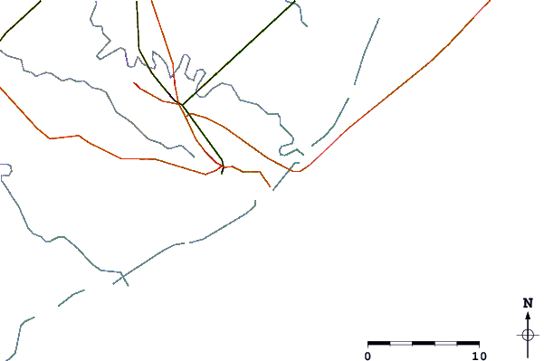
| Contours: | Roads & Rivers: | Select a
tide station / surf break / city |

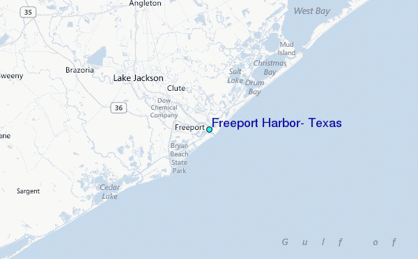
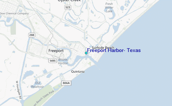
Use this relief map to navigate to tide stations, surf breaks and cities that are in the area of Freeport Harbor, Texas.
Other Nearby Locations' tide tables and tide charts to Freeport Harbor, Texas:
click location name for more details
 Surf breaks close to Freeport Harbor, Texas:
|
||
|---|---|---|
| Closest surf break | Surfside Beach Octagone | 1 mi |
| Second closest surf break | Surfside | 1 mi |
| Third closest surf break | Freeport Pier | 7 mi |
| Fourth closest surf break | Freeport Channel | 8 mi |
| Fifth closest surf break | Quintana Jetty | 8 mi |


 Nearest
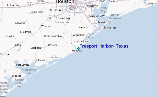