
| Distance / Altitude | Location | Report Date / Time | Live Weather | Wind | Gusts | Temp. | Visibility | Cloud |
|---|---|---|---|---|---|---|---|---|
| 26 km ENE / 56 m | Kirkja (Denmark) | 2025-12-25 13:00 local (2025/12/25 13:00 GMT) | no report | wind obs. (6 kph from 290 degs) was rejected (- km/h at -) | 11°C | - | - | |
| 31 km SW / 375 m | Vága Floghavn/Sørvágur-Airport (Denmark) | 2025-12-25 13:20 local (2025/12/25 13:20 GMT) | Drizzle | light winds from the WSW.(Wind varies from 210 to 280 degs) (13 km/h at 240) | 7°C | 8.0 | overcast | |
| 50 km SW / 100 m | Mykines Fyr (Denmark) | 2025-12-25 13:00 local (2025/12/25 13:00 GMT) | no report | light winds from the SSW (15 km/h at 210) | 10°C | - | - - - | |
| 52 km NNE / 15 m | ASCATB354E63N (Marine) | 2025-12-25 11:39 local (2025/12/25 11:39 GMT) | fresh winds from the W (32 km/h at 263) | — | - km | |||
| 67 km NW / 15 m | ASCATB353E63N (Marine) | 2025-12-25 11:39 local (2025/12/25 11:39 GMT) | fresh winds from the SW (32 km/h at 232) | — | - km | |||
| 79 km SE / 15 m | ASCATB354E62N (Marine) | 2025-12-25 11:39 local (2025/12/25 11:39 GMT) | moderate winds from the SW (26 km/h at 227) | — | - km | |||
| 80 km NE / 15 m | ASCATB355E63N (Marine) | 2025-12-25 11:39 local (2025/12/25 11:39 GMT) | moderate winds from the W (24 km/h at 279) | — | - km | |||
| 100 km W / 15 m | ASCATB352E63N (Marine) | 2025-12-25 11:39 local (2025/12/25 11:39 GMT) | fresh winds from the SW (30 km/h at 229) | — | - km | |||
| 101 km SE / 15 m | ASCATB355E62N (Marine) | 2025-12-25 11:39 local (2025/12/25 11:39 GMT) | moderate winds from the SW (26 km/h at 236) | — | - km | |||
| 107 km SSW / 15 m | ASCATB352E62N (Marine) | 2025-12-25 11:39 local (2025/12/25 11:39 GMT) | fresh winds from the SW (30 km/h at 220) | — | - km |
| Contours: | Roads & Rivers: | Select a
tide station / surf break / city |
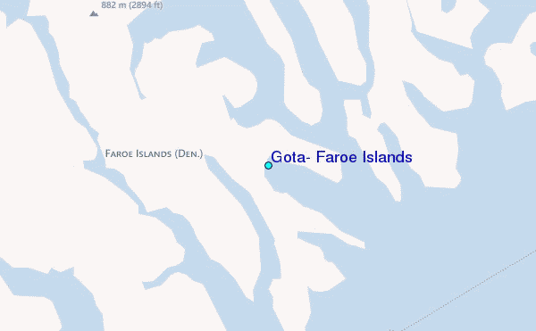
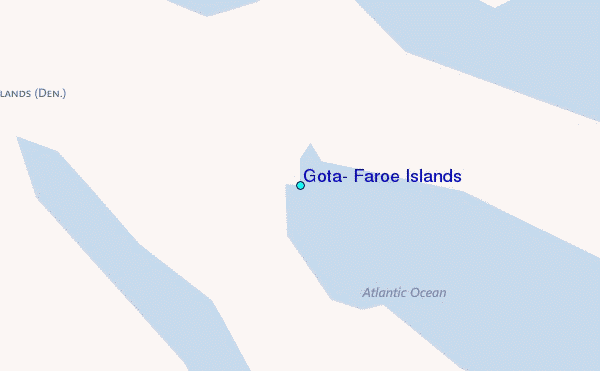
Use this relief map to navigate to tide stations, surf breaks and cities that are in the area of Gøta, Faroe Islands.
Other Nearby Locations' tide tables and tide charts to Gota, Faroe Islands:
click location name for more details
 Surf breaks close to Gota, Faroe Islands:
|
||
|---|---|---|
| Closest surf break | Tjornuvik Bay (Streymoy) | 16 mi |
| Second closest surf break | Húsavik Shorey (Sandoy) | 27 mi |
| Third closest surf break | Fámjin Left | 47 mi |
| Fourth closest surf break | Fámjin Right | 47 mi |
| Fifth closest surf break | Birsay Bay | 242 mi |


 Nearest
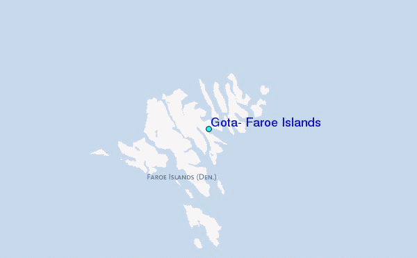