
| Distance / Altitude | Location | Report Date / Time | Live Weather | Wind | Gusts | Temp. | Visibility | Cloud |
|---|---|---|---|---|---|---|---|---|
| 12 km W / 20 m | Parada de Señal Irizarry wx (Puerto Rico) | 2026-04-03 14:33 local (2026/04/03 18:33 GMT) | dry | wind obs. (6 kph from 58 degs) was rejected (- km/h at -) | 31°C | - | - - 0 | |
| 14 km WSW / 8 m | La Parguera wx (Puerto Rico) | 2026-04-03 14:36 local (2026/04/03 18:36 GMT) | dry | wind obs. (6 kph from 5 degs) was rejected (- km/h at -) | 26°C | - | - - 0 | |
| 14 km WSW / 3 m | BUOY-MGIP4 (Marine) | 2026-04-03 14:00 local (2026/04/03 18:00 GMT) | light winds from the SE (15 km/h at 130) | — | - | |||
| 18 km WNW / 47 m | San German (Puerto Rico) | 2026-04-03 14:02 local (2026/04/03 18:02 GMT) | light rain | calm (3 km/h at 360) | 26°C | - | - - 0 | |
| 22 km WSW / 85 m | Las Palmas wx (Puerto Rico) | 2026-04-03 14:17 local (2026/04/03 18:17 GMT) | dry | wind obs. (14 kph from 76 degs) was rejected (- km/h at -) | 26°C | - | - - 0 | |
| 32 km E / 1 m | Muelle de Ponce wx (Puerto Rico) | 2026-04-03 14:37 local (2026/04/03 18:37 GMT) | dry | moderate winds from the ESE (26 km/h at 109) | 28°C | - | - - 0 | |
| 32 km E / 13 m | Ponce (Puerto Rico) | 2026-04-03 14:35 local (2026/04/03 18:35 GMT) | dry | wind obs. (26 kph from 196 degs) was rejected (- km/h at -) | 27°C | - | - - 0 | |
| 34 km NNE / 560 m | La Estancita wx (Puerto Rico) | 2026-04-03 13:44 local (2026/04/03 17:44 GMT) | dry | light winds from the ESE (10 km/h at 117) | 20°C | - | - - 0 | |
| 36 km WNW / 25 m | Mayaguez (Puerto Rico) | 2026-04-03 14:42 local (2026/04/03 18:42 GMT) | dry | light winds from the SSW (11 km/h at 202) | 27°C | - | - - 0 | |
| 37 km E / 443 m | Ponce/Mercedita Airport (Puerto Rico) | 2026-04-03 13:35 local (2026/04/03 17:35 GMT) | Dry and partly cloudy | fresh winds from the SE (31 km/h at 140) | 29°C | 16 | few scattered scattered |
| Contours: | Roads & Rivers: | Select a
tide station / surf break / city |
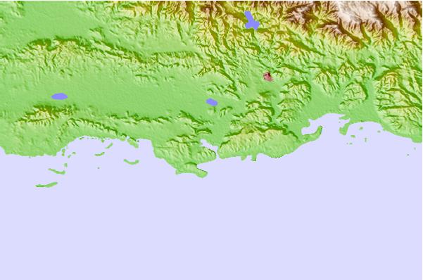
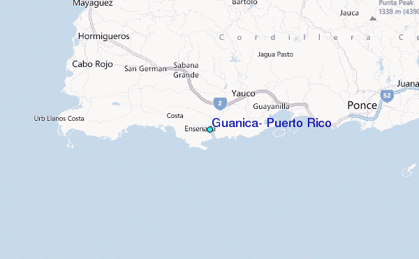
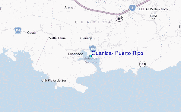
Use this relief map to navigate to tide stations, surf breaks and cities that are in the area of Guánica, Puerto Rico.
Other Nearby Locations' tide tables and tide charts to Guanica, Puerto Rico:
click location name for more details
 Surf breaks close to Guanica, Puerto Rico:
|
||
|---|---|---|
| Closest surf break | Punta de Brea | 2 mi |
| Second closest surf break | Playa Ballena | 4 mi |
| Third closest surf break | Sea Beach (Rincon) | 34 mi |
| Fourth closest surf break | Little Malibu (Rincon) | 34 mi |
| Fifth closest surf break | BC's | 35 mi |


 Nearest
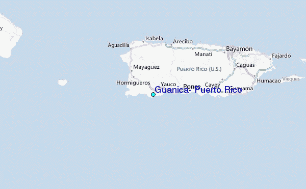