
| Distance / Altitude | Location | Report Date / Time | Live Weather | Wind | Gusts | Temp. | Visibility | Cloud |
|---|---|---|---|---|---|---|---|---|
| 86 km E / 506 m | Adak Naval Air Station Airport (Alaska) | 2025-12-24 21:56 local (2025/12/25 07:56 GMT) | Light rain | light winds from the S (6 km/h at 190) | 7°C | 6 | overcast | |
| 87 km E / 3 m | BUOY-ADKA2 (Marine) | 2025-12-24 23:00 local (2025/12/25 09:00 GMT) | moderate winds from the SE (21 km/h at 140) | 7°C | - | |||
| 186 km SW / - m | SHIP875 (ocean) | 2025-12-24 23:00 local (2025/12/25 09:00 GMT) | - | fresh winds from the N (29 km/h at 10) | — | - | no observation | |
| 186 km SW / 3 m | Western Aleutians Buoy (Marine) | 2025-12-24 23:20 local (2025/12/25 09:20 GMT) | fresh winds from the N (29 km/h at 10) | — | - | |||
| 256 km E / 211 m | Atka Airport (Alaska) | 2025-12-24 21:56 local (2025/12/25 07:56 GMT) | - | moderate winds from the E (20 km/h at 90) | 7°C | 0.0 | ||
| 187 km SW / - m | SHIP1406 (ocean) | 2025-12-24 23:00 local (2025/12/25 09:00 GMT) | - | fresh winds from the N (29 km/h at 10) | — | - | no observation | |
| 187 km SW / - m | SHIP1045 (ocean) | 2025-12-24 23:00 local (2025/12/25 09:00 GMT) | - | fresh winds from the N (29 km/h at 10) | — | - | no observation | |
| 187 km SW / - m | SHIP1176 (ocean) | 2025-12-24 23:00 local (2025/12/25 09:00 GMT) | - | fresh winds from the N (29 km/h at 10) | — | - | no observation | |
| 187 km SW / - m | SHIP1024 (ocean) | 2025-12-24 21:00 local (2025/12/25 07:00 GMT) | - | fresh winds from the NNE (32 km/h at 30) | — | - | no observation | |
| 187 km SW / - m | SHIP400 (ocean) | 2025-12-24 23:00 local (2025/12/25 09:00 GMT) | - | fresh winds from the N (29 km/h at 10) | — | - | no observation |
| Contours: | Roads & Rivers: | Select a
tide station / surf break / city |

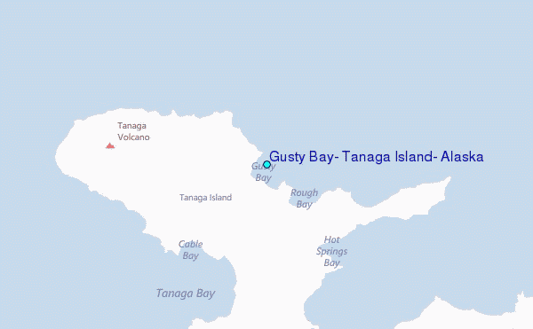
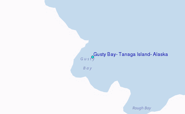
Use this relief map to navigate to tide stations, surf breaks and cities that are in the area of Gusty Bay, Tanaga Island, Alaska.
Other Nearby Locations' tide tables and tide charts to Gusty Bay, Tanaga Island, Alaska:
click location name for more details
 Surf breaks close to Gusty Bay, Tanaga Island, Alaska:
|
||
|---|---|---|
| Closest surf break | Khalaktyrsky Beach | 978 mi |
| Second closest surf break | Fossil Beach Kodiak | 1084 mi |
| Third closest surf break | Monashka Bay | 1086 mi |
| Fourth closest surf break | Termination Point | 1088 mi |
| Fifth closest surf break | Mill Bay | 1089 mi |


 Nearest
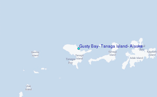