
| Distance / Altitude | Location | Report Date / Time | Live Weather | Wind | Gusts | Temp. | Visibility | Cloud |
|---|---|---|---|---|---|---|---|---|
| 24 km E / 3 m | BUOY-CHCM2 (Marine) | 2026-06-09 04:30 local (2026/06/09 08:30 GMT) | light winds from the SE (8 km/h at 130) | 11°C | - | |||
| 32 km ENE / 24 m | Newark (Delaware) | 2026-06-09 05:04 local (2026/06/09 09:04 GMT) | dry | calm (0 km/h at 264) | 12°C | - | - - 0 | |
| 37 km SSW / 203 m | Baltimore/Martin State Airport (Maryland) | 2026-06-09 04:35 local (2026/06/09 08:35 GMT) | Dry and cloudy | light winds from the S (11 km/h at 170) | 18°C | 16 | overcast | |
| 39 km S / 3 m | BUOY-TCBM2 (Marine) | 2026-06-09 04:30 local (2026/06/09 08:30 GMT) | calm (5 km/h at 110) | 13°C | - | |||
| 43 km E / 3 m | BUOY-DELD1 (Marine) | 2026-06-09 04:30 local (2026/06/09 08:30 GMT) | calm (5 km/h at 250) | 12°C | - | |||
| 45 km ENE / 216 m | Wilmington Airport (Delaware) | 2026-06-09 03:51 local (2026/06/09 07:51 GMT) | Clear | light winds from the WSW (7 km/h at 240) | 12°C | 16 | ||
| 46 km NE / 103 m | Larchmont wx (United States) | 2026-06-09 04:41 local (2026/06/09 08:41 GMT) | - | calm (0 km/h at 150) | 10°C | - | - - 0 | |
| 48 km NE / 95 m | Kennett Square (Pennsylvania) | 2026-06-09 05:17 local (2026/06/09 09:17 GMT) | dry | calm (0 km/h at 67) | 10°C | - | - - 0 | |
| 49 km ENE / 88 m | Greenville (Delaware) | 2026-06-09 04:46 local (2026/06/09 08:46 GMT) | dry | calm (0 km/h at 176) | 10°C | - | - - 0 | |
| 51 km SSW / - m | SHIP463 (ocean) | 2026-06-09 04:00 local (2026/06/09 08:00 GMT) | - | moderate winds from the SSE (22 km/h at 160) | 18°C | - | no observation |
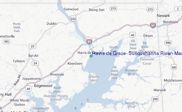
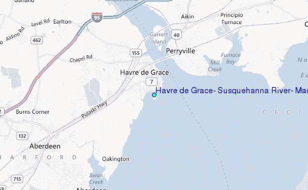
Choose Havre de Grace, Susquehanna River, Maryland Location Map Zoom:
| Contours: | Roads & Rivers: | Select a
tide station / surf break / city |
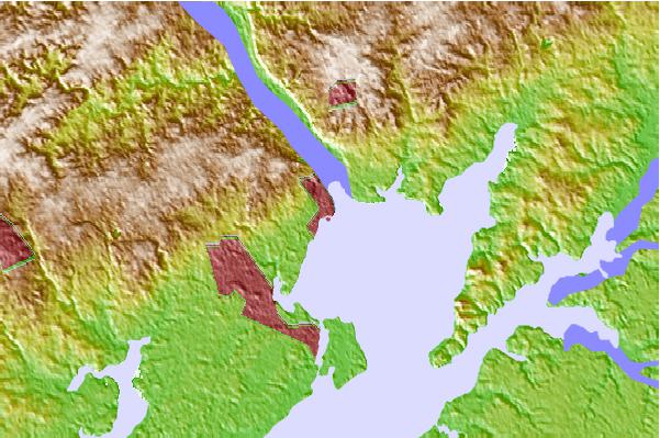
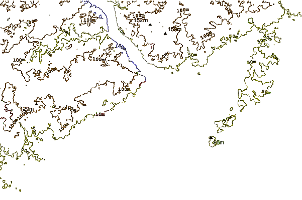
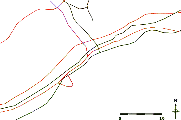
Use this relief map to navigate to tide stations, surf breaks and cities that are in the area of Havre de Grace, Susquehanna River, Maryland.
Other Nearby Locations' tide tables and tide charts to Havre de Grace, Susquehanna River, Maryland:
click location name for more details
 Surf breaks close to Havre de Grace, Susquehanna River, Maryland:
|
||
|---|---|---|
| Closest surf break | Naval Jetties | 75 mi |
| Second closest surf break | The Cove Cape May | 75 mi |
| Third closest surf break | Broadway | 75 mi |
| Fourth closest surf break | Queen Street | 75 mi |
| Fifth closest surf break | The Cove Delaware | 75 mi |


 Nearest
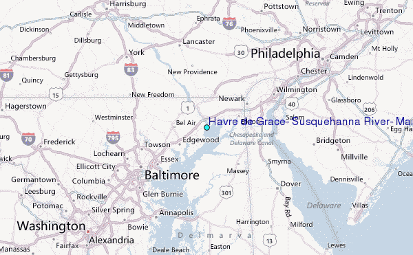