
| Distance / Altitude | Location | Report Date / Time | Live Weather | Wind | Gusts | Temp. | Visibility | Cloud |
|---|---|---|---|---|---|---|---|---|
| 1 km NE / 33 m | Hawaiian Paradise Park wx (United States) | 2026-03-15 20:49 local (2026/03/16 06:49 GMT) | dry | calm (2 km/h at 196) | 24°C | - | - - 0 | |
| 4 km ESE / 33 m | Hawaiian Paradise Park wx (United States) | 2026-03-15 22:21 local (2026/03/16 08:21 GMT) | dry | calm (0 km/h at 155) | 23°C | - | - - 0 | |
| 16 km NW / 218 m | Hilo Airport (Hawaii) | 2026-03-15 20:53 local (2026/03/16 06:53 GMT) | Dry and partly cloudy | light winds from the N (9 km/h at 360) | 24°C | 16 | few broken | |
| 18 km NW / 3 m | BUOY-ILOH1 (Marine) | 2026-03-15 22:00 local (2026/03/16 08:00 GMT) | calm (5 km/h at 330) | 24°C | - | |||
| 21 km N / 3 m | Hilo- Hawaii- HI (Marine) | 2026-03-15 21:56 local (2026/03/16 07:56 GMT) | - (- km/h at -) | — | - | |||
| 26 km WNW / 457 m | Hilo (Hawaii) | 2026-03-15 22:29 local (2026/03/16 08:29 GMT) | dry | calm (5 km/h at 225) | 21°C | - | - - 0 | |
| 50 km NW / 43 m | Pāpa‘aloa wx (United States) | 2026-03-15 22:46 local (2026/03/16 08:46 GMT) | dry | calm (2 km/h at 309) | 22°C | - | - - 0 | |
| 52 km W / 1977 m | Pua‘ākala wx (United States) | 2026-03-15 22:06 local (2026/03/16 08:06 GMT) | dry | strong winds from the W (39 km/h at 260) | 12°C | - | - - 0 | |
| 63 km W / 2167 m | Bradshaw Army Airfield (Hawaii) | 2026-03-15 21:20 local (2026/03/16 07:20 GMT) | Dry and cloudy | light winds from the WSW (6 km/h at 240) | 16°C | 14 | overcast | |
| 74 km WNW / 327 m | Honokaa (Hawaii) | 2026-03-15 22:27 local (2026/03/16 08:27 GMT) | dry | calm (0 km/h at 293) | 21°C | - | - - 0 |
| Contours: | Roads & Rivers: | Select a
tide station / surf break / city |
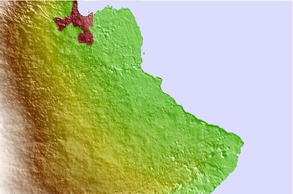
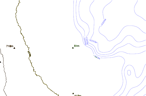
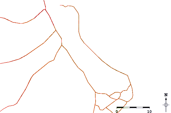
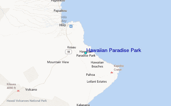
Use this relief map to navigate to tide stations, surf breaks and cities that are in the area of Hawaiian Paradise Park.
Other Nearby Locations' tide tables and tide charts to Hawaiian Paradise Park:
click location name for more details
 Surf breaks close to Hawaiian Paradise Park:
|
||
|---|---|---|
| Closest surf break | Chocks | 11 mi |
| Second closest surf break | James Kealoha Beach Park | 11 mi |
| Third closest surf break | Richardsons | 11 mi |
| Fourth closest surf break | Blonde Reef | 11 mi |
| Fifth closest surf break | Bay Front | 12 mi |


 Nearest
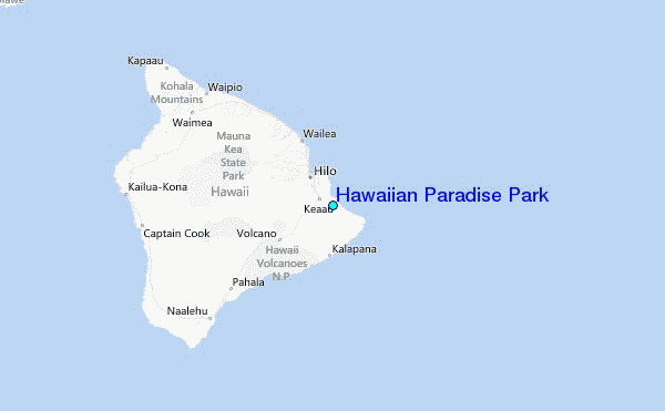