
| Distance / Altitude | Location | Report Date / Time | Live Weather | Wind | Gusts | Temp. | Visibility | Cloud |
|---|---|---|---|---|---|---|---|---|
| 31 km S / 216 m | Hamilton Island (Australia) | 2026-05-06 23:44 local (2026/05/06 13:44 GMT) | Dry and cloudy | moderate winds from the SE (20 km/h at 130) | 24°C | 10.0 | scattered overcast - | |
| 33 km S / 59 m | HamiltonIslandAirport (Australia) | 2026-05-07 00:00 local (2026/05/06 14:00 GMT) | Clear skies | moderate winds from the SE (20 km/h at 130) | 23°C | - | - no observation - | |
| 62 km SSW / 20 m | ProserpineAirport (Australia) | 2026-05-07 00:00 local (2026/05/06 14:00 GMT) | Clear skies | light winds from the S (11 km/h at 190) | 19°C | - | - no observation - | |
| 62 km SSW / 20 m | Prosperine Airport (Australia) | 2026-05-07 00:00 local (2026/05/06 14:00 GMT) | Clear skies | light winds from the S (11 km/h at 190) | 19°C | - | - no observation - | |
| 75 km WSW / 1 m | BowenAirportAws (Australia) | 2026-05-07 00:00 local (2026/05/06 14:00 GMT) | no report | light winds from the SE (17 km/h at 140) | 17°C | - | - no observation - | |
| 120 km SSE / 36 m | MackayM.o (Australia) | 2026-05-07 00:00 local (2026/05/06 14:00 GMT) | No report | light winds from the SSW (7 km/h at 210) | 22°C | - | - overcast - | |
| 124 km S / 6 m | OoraleaRacecourse(Mackay Turf Club) (Australia) | 2026-05-07 00:00 local (2026/05/06 14:00 GMT) | No report | calm (2 km/h at 190) | 20°C | - | no observation | |
| 125 km SSE / 5 m | MackayAero (Australia) | 2026-05-07 00:00 local (2026/05/06 14:00 GMT) | Clear skies | light winds from the SSW (7 km/h at 200) | 19°C | - | - no observation - | |
| 133 km S / 54 m | Eton wx (Australia) | 2026-05-07 00:34 local (2026/05/06 14:34 GMT) | dry | calm (3 km/h at 263) | 18°C | - | - - 0 | |
| 157 km S / 308 m | Shinfield wx (Australia) | 2026-05-07 00:04 local (2026/05/06 14:04 GMT) | dry | calm (0 km/h at 44) | 19°C | - | - - 0 |
| Contours: | Roads & Rivers: | Select a
tide station / surf break / city |
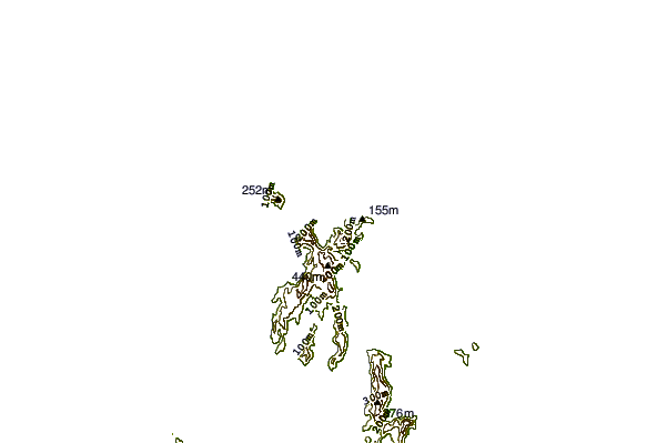
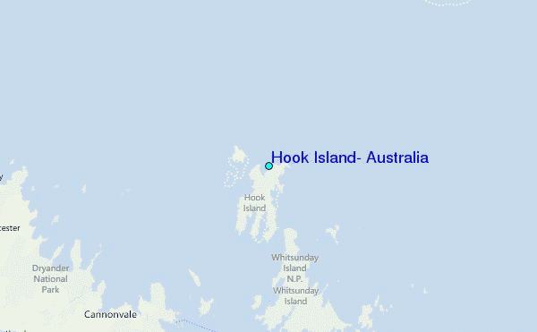
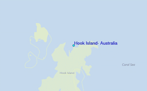
Use this relief map to navigate to tide stations, surf breaks and cities that are in the area of Hook Island, Australia.
Other Nearby Locations' tide tables and tide charts to Hook Island, Australia:
click location name for more details
 Surf breaks close to Hook Island, Australia:
|
||
|---|---|---|
| Closest surf break | Eimeo Point | 68 mi |
| Second closest surf break | Dolphin Heads | 69 mi |
| Third closest surf break | Lamberts Beach | 72 mi |
| Fourth closest surf break | North Wall Mackay Harbour Beach | 74 mi |
| Fifth closest surf break | South Wall Mackay Harbour | 75 mi |


 Nearest
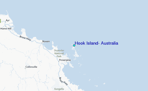