
| Distance / Altitude | Location | Report Date / Time | Live Weather | Wind | Gusts | Temp. | Visibility | Cloud |
|---|---|---|---|---|---|---|---|---|
| 50 km S / 179 m | Mombasa-Moi International Airport (Kenya) | 2026-03-17 03:30 local (2026/03/17 00:30 GMT) | Dry and partly cloudy | calm (0 km/h at 0) | 26°C | 10.0 | few scattered - | |
| 146 km WSW / 87 m | Voi (Kenya) | 2026-03-17 04:00 local (2026/03/17 01:00 GMT) | no report | wind obs. (15 kph from 240 degs) was rejected (- km/h at -) | 22°C | 30 | - | |
| 191 km NE / 1 m | Lamu (Kenya) | 2026-03-17 04:00 local (2026/03/17 01:00 GMT) | no report | wind obs. (13 kph from 180 degs) was rejected (- km/h at -) | 30°C | 30 | - | |
| 270 km WNW / 1053 m | Makindu (Kenya) | 2026-03-17 04:00 local (2026/03/17 01:00 GMT) | no report | light winds from the ESE (7 km/h at 120) | 24°C | 40 | - | |
| 294 km S / 372 m | Zanzibar/Kisauni Airport (Tanzania) | 2026-03-17 02:00 local (2026/03/16 23:00 GMT) | Mist - | calm (0 km/h at 0) | 25°C | 5.0 | scattered | |
| 365 km S / 376 m | Dar Es Salaam Airport (Tanzania) | 2026-03-17 02:00 local (2026/03/16 23:00 GMT) | - | calm (2 km/h at 1) | 25°C | 10.0 | few - - | |
| 415 km WNW / 1624 m | Nairobi/Jomo Kenyatta Airport (Kenya) | 2026-03-17 03:30 local (2026/03/17 00:30 GMT) | Dry and partly cloudy | light winds from the NNE (6 km/h at 20) | 17°C | 10.0 | broken | |
| 425 km WNW / 1685 m | Nairobi Wilson Airport (Kenya) | 2026-03-17 04:00 local (2026/03/17 01:00 GMT) | no report | moderate winds from the SSE (20 km/h at 150) | 20°C | 20 | - - - | |
| 430 km WNW / 1796 m | Dagoretti Corner (Kenya) | 2026-03-17 04:00 local (2026/03/17 01:00 GMT) | intermittent light drizzle | wind obs. (6 kph from 110 degs) was rejected (- km/h at -) | 15°C | 30 | - | |
| 468 km WNW / 2191 m | Kijabe (Kenya) | 2026-03-17 04:18 local (2026/03/17 01:18 GMT) | dry | calm (3 km/h at 115) | 14°C | - | - - 0 |
| Contours: | Roads & Rivers: | Select a
tide station / surf break / city |
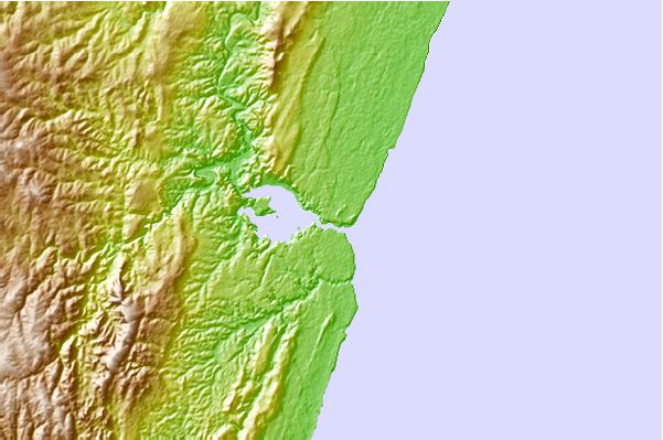
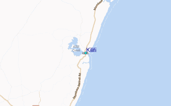
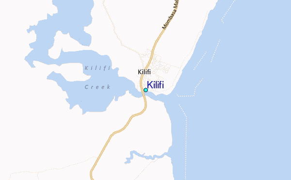
Use this relief map to navigate to tide stations, surf breaks and cities that are in the area of Kilifi.
Other Nearby Locations' tide tables and tide charts to Kilifi:
click location name for more details
 Surf breaks close to Kilifi:
|
||
|---|---|---|
| Closest surf break | Watamu Bay | 23 mi |
| Second closest surf break | Mombasa Channel | 33 mi |
| Third closest surf break | Malindi Bay | 35 mi |
| Fourth closest surf break | Nungwi Reefs | 149 mi |
| Fifth closest surf break | Jam's Right | 216 mi |


 Nearest
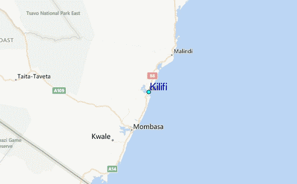