
| Distance / Altitude | Location | Report Date / Time | Live Weather | Wind | Gusts | Temp. | Visibility | Cloud |
|---|---|---|---|---|---|---|---|---|
| 7 km S / 1 m | Siam Pro Kite (SPK) (Thailand) | 2026-06-08 03:00 local (2026/06/07 20:00 GMT) | - | fresh winds from the WSW (30 km/h at 252) | 29°C | - | - - 0 | |
| 7 km S / 4 m | Accrokite KohPhangan (Thailand) | 2026-06-08 03:00 local (2026/06/07 20:00 GMT) | - | moderate winds from the WSW (26 km/h at 254) | 29°C | - | - - 0 | |
| 34 km S / 6 m | KO Samui (Thailand) | 2026-06-08 03:00 local (2026/06/07 20:00 GMT) | no report | wind obs. (9 kph from 290 degs) was rejected (- km/h at -) | 32°C | - | - | |
| 81 km S / 37 m | Surat Thani Agromet (Thailand) | 2026-06-08 03:00 local (2026/06/07 20:00 GMT) | no report | light winds from the WSW (7 km/h at 240) | 31°C | - | - | |
| 103 km SSW / 120 m | Surat Thani (Thailand) | 2026-06-08 03:00 local (2026/06/07 20:00 GMT) | no report | light winds from the WSW (13 km/h at 240) | 31°C | 30 km | - mostly cloudy - | |
| 121 km W / 13 m | SawiAgromet (Thailand) | 2026-06-08 03:00 local (2026/06/07 20:00 GMT) | no report | light winds from the SW (7 km/h at 230) | 32°C | 27 km | - mostly cloudy - | |
| 123 km WNW / 5 m | Chumphon (Thailand) | 2026-06-08 01:00 local (2026/06/07 18:00 GMT) | no report | light winds from the WSW (11 km/h at 250) | 32°C | - | - | |
| 123 km S / 7 m | Ban Pratu Chang wx (Thailand) | 2026-06-08 03:13 local (2026/06/07 20:13 GMT) | - | calm (0 km/h at 0) | — | - | - - 0 | |
| 135 km S / 6 m | Nakhonsi Thammarat (Thailand) | 2026-06-08 01:00 local (2026/06/07 18:00 GMT) | no report | wind obs. (7 kph from 300 degs) was rejected (- km/h at -) | 32°C | - | - | |
| 155 km S / 3 m | Nakhonsi Thammarat Agromet (Thailand) | 2026-06-08 03:00 local (2026/06/07 20:00 GMT) | no report | light winds from the WSW (15 km/h at 240) | 31°C | 10 | - |
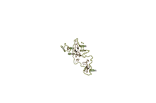
| Contours: | Roads & Rivers: | Select a
tide station / surf break / city |
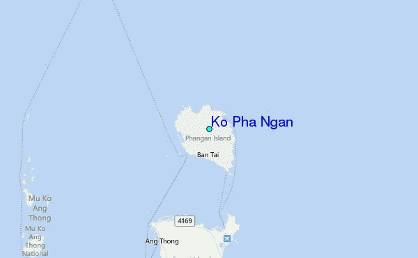
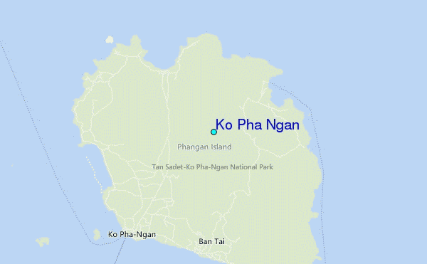
Use this relief map to navigate to tide stations, surf breaks and cities that are in the area of Ko Pha Ngan.
Other Nearby Locations' tide tables and tide charts to Ko Pha Ngan:
click location name for more details
 Surf breaks close to Ko Pha Ngan:
|
||
|---|---|---|
| Closest surf break | Kho Phan-Ngan - Haad Rin | 6 mi |
| Second closest surf break | Chaweng Malibu | 16 mi |
| Third closest surf break | Ko Samui | 17 mi |
| Fourth closest surf break | Bang Saphan | 106 mi |
| Fifth closest surf break | Mae Ram Phueng | 106 mi |


 Nearest
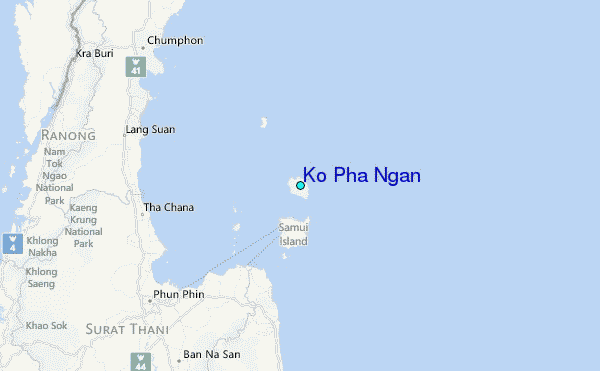