
| Distance / Altitude | Location | Report Date / Time | Live Weather | Wind | Gusts | Temp. | Visibility | Cloud |
|---|---|---|---|---|---|---|---|---|
| 109 km S / 15 m | SHIP7744 (Marine) | 2025-12-25 09:00 local (2025/12/25 00:00 GMT) | strong winds from the NNW (46.800000000000004 km/h at 330) | 16°C | - km | |||
| 109 km S / 3 m | BUOY-22103 South Korea (Marine) | 2025-12-25 10:00 local (2025/12/25 01:00 GMT) | strong winds from the NNW (47 km/h at 340) | 6°C | - | |||
| 110 km WSW / 2 m | Muan International Airport (Korea) | 2025-12-25 09:00 local (2025/12/25 00:00 GMT) | Dry and partly cloudy | moderate winds from the N (22 km/h at 350) | 4°C | 10.0 | broken | |
| 121 km E / 3 m | BUOY-22104 South Korea (Marine) | 2025-12-25 10:00 local (2025/12/25 01:00 GMT) | strong winds from the NNW (47 km/h at 330) | 6°C | - | |||
| 108 km S / 15 m | SHIP3813 (Marine) | 2025-12-25 09:00 local (2025/12/25 00:00 GMT) | strong winds from the NNW (46.800000000000004 km/h at 330) | 16°C | - km | |||
| 110 km WSW / 2 m | Muan International Airport (Korea) | 2025-12-25 09:00 local (2025/12/25 00:00 GMT) | Dry and partly cloudy | moderate winds from the N (22 km/h at 350) | 4°C | 10.0 | broken | |
| 111 km E / 15 m | SHIP4021 (Marine) | 2025-12-25 09:00 local (2025/12/25 00:00 GMT) | - (- km/h at -) | — | - km | |||
| 111 km E / 15 m | SHIP3742 (Marine) | 2025-12-25 10:00 local (2025/12/25 01:00 GMT) | - (- km/h at -) | — | - km | |||
| 111 km E / 15 m | SHIP4749 (Marine) | 2025-12-25 09:00 local (2025/12/25 00:00 GMT) | - (- km/h at -) | — | - km | |||
| 111 km E / 15 m | SHIP5590 (Marine) | 2025-12-25 08:00 local (2025/12/24 23:00 GMT) | - (- km/h at -) | — | - km |
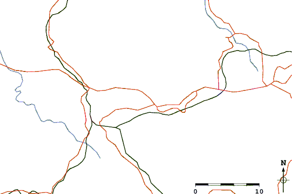
| Contours: | Roads & Rivers: | Select a
tide station / surf break / city |
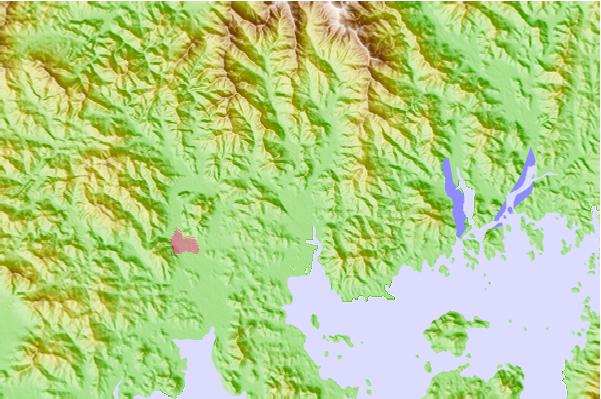
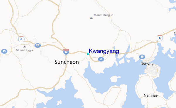
Use this relief map to navigate to tide stations, surf breaks and cities that are in the area of Kwangyang.
Other Nearby Locations' tide tables and tide charts to Kwangyang:
click location name for more details
 Surf breaks close to Kwangyang:
|
||
|---|---|---|
| Closest surf break | Busan (Haeundae Beach) | 90 mi |
| Second closest surf break | Kangjeong (Jejudo Island) | 137 mi |
| Third closest surf break | Jungmun Beach (Jeju Island) | 137 mi |
| Fourth closest surf break | Fukuoka | 173 mi |
| Fifth closest surf break | Nomozaki | 191 mi |


 Nearest
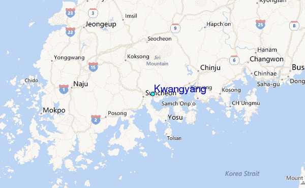